
The X marks a place although a treasure has never been discovered. But the promise remains that one can get rich by digging, and even more so, that the map hides the cartographer's fascinations and the dangers of his avid enemies. During the rainy Scottish summer, 12-year-old boy Lloyd Osbourne kills boredom by drawing a map of an imaginary odyssey on an island with weapons and gold doubloons buried. Robert Louis Stevenson is thrilled with the plan of his stepson to the point that by the end of the holidays he has already written enough chapters of Treasure Island(1883). The drawing of the Skeleton Island (Norman Island, in the British Virgin Islands) is kept in the Yale University Library along with the manuscript, which Henry James said was perfect "like a well played boy's game".
A map, however small and detailed it may be, is never real, but it is a link to the world, a mirror in our room where we observe a mountain range in the fold of our shirt, the ocean with its spots on the iris of the eye, the Everest on one knee, the Gobi desert on her forehead and Etna on her mouth, her lips erupting fleshy. The map is also the life that one wants for oneself, since existence consists in arriving.
Maps are born from the desire to know. Also by chance. In 1971, the German artist Hans Haacke (Cologne, 1939) was preparing his exhibition at the Guggenheim in New York when, in one of his many comings and goings between his West Village house and the museum, he realized the contrast that existed between the two neighborhoods - a warehouse area and semi-abandoned docks, the first; and a luxurious residential area, the second - to the point of inspiring one of his best-known works, Shapolsky et al. Manhattan Real Estate Holdings, to the Real Time Social System, as of May 1 and which cost him his brand-new debut at the museum, as its director, Thomas Messer, canceled the exhibition due to the artist's refusal to not include it. Haacke had done impeccable field work - an exponent of the misnamed political art (everything is political!) - where he juxtaposed photographs of the facades of buildings with information on their owners and cadastral value collected from the city's public archives. The work ended up being a countermap to the ins and outs of the greedy family that owns the largest real estate group in the city, whose interests intersected with those of the Guggenheim trustees .
The map, like the book, requires the reader's foray into a territory where there are no limits or borders because the treasure is never in the same place or in a mythical time, so to speak, and , because north and south do not coincide for the who lives in Barcelona and Melbourne. The metaphorical uses of the map are in the highlands of visual creation throughout the 20th century and have been used to tell stories, primarily of pirates. For Haacke and for artists like Gordon Matta-Clark, Ed Ruscha, Alighiero Boetti or Richard Hamilton, the map was defined by economic and political forces. The famous cover that Saul Steinberg created in 1976 for The New Yorker, View of the World from Ninth Avenue, is also a criticism of the narrow-mindedness of many citizens who believe that the only important thing is what is in the corner of their house , except for the one who sees the navel of the world at the door of a tobacconist ( Smoke ).
Cartographies also serve to denounce people's real problems, such as those William Bunge did on Detroit in the 1970s, with the black dots that indicated the crossroads where the wealthy run over black children, in sarcastic parallelism with those of the places where rats bite babies. Hungarian artist Agnes Denes, a New Yorker by adoption, came up with the image of a donut-shaped globe with the continents floating and the poles kissing through the donut hole ( Isometric System in Isotropic Spaces , 1974). For the octogenarian artist, representing the Earth's omphalon makes us more aware of the responsibility we have with the planet. Lebanese Mona Hatoum devised a slippery and provisional world, a puzzle of soap bars made with Nablus oil, in the West Bank ( Present Time , 1996).
These examples are included in the volume Maps (Phaidon) mixed with the planispheres and charts that emerged from the utopian imagination of artists, cartographers, and adventurers. And although Google's digital tools convince us that we can enter the porch of an old love's house right now in a town in Massachusetts, such an eventuality would be no more real than the visible map of an elusive world like that of smell, by the way, the first sense that a coronavirus patient loses. The Glasgow Scent Map (2012), devised by Kate McLean, marks the origin of the aromas with large dots and with small dots where the wind takes them and how they fade away. The wonderful nebulae of this Scottish artist and designer chase the aromatic routes of the underground, represented with elegant rings. Since then, it is believed that there are real treasures in the tubes that make us forget the bad smell of crowds during the rainy Scottish summer.
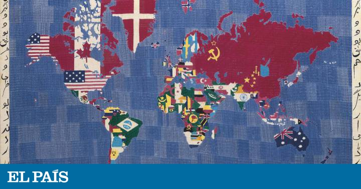
Maps. Exploring the world. Phaidon. 352 pages. 29.95 euros.