
Forest engineer Omar Cárdenas draws a polygon on the board that simulates the territory of a community. Beside him, he writes down coordinates while manipulating a GPS device. Sincerely, attendees listen to and write down the instructions in their notebooks. The students range from 26 to 60 years old, and have come to this Yurimaguas parish from different parts of the Peruvian Amazon to learn how to use GPS and thus protect their territories.
MORE INFORMATION
- Julián: the fight against the highway that divides the Amazonian people
- Indigenous maps of the Amazon in 3D
- The double threat to the peoples of the Amazon
"In this workshop we are forming a team of environmental monitors in the defense of water resources. They want to register the water sources with the National State Water Authority and for this they have to locate them. Therefore, managing technology can help them, ”explains Cárdenas, a forestry engineer at Pastoral de la Tierra, the NGO that is leading the project.
In the Peruvian Amazon, the continuous expansion of agro-industrial companies threatens communities and exerts strong pressure against their natural resources. The disappearance and contamination of rivers and streams is one of the consequences. By establishing the huge plantations, they modify the land in such a way that they either make them disappear or drain fertilizer residues into nearby rivers. Thus, the water sources from which the communities live disappear or become contaminated.
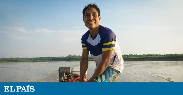
Marcelino Vilela Neira is the environmental monitor of his community, San José Obrero, in which some 35 families live. He has spent years immersed in the fight for the territory and managed in 2015 to contain the expansion of crops of a large agro-industrial group established between the Loreto and San Martín regions, which owns 14,000 hectares where it produces oil palm and cocoa. However, that was only a small victory that feels bitter today.
“When it is summer, we practically run out of water and what there is has a smell and another flavor when you drink it. To identify the destruction that has occurred, we are preparing to manage the GPS to identify the missing areas and then ask the national water authority for their protection, ”he explains.
In reality, the State should be in charge of identifying all the natural resources that the country has. However, whether due to lack of budget or interest, this is not the case. For this reason, the Pastoral Ministry of the Earth directs its actions to put the ball on the roof of the government or, as Omar says, “give food to the state in the mouth” so that they do not make excuses and resolve this situation.
Megaphone in hand to register territories
The native community of Reforma is reached by navigating the Huallaga River on a journey that takes just over half an hour. The mayor, Luis Chujandama, is calling all residents to an emergency meeting with a megaphone to discuss the issue of greatest concern today, the titling of their territories.
We need to do this of the degree, it is like a human being without a birth certificate, which is worth nothing
"There are companies deforesting that are not far away anymore and in our territories there is rubber and also three oil wells and other communities where there are fish and wood are already invading the land. We need to do this about the degree, it is like a human being without a birth certificate, which is worth nothing. This is how we are with our territory, ”says Luis Chujandama.
Without the communal property title, the communities are totally unprotected. According to a report by the Inter-Ethnic Association for the Development of the Peruvian Jungle (AIDESEP), there are more than 1,100 native communities in the Amazon that do not have communal property titles. Furthermore, the study carried out by the World Resources Institute shows that the process of legalizing indigenous territory is extremely complex, expensive and slow. In the most extreme cases, it can take thirty years.
During the meeting in the Reforma community, the 29-year-old Frander Herrera asks to speak. He is one of those in charge of carrying out one of the most complicated phases of the entire titling process, mapping the territories of the community.
"The routes take us from ten to 15 days through the forest and we are marking on the GPS every thousand meters, but we have to move about 35,000 hectares and we end up with scarce food because we cannot carry much," says Frander. "It is very dangerous, we also face animals; vipers and otorongos (jaguars); those are the most dangerous."
The titling process of their territories makes them expose even their own lives because of the abandonment of the state because in reality, the institutions do have resources to map the territories, only that they use them for other interests. In his book, Guerras del interior , journalist Joseph Zárate argues the reason for this situation: "For almost half a century, the entire Peruvian Amazon has been divided into dozens of rectangles called lots, which have been transferred to logging, oil and mining companies to be explored and eventually exploited. While in some concession maps the companies are polygons, the native communities are represented by dots, like small scattered archipelagos. The state draws them with dots so that everything outside that point is consider free to exploit. "
A logic that, thanks to technological advances and the efforts of NGOs and native communities, can be fought. An important step for the protection of the Amazon forests is the recognition of the territories to the indigenous communities because when placing them on the map, their existence, their rights are recognized and the entry of projects that are harmful to them, the environment and the environment is prevented. planet as a whole.
You can follow PLANETA FUTURO on Twitter and Facebook and Instagram, and subscribe here to our newsletter.