
Hurricane Laura: Texas and Louisiana on alert 5:28
(CNN Spanish) - Here's a city-by-city forecast with what to expect in terms of timing and impacts of Hurricane Laura. These estimates are compiled by CNN Weather using current forecast information available Tuesday afternoon.
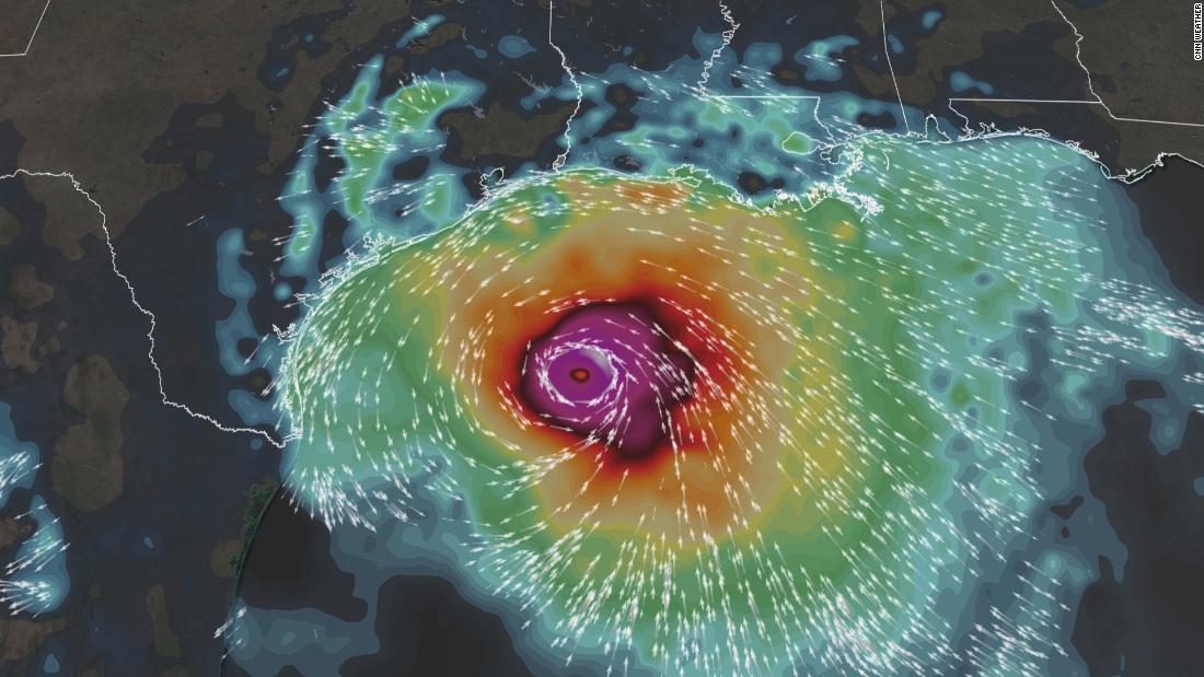
Follow the path of Hurricane Laura
Beaumont / Port Arthur
Tropical Storm Winds (62 km / h +) = 8 pm Wednesday to 10 am Thursday
Hurricane Force Winds (120 km / h +) = 2 am to 6 am Thursday
Maximum Wind Gusts: 160+ km / h
Total expected rainfall = 4-20.3 centimeters
Maximum storm surge = 1.8-3 meters
High tide = 4 am Thursday
Lake Charles, Louisiana
Tropical Storm Winds (62 km / h +) = 7 pm Wednesday to 11 am Thursday
Hurricane Force Winds (120 km / h +) = Thursday 2 am to 8 am.
Maximum wind gusts: more than 160 km / h
Expected total precipitation = 6-25.4 centimeters
Maximum storm surge = 2.7-3.9 meters
High tide = 6 am Thursday
Galveston
Tropical Storm Winds (62 km / hr +) = 9 pm Wed to 4 am Thursday
Hurricane Force Winds (120 km / hr +) = Not expected, but maximum winds between 12 and 3 am
Maximum wind gusts : 80-96 km / h
Expected total rain = 2-10.2 centimeters
Maximum storm surge = 1.2-1.8 meters
High tide = 3 am Thursday
Houston
Tropical Storm Winds (62 km / hr +) = 8 pm Wed to Thursday 4 am
Hurricane Force Winds (120 km / h +) = Not
Expected Maximum Wind Gusts: 56-72 km / h
Expected Total Precipitation = 2-10.2 centimeters Peak
Storm Surge = 0.9-1.5 meters (along Harris / Galveston Bay shoreline)
High tide = 7 am Thursday
Hurricane Laura


