
Friday will be calmer across the country.
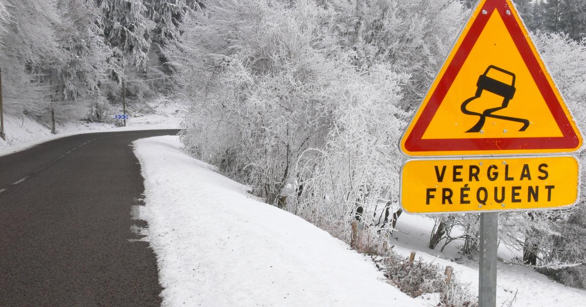
Risks of refreezing of the roads could, however, affect traffic in a large northern half of France on Thursday evening and Friday, at the end of a snowy episode which reaches the Massif Central and the Alps.
In fact, the disturbance associated with the depression brings snowfall to Auvergne-Rhône-Alpes this evening.
Between Normandy and Hauts-de-France as far as the Paris basin and the north of Lorraine, it is the ice which hampers traffic during the night from Thursday to Friday and Friday morning.
Indeed, with temperatures dropping between -5 and -10°C, the refreezing of the snow will make the roads very slippery on the road network, indicates La Chaîne Météo*.
The orange “
snow-ice
” alert (“
be very vigilant
”) only concerns six departments, according to La Chaîne Météo: Aisne, Ardennes, Eure, Oise, Orne and Somme
.
The Paris police chief, Laurent Nuñez, announced that the ice snow plan was returning to level two in Île-de-France, after two consecutive nights at level three, then implying a “
reinforced monitoring level
”.
From 8 p.m. this Thursday, and until 8 a.m. Friday, the speed is lowered by 20 km/h for all vehicles and overtaking will be prohibited.
School transport suspended
In Hauts-de-France, school transport remains suspended on Friday, for the third consecutive day, and interurban lines will gradually resume, indicated the region, which expects “
strong disruptions
” in the morning in certain sectors in due to the ice.
Classes remain suspended on Friday in certain high schools and colleges, as the day before and the day before, the Lille rectorate having called on establishments to maintain a “
minimum reception
” and distance learning due to the “
risk of ice on the secondary road networks
”.
In Normandy, school transport will also be interrupted on Friday in the departments of Eure and Seine-Maritime.
The Cantal prefecture also banned the transport of schoolchildren on Friday morning, as well as the circulation of heavy goods vehicles from the early evening on Thursday on several roads in the department.
Several portions of the A75 motorway will be closed to traffic, in Cantal, Puy-de-Dôme, Haute-Loire and Rhône.
In Paris, the canteens of around fifteen schools were not supplied this Thursday due to bad weather conditions and traffic difficulties.
“
School principals had to go buy sandwiches for the students
,” the city told AFP.
The town hall expects a return to normal on Friday.
Yellow alert
After the precipitation and snowfall of the previous night, two thirds of the country, from Brittany to the Alps, remain or gradually return to yellow alert ("
be careful
") for icy conditions during the night from Thursday to Friday.
From 1 to 5 centimeters of snow were recorded in most of these areas, with peaks in places of 10 cm in Normandy and 15 cm in Hauts-de-France, where the episode was the most intense, according to Météo-France.
In the Massif Central and the north of the Rhône valley, a “
snowy episode of short duration, not exceptional for the season, but significant enough to cause traffic difficulties
” is expected, “
especially since the snow is cold
” and that “
significant
” accumulations
are expected at low altitude from 300-400 meters, warns Météo-France.
Little disruption to the rail network
Trains on the high-speed line between Paris and Lille had to slow down to 230 km/h instead of the usual 300 km/h, causing delays of 10 to 15 minutes.
No major disruption was noted on the rail network, much less affected than during storms Ciaran and Domingos in November, according to an SNCF spokesperson.
In Île-de-France, one in two buses ran in the morning, but traffic returned almost to normal by midday, including on commuter trains.
While a few flakes will continue to fall in the north of the Alps, the sun will then dominate the entire country in the afternoon.
However, we will have to wait until Sunday to experience an increase in temperatures.
*The Weather Channel is a property of the Figaro group.