
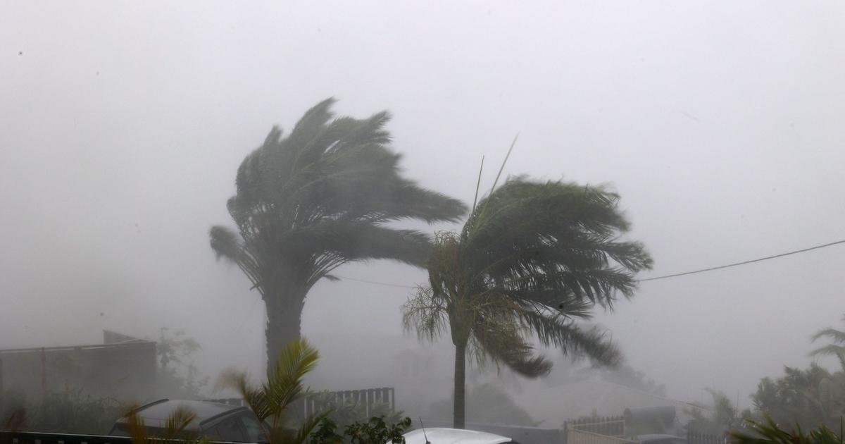
Exceptional gusts and heavy rain. The island of Reunion was hit on Monday 15 January by an extremely violent cyclone that first hit the north-west coast. In order to limit the damage, the 870,000 inhabitants of this Indian Ocean territory are confined until Tuesday morning and asked to exercise the utmost caution.
While the island was initially placed on purple alert, the highest level of warning, it went back to red alert at 13 p.m. (local time) on Monday. In practical terms, this means that the emergency services - and only them - are allowed to circulate on the island again. Residents will have to stay locked in their homes until Tuesday morning. But where does this danger come from?
Circular clouds
«
Cyclones form in tropical areas, explains Gilles Matricon, meteorologist for La Chaîne météo*. These are the places where we find the warmest waters." However, for them to form, "the surface temperature must be above 26°C and at a depth of at least 50 metres," the specialist continues. An influx of moisture such as evaporation creates a cloud cluster that organizes itself in a circular shape, explains the meteorologist.
In their path, cyclones cause exceptional winds and heavy rains. "For the time being, gusts of 217 km/h have been recorded at Piton Maïdo [a mountain peak at an altitude of 2200,170 metres, editor's note]," says the Weather Channel specialist. Very strong winds were also recorded by the sea, with gusts of <> km/h in Saint-Denis.
Read also"We've never seen anything like this": the inhabitants of Reunion Island tell the story of the shock of Cyclone Belal
On the coast, the waves reached nearly 10 meters, the equivalent of a three- to four-storey building. "There is also a phenomenon of overpricing," adds Gilles Matricon. This rise in sea level is linked to the drop in atmospheric pressure and increases the risk of marine submersion.
Waves crash on the shore of La Possession, Reunion Island, January 14, 2024. RICHARD BOUHET / AFP
And this, while heavy rains are still falling on the island. The specialist is already talking about a very significant accumulation over the last 24 hours. "At this stage, nearly 600 millimetres of rain can be measured on the Plaine des Palmistes, in the centre of the island. That's the equivalent of what falls in Paris in a year," he said.
Moderate Intensity
When Cyclone Belal made landfall on the island, however, it had not reached a major level of intensity, category 3 on the Saffir-Simpson scale, as feared. Although very dangerous, Belal did not go beyond category 2/5, the one of moderate intensity, the specialist further analyses. Before detailing: "Phenomena of such intensity, in the south-western zone of the Indian continent, there are about ten each year". And especially "at this time of year, in the middle of the hurricane season", from November to April, the meteorologist adds.
«
This cyclone is therefore particularly remarkable, not because of its intensity, but because of its trajectory. Indeed, it hit the island of Reunion, an inhabited area, right in the heart of it," observes Gilles Matricon. To find such a phenomenon, we have to go back to the beginning of 1989. The island was hit by Cyclone Firinga. Once again, Reunion Island had been crossed, from north to south, by this very powerful meteorological phenomenon, causing heavy material and human damage.
Cyclone Belal will now deviate its trajectory to the south-east and pass off the coast of Mauritius, about a hundred kilometres away. While the consequences will certainly be much less significant, "we must remain cautious," insists the expert.
*The Weather Channel is a property of the Figaro Group.