There are dozens of active artificial satellites that orbit our planet. Many of them, like the 22 that NASA has in operation, observe the changes that occur in the earth and send millions of data, from the levels of carbon dioxide in the atmosphere to the rise in sea level.
MORE INFORMATION
Latin America needs solutions and needs them now- Obesity: it's time to act in Latin America
- Youth, divine treasure that we are neglecting
But there are also data that offer the possibility of planning different climatic, economic and social scenarios in advance, while promoting a digital transformation by generating geospatial information that helps decision-making, such as the delivery of public services or electronic commerce
But the geographic information that is obtained does not only come from satellites, like the one we receive in a GPS. It also has as a basis, for example, the mapping of maps that have been previously drawn up, censuses or cadastral references in which data for each dwelling are indicated, such as its location within a map and a unique number that is assigned to locate it within of the same.
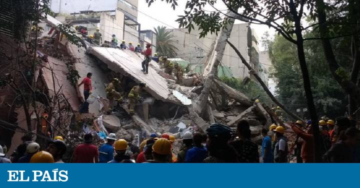
As the information is so much and so varied it is necessary to order and define it in order to make better use of that data. For example, a risk map could be created to see the strengths and vulnerabilities of a region or a nation in the face of disaster risks caused by natural phenomena. Ivonne Moreno, a World Bank land administration specialist, explains in this interview how to take advantage of this data to generate more resilience to disasters.
Question: What is geospatial information and what is the current landscape in Latin America regarding this issue?
Answer : Geographic or geospatial information refers to data that has a certain position on some place on earth, through coordinates, geographical names, addresses or postal codes, among others. For example, the characteristics and location of the network of hospitals, roads, public service networks, cell phone users, parks and places of recreation. Among the most common sources of geospatial information are maps, databases, satellite images, graphics and applications for mobile devices.
The importance of geospatial information lies in the fact that, in addition to being used for the location of places, data or phenomena, it serves as an input for planning, effective disaster management, and the development of projects aimed at the management and sustainability of the territories
With the objective of harmonizing the standards for the capture, exchange and management of spatial data, Spatial Data Infrastructures (IDE) have been developed in the nation. The purpose of IDEs is to access, integrate, use and maintain spatial data from different sources. This is what interoperability is all about; The data and systems must be compatible allowing standardized formats and platforms for the efficient exchange of geospatial information, which allows to answer strategic questions such as: How many properties are in areas of non-mitigable risk? and Who are their owners or holders ?; How many homes were affected by a natural disaster and what is its commercial value ?; Or, in how many square meters of public space does each of the neighborhoods of a city have?
In the Latin American and Caribbean region, among the countries that have IDE are Argentina (IDERA), Brazil (INDE), Chile (IDE Chile) and Colombia ICDE. Additionally, in 2007 the Geospatial Network of Latin America and the Caribbean (GEOSUR) was established, with the objective of promoting Spatial Data Infrastructures in the Americas.
What follows is to strengthen existing IDEs and the development and implementation of spatial data infrastructure in the other countries of the region.
Q: How are you working to implement this technology?
A: The UN and the World Bank have developed the Integrated Geospatial Information Framework (IGIF) as a conceptual and reference basis for countries to achieve the development, strengthening and effectiveness in the management of their geospatial information. The IGIF is based on the experience and advances of the Space Information Infrastructure in Europe - INSPIRE (for its acronym in English).
Some of the main advantages offered by the IGIF is that it establishes clear and indispensable routes that guide governments for the management and use of geospatial information, avoiding reprocesses and cost overruns; allows interoperability of geospatial information in operational terms; promotes and reinforces the provision of open data; It identifies the fundamental data sets to move towards efficient territory management and digital transformation and also organizes the institutional efforts towards the implementation of the Sustainable Development Goals of the 2030 Agenda of the United Nations.
Q: Are there examples in Latin America of how this framework is being applied?
A: Indeed, in Colombia a diagnosis and action plan of the Colombian Spatial Data Infrastructure (ICDE) has been carried out, based on the standards of the Integrated Geospatial Information Framework. For example, the Multipurpose Cadastre Project will partially finance the implementation of the Action Plan, allowing the integration of the Cadastre and Registry databases, and their interoperability with the regulated uses and environmental determinants established by the Territorial Planning instruments.
Q: How replicable can this geospatial information strategy be for other countries in the region?
A: The IGIF, which I mentioned earlier, was designed precisely to help developing countries achieve integrated and strengthened geospatial information, develop capacities to use geospatial technology, improve decision-making processes, facilitate private sector development, and take practical measures to achieve a digital transformation in favor of citizens.
The formulation and implementation of the National IGIF Plan will allow the countries of the region to progressively reach the standards required to fully implement and maintain the fundamental issues of geospatial data, such as georeferenced land surface, ortho-images, cadastre, buildings, addresses, risk and vulnerability areas, thus strengthening disaster management and climate resilience.
This will allow, for example, the identification of homes and families affected by a natural disaster for the delivery of aid; obtain data on homes and families located in areas at risk of landslides to prioritize mitigation actions such as strengthening housing structures; the identification of families located in environmentally strategic areas to receive training and direct sustainable forest management programs; and the identification of schools and health posts in which property must be regularized so that the State can make public investments for improvement, among others.
Jessica Belmont is an online producer for the World Bank.