This is what Ian looks like inside: storm chaser films the hurricane in Florida 0:53
(CNN Spanish) --
Ian was downgraded to a tropical storm, but it has intensified and could become a hurricane: it is expected to produce strong winds and storms and storm surges in parts of Florida, Georgia and the Carolinas, according to the latest information from the Center National Hurricane (NHC).
Active watches and warnings for Storm Ian
The risk of life-threatening storm surge in parts of Florida, Georgia and South Carolina will continue through Friday, so it's critical that residents carefully follow advisories from public officials.
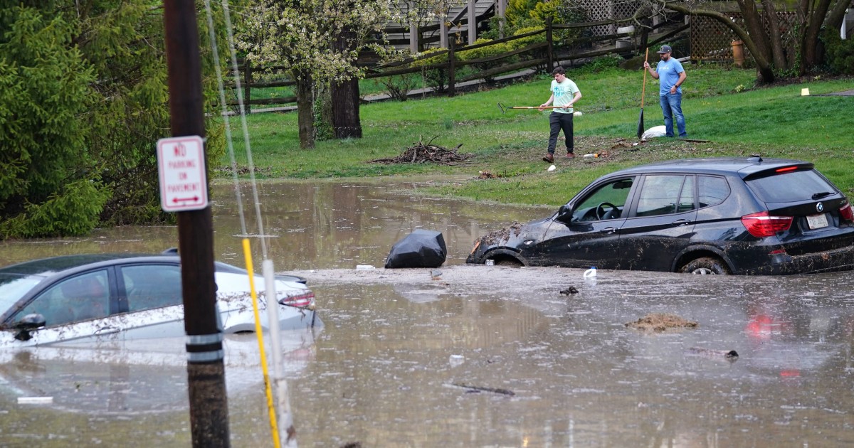
What to do if you find yourself in the middle of a power outage from Hurricane Ian?
In turn, tropical storm-force winds are expected to move north across northern Florida, Georgia and the coasts of the Carolinas as well through Friday.
Below is a summary of the advisories and watches in effect for Florida.
A tropical storm warning is in effect from Jupiter Inlet in Florida to Cape Lookout in North Carolina.
A storm surge watch is in effect for the Flagler/Volusia County line to the mouth of the South Santee River and for the St. Johns River.
There is a storm surge watch for north of the South Santee River
to Little River Inlet and a hurricane watch for the
Flagler/Volusia County line to south of the Santee River.
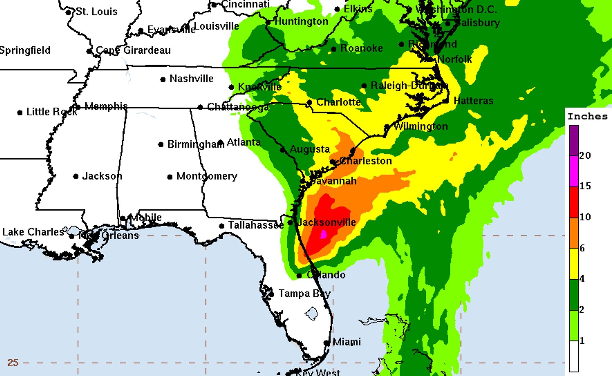
rain forecast
The Weather Prediction Center issued a forecast of the rains from this Thursday, September 29 to Sunday, October 2, which shows how in some areas of Florida it can accumulate from 1.8 to 3 meters of water.
advertising
The rain forecast until October 2 prepared by the Weather Prediction Center.
Ian set records for the highest water levels ever observed in multiple locations including Fort Myers and Naples in Southwest Florida.
Estimates and observations show that more than 300 mm of rain fell between 12 and 24 hours in a swath of the region.
In some of the hardest-hit places, this exceeds rainfall rates for flood events of 1 in 1,000 years, according to NOAA data.
Storm surge reached 3.6 meters in places.
Life-threatening storm surge could occur for a stretch of coastline from northeast Florida to an area north of Charleston, South Carolina.
The prediction center also published a forecast of the risk of flash floods for the next from this Thursday to Sunday.
In the areas colored pink, the risk is moderate, at least 40%;
in the yellow ones the risk is low, at least 15%;
and in the green ones it is marginal, with a minimum of 5% probability.
(Source: Weather Prediction Center)