
By Mithil Aggarwal—
NBC News
Tropical Storm Colin formed early Saturday off the coast of South Carolina, and the National Hurricane Center (NHC) issued a tropical storm watch for parts of North and South Carolina.
Heavy rain and flash flooding are expected in some areas this July 4th weekend.
Colin formed about 50 miles (80 km) southwest of Myrtle Beach, according to the NHC.
As of 8 a.m. ET Saturday, the system was inland over eastern South Carolina and had
maximum sustained winds of 40 mph
(65 km/h), according to the agency.
The storm is forecast to move northeast just off the coast of the Carolinas at a speed of 8 mph (13 km/h), the NHC added.
Also,
heavy rains of up to 4 inches are expected,
which could result in "localized areas of flash flooding," the agency said.
According to forecasters, Colin will continue to produce locally heavy rain across portions of the South and North Carolina coast through Sunday morning, which may result in flash flooding.
Colin is expected to dissipate over the Atlantic on Monday.
The 4th of July holiday begins with chaos at airports, complaints and hundreds of canceled flights
July 2, 202201:42
A tropical storm warning is in effect from South Santee River, South Carolina, to Duck, North Carolina.
The storm formed hours after Tropical Storm Bonnie made landfall in Nicaragua, bringing with it the threat of flooding from heavy rains.
Bonnie made landfall late Friday on the Caribbean coast of the Central American country, about 75 miles south of Bluefields, according to the NHC.
Forecasters warned of the danger of significant flooding, with rains of up to 8 inches and even more in isolated places.
Bluefields officials said they put up 50 temporary shelters before the storm hit, and many of its 57,000 residents boarded up their windows.
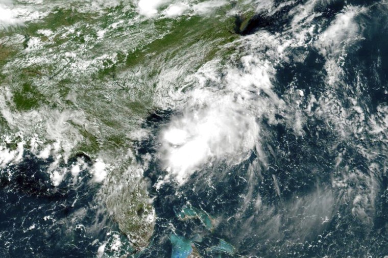
Tropical Storm Colin off the Atlantic Coast of the United States on Saturday, July 2. NOAA via AP