Ian could hit Florida as a category 4 hurricane 4:09
(CNN Spanish) --
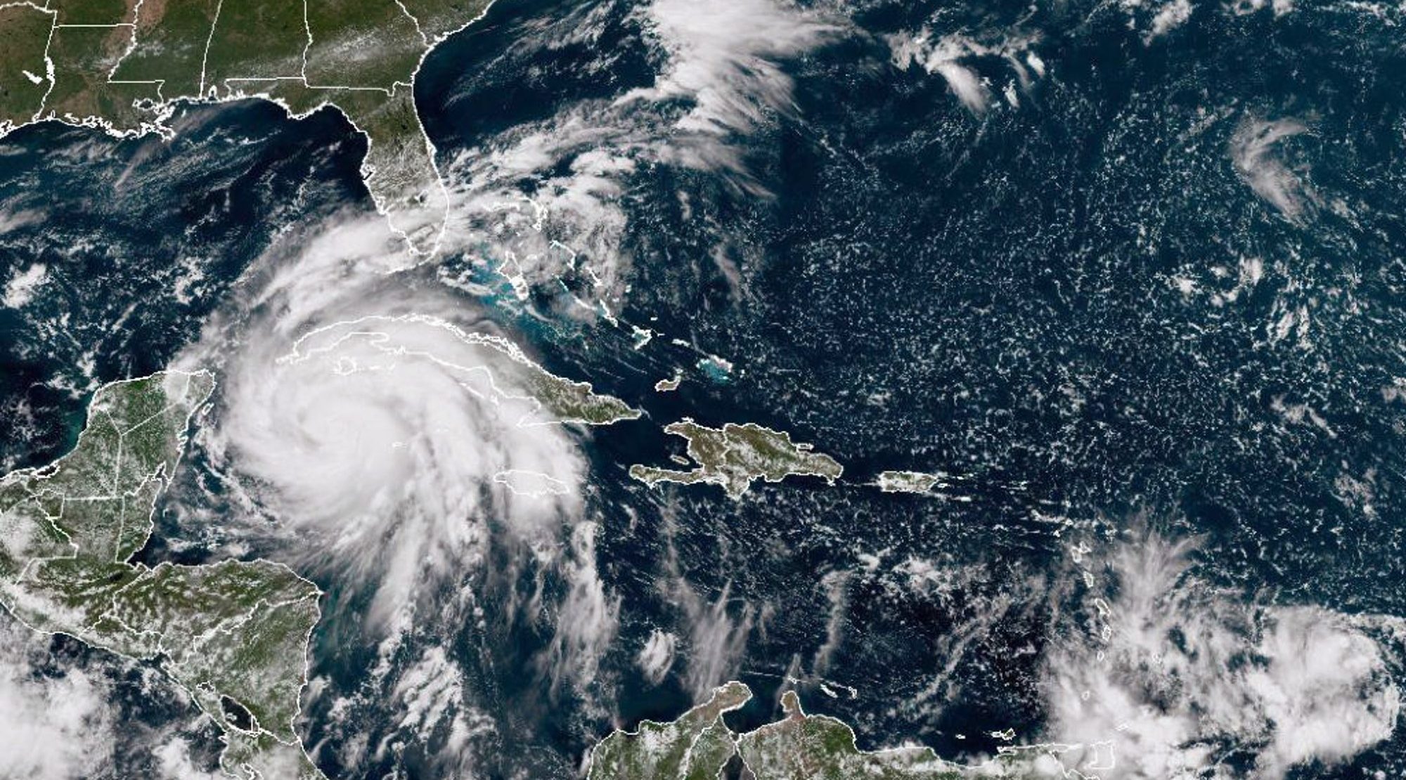
Hurricane Ian is expected to make landfall in Florida on Wednesday night, around 8:00 pm local time.
The cyclone would make landfall north of Venice six to 12 hours earlier than previously expected, according to an update from the National Hurricane Center (NHC).
"On the forecast track, the center of Ian is expected to move over the southeastern Gulf of Mexico in a couple of hours, pass west of the Florida Keys later today (Tuesday), and approach the west coast of Florida. Florida within the hurricane warning area this Wednesday," the agency said in an update Tuesday morning.
This also changes the magnitude of expected waves, with heights of 2.4 to 3.6 meters, which can be recorded south of Tampa Bay and north of Bonita Beach, including Charlotte Harbor and the cities of Port Charlotte and Punta Gorda.
Storm surge in and around Tampa Bay, including St. Petersburg and Clearwater, is still expected to be 5 to 8 feet.
Stunning video shows Hurricane Ian from space 1:21
How Tampa may be affected depending on where it makes landfall
In recent days there has been great uncertainty about the exact location of Hurricane Ian's landfall, which will make a dramatic difference to storm surge.
advertising
"A landfall in the southern part of the cone will pull Tampa Bay out of extreme storm surge and put the Port of Charlotte in the center of the worst conditions," according to CNN meteorologist Chad Myers.
"Massive landfall north of Tampa puts massive storm surge right in Tampa Bay."
Eighty miles one way or the other changes everything.
If it makes landfall north of Tampa, this will push water levels to a height not seen in more than 50 years of records of tide levels in the Tampa Bay area.
The most devastating hurricanes could double by 2050 in almost all regions of the world, according to scientists
"This is a near worst-case approach angle coming in from the south and west and stalling," according to Jamie Rhome, acting director of the National Hurricane Center.
"With the slowdown, this would be a near worst-case approach angle."
That slowing of progress will allow another extreme event to unfold.
Obviously there are damaging winds in the eyewall and the tide.
However, there is also the possibility of torrential rain, Myers said.
There is "a chance of 500 to 600 millimeters of precipitation as the storm appears to stall temporarily after landfall, creating massive flash flooding," Myers said.
The month of September, on average, brings around 150mm of rain to the Tampa region.
Editor's Note:
This article was originally published on September 26 and has been updated with the latest information.
InstaNews


/cloudfront-eu-central-1.images.arcpublishing.com/prisa/KMEYMJKESBAZBE4MRBAM4TGHIQ.jpg)