
Intense rain, lightning, hailstorms ... Ile-de-France was not spared from the raging weather this Wednesday evening.
According to the Weather Channel, 15 to 30 mm of rain fell in the Paris region between 8 p.m. and 10:30 p.m., the equivalent of two weeks of rain. And the thunderstorms were to continue overnight, auguring even greater precipitation. Instability is reinforced over a large area to the east of a Bordeaux -Tours-Brussels line, said Météo France earlier in the afternoon, announcing "thunderstorms punctually violent, sometimes accompanied by hail and gusts of winds ”. They were therefore there.
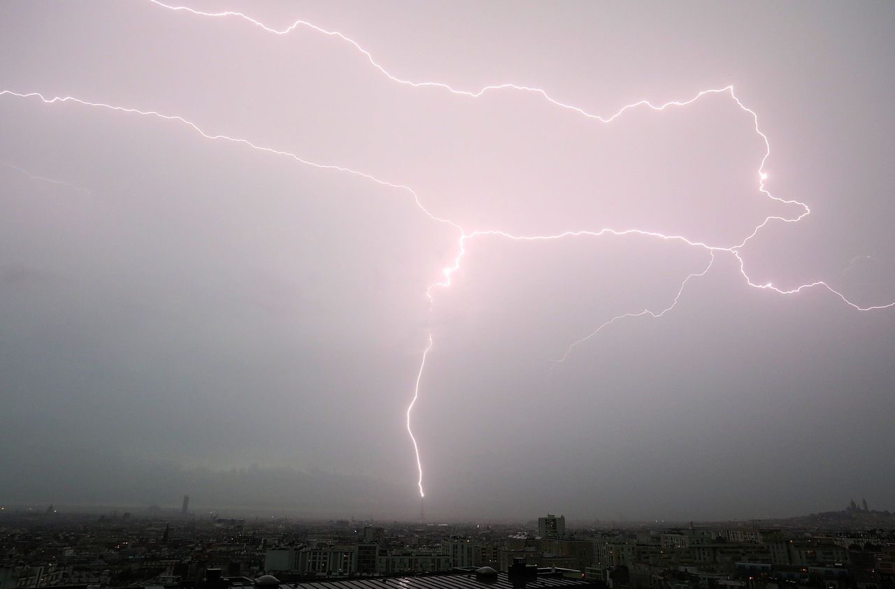
Significant stormy activity and intense lightning strikes in the Paris region as this evening's animation shows. In the Paris region, you have to go back to the evening of Saturday, May 9 to find such a marked electrical activity. Source @Meteorage__ pic.twitter.com/f2K74WV8E1
- The Weather Channel (@lachainemeteo) June 3, 2020On social networks, impressive videos of these storms circulate, as here in Paris.
New video of the big #orage which is currently falling on #Paris. Note that this is the 2nd violent storm that hits the Paris region this year, after that of the night of May 9 to 10 ... https://t.co/ygATWxp4sQ
- The Weather Channel (@lachainemeteo) June 3, 2020In the capital, streets were flooded in minutes.
# Flooding avenue de Suffren in Paris after the downpours. #orage #meteo #grele #pluie pic.twitter.com/YiYkjnpHDU
- Sylvain RAUCY (@SlyThoughts) June 3, 2020And hail fell violently, trapping metro passengers, who, dressed in summer outfits, did not seem to have anticipated this deluge, also found in Hauts-de-Seine, Val-de-Marne or Seine-et- Marl.
Stuck by hail in the metro at #Convention de aide please pic.twitter.com/xruiygTljV
- Loupiote 🇫🇷🏉 (@ClementDufour) June 3, 2020#creteil #meteo #orage #grele 😳 a thunderstorm and 5 minutes of hail non stop ... pic.twitter.com/Vo8YDqP6KO
- Jérôme PASANAU (@JeromePasanau) June 3, 2020A mini-tornado was even seen near Étampes (Essonne). Unless it is a snorkel, a sort of outgrowth at the base of a cloud created by the violent swirling winds.
Tornado near Étampes, a little damage anyway ... pic.twitter.com/vMde88A3zf
- Thomas (@ Mr_RedBlood91) June 3, 2020And now, the Southeast?
During the night and during the day on Thursday, a small depression was positioned in the south-east of France, worsening the weather conditions over this region. The rains are becoming more frequent, and sometimes more intense, indicates Météo France.
Newsletter - The essentials of the news
Every morning, the news seen by Le ParisienI'm registering
Your email address is collected by Le Parisien to allow you to receive our news and commercial offers. Find out more
For Thursday, the expected cumulative precipitation is around 40 to 70 mm from the Rhône valley to the Alps, but may reach locally up to 100 mm over the Alpes Maritimes and the Italian border. Problems of local flooding and runoff are therefore to be monitored.
The improvement will take place in the evening with the dislocation of the rainy event and its shift to Italy.
Temperatures should be in free fall this Thursday throughout France.