
Meet Israel's new trail: 240 km along the coast
They have been trying to build it for 5 years, but only last month did the marking of the first section out of 240 km end - the "Sea Trail" is a hiking route divided into sections of 12 km, from Rosh Hanikra to Zikim Beach.
The "father" of the trail talks about the ambitious project and the difficulties.
And there is also a dedicated app
Eyal Shapira
03/12/2021
Friday, 03 December 2021, 00:00 Updated: 00:02
Share on Facebook
Share on WhatsApp
Share on Twitter
Share on Email
Share on general
Comments
Comments
In the video: A path around the Sea of Galilee allows access to the beaches that are within the kibbutzim (Photo: Reuven Castro)
"What's the problem? Take a bucket of paint, take some brushes, and start marking in the field."
This response has often been heard by Dr. Alik Adler, who has been in charge of the "Sea Trail" project for several years, when he turned to various sources for assistance and budgeting.
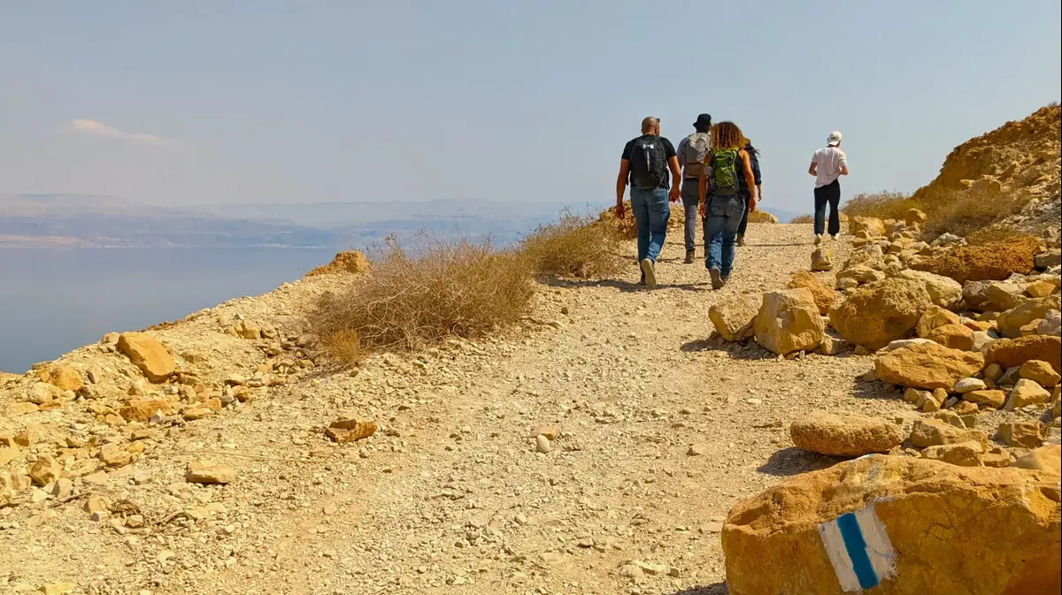
The Sea Trail is a continuous national trail for pedestrians, 240 km along the coast The Mediterranean Sea of Israel, from Rosh Hanikra in the north to the beaches of Zikim on the Gaza Strip border in the south.
And since five such years have been told to Adler and his associates, about five years have passed.
However, it was not until the beginning of November this year that the marking of the first section of the trail, from Rosh Hanikra to Acre, finally ended.
It turns out that building a new trail is not a trivial matter.
To say the least.
"Along the way, even we were surprised by the amount of bureaucratic challenges that awaited us along the way," he says.
More on Walla!
The new hiking trail of the Negev, located on the Egyptian border
To the full article
More on Walla!
"Yonatan Trail": The new route of Ramat Gan that runs along the Yarkon
The new hiking trail of the Negev, located on the Egyptian border
Meir Ariel is also inside: the new path of Pardes Hanna-Karkur
The natural solution to knee pain is closer than ever - with a refund from the health insurance fund
Length 240 km along the shores of the Mediterranean Sea of Israel. The sea trail in Rosh Hanikra (Photo: Walla !, Alik Adler)
Map of the Sea Trail in the North (Photo: Walla !, Alik Adler)
Map of the Sea Trail in the South (Photo: Walla !, Alik Adler)
The message: The beaches belong to the public
Adler, a former head of the Department of Marine and Coastal Affairs at the Ministry of Environmental Protection and a senior official at the United Nations Environment Program (UNEP), seems to be active, optimistic and stubborn. a small group of what he calls "ordinary people: lovers of hiking, sea and hiking trails."
In fact, sea path is a continuation of the previous project, called "coastal path", unable to rise, due to budgetary and bureaucratic. currently the project is carried out within the framework of the University of Haifa , Which has adopted the trail and is leading its construction.
"Along the way, we witnessed the large number of bodies related to the coast and the sea. Along the Israeli coast there are no less than 22 local and regional authorities. And there is the Ministry of Defense, various infrastructure facilities, seaports, IDF bases and much more. Moreover: out of a 196 km coastline, 45 km are now completely closed to the general public. To deal with the matter, we made occasional detours of the trail, so that its total length is 240 km ".
Why even plan a sea trail? What added value does it have?
"When we started, we decided it would no longer be a routine walking trail, but part of a community, educational and social project, with an important message: beaches belong to the general public, and anyone can and is welcome to walk along the beaches, without fences and obstacles. The Israeli public's right to the sea and its shores and its duty to preserve the environment and open spaces along the coasts. Fast and uncontrolled real estate initiatives. ”
Like other long trails, will this trail also consist of defined sections?
"Yes, the trail will consist of 20 sections, each about 12 km long.
We appeal not only to guys who walk continuously with 20 pounds on their backs, but also to families.
A family with children can decide to travel to Rosh Hanikra at the weekend and walk to Nahariya or Acre.
The following Saturday, they will march another segment.
And so, after about a year or less, they will finish all the sections of the trail. "
More on Walla!
Beach trips: from Rosh Hanikra to Zikim
To the full article
"The trail will consist of 20 sections, each about 12 km long" (Photo: Walla !, Alik Adler)
The trail "makes use" of existing infrastructure (Photo: Walla !, Alik Adler)
Shai Yagel: "The idea is to create a tradition of walking for this, similar to the Israel Trail, a water trail to the sea and others"
Speaking of trail sections - what were the planning principles of the sea trail?
"First and foremost, we make use of existing infrastructure. That is, connecting existing coastal paths and city promenades. Additional principles are minimalist trail creation and signage, to minimize environmental impact, and of course, as close to the sea as possible and create interesting detours in inaccessible areas. Additional principles "There was the creation of a platform for educational, environmental and social activities, the participation and involvement of coastal communities, as well as the creation of partnerships with local authorities, government ministries, state authorities, NGOs and research and academic bodies."
The trail will pass through lots of points of interest along the coast. For example, Rosh Hanikra, Old Acre, Tel Shikmona in Haifa, observation of Atlit Fortress, Tel Dor, Tel Gador and the Gulf of China, Caesarea Antiquities, Tel Aviv Port, walking at the foot of Apollonia National Park, Nahal Sorek estuary on Palmachim Beach, Tel Yavne-Yam, Zikim Reserve And more.
The trail planner Shai Yagel, who is involved in the project, adds that "the hope is that people will walk the trail and get to know the less famous beaches through their feet. The idea is to create a walking tradition, similar to the Israel Trail, water trail to sea and others."
He further says that "as part of the planning principles, we are not paving or developing new paths, but taking existing sections in the area, some of which are marked, and turning them into a continuous path."
More on Walla!
Turquoise in the heart of the dunes: the secret pools of Zikim Beach
To the full article
The cruise monument on Shavei Zion beach, next to which the path passes (Photo: Walla !, Alik Adler)
"The idea is to create a tradition of walking, similar to the Israel Trail."
Haifa beach (Photo: ShutterStock)
Field research: 250 km on the "fishing trail" in Portugal
As mentioned, a plethora of nerve-wracking bureaucratic challenges face those who take it upon themselves to plan a new hiking trail. The personal question arises - why bother at all? "It all started when I returned to Israel after 14 years of working in a very significant position at the UN," says Adler. "I myself am a man of nature, sports and hiking, and I was looking to do something significant. Ever since, the sea has been burning (or actually, wet) in my bones. In any case, when I returned, a young woman named Tal Kimhi came to me. She told me about her attempt to lift the project in another setting, but it did not rise. She told me 'it's tailor-made for you'. And so it was. I did not come up with the initial idea, but at that point I took it upon myself to manage it. "
The next thing Adler did was to go out and learn what was going on in the big world. About 250 km long.
In general, it is interesting to discover that sea trails are common in many places in the world.
According to him, coastal and sea trails have become increasingly popular in recent years, and many dozens of such trails are found around the world: in the United States, France, Scotland, Ireland, Spain, Portugal and more.
Every year, tens of thousands of people walk through them.
"Among the common goals of all these coastal trails is the goal of making the beaches accessible to the general public and emphasizing the public's right to move freely along all beaches," says Adler.
More on Walla!
Camino de Santiago: The Israeli who set out on a trek that has been going on for a thousand years
To the full article
Served as inspiration for the sea trail.
"Fishing Trail" in Portugal (Photo: ShutterStock, Cat_s)
"Sea trails are common in many places in the world."
Alik Ron next to one of the signs (Photo: Walla !, Alik Adler)
Anchors on the road
Beyond the meticulous trail planning work, one of the main questions in the project, in which Yossi Dishon and Prof. Noga Collins-Kreiner from the University of Haifa are also partners, is the matter of marking and signage. Adler notes that taking into account the planning principles of the trail, which include striving for minimal prominence in the area, it was understood that in the first phase of trail development, the only physical element to be built along the trail route would be signage. Such signage must be sustainable and survive the harsh conditions of the seashore: high humidity, salt water spray, strong sunlight, strong winds and more. Simply put, neither plastic nor iron.
The idea chosen: "Milestones", which Adler affectionately calls "Mill Anchors" (similar to "Milestones", the same milestones used by the Romans to mark distances throughout the Roman Empire). "The road anchors were also chosen because they draw from the 'spirit of the place' and have been part of the landscape of the coastal environment, archeology and maritime heritage for thousands of years."
The road anchors are made of cylindrical stone that is hand-hewn, so that each of the 40 road anchors along the path will be slightly different from the others.
Next to the road anchors, signs will be placed in each section, including useful information, a section map and more.
The first road anchor was placed in Rosh Hanikra in November, marking the beginning of the trail marking.
"The regional council headquarters that was the first to initiate the sea trail initiative and was the pioneer in opening the first section, which is also the northernmost. It will also serve as a kind of 'connecting chain' between all the authorities along the shores of Israel's Mediterranean Sea. "
"The anchors of the road draw from the 'spirit of the place' and were part of the landscape of the coastal environment."
The anchor of the road in Rosh Hanikra (Photo: Walla !, Alik Adler)
Online Trail: The app is here
In addition to road markings, the sea trail will be branded and marked as a guided and online walking route. This way, travelers will be able to use the navigation app and information in real time and location as well as on a website. These are designed to enrich the walking experience along the marked route. Already today, you can download the Wishtrip app, which contains the necessary information of the sea trail.
According to Adler, these digital tools will allow viewing the route map, marking the hiker's location and navigating the area, searching routes, receiving information on points of interest, real-time search of logistical information such as restaurants, public transportation, parking lots, accommodations and more.
Speaking of overnight stays, will it be possible to walk the trail continuously, as for Israel, and spend the night in the field?
"Currently, this is one of the weak points of the trail. True, there are several overnight campgrounds in reserves and national parks, such as Palmachim, Beit Yanai, Ashkelon and more, and tents can be set up at several beaches where this is allowed, subject to local authority directives. "Accommodation is arranged and there are not yet trail angels like there are for Israel. In the future, we hope to create collaborations with moshavim, kibbutzim and even cities where there will be accommodation solutions for travelers."
When do you think everything will end and it will be possible to cut the film at the other end of the path, at Zikim Beach?
"In about three years. Do not forget that it took 13 years to establish the Israel Trail. We have many challenges along the way. We need the cooperation of the local authorities. They are our most important partnership."
Until then, is it possible to simply walk along the entire coastline of Israel?
"Of course. Anyone who wants to go from Rosh Hanikra to Zikim today can do so, bypassing such and such places in inaccessible places. I did it myself, and I estimate that tens of thousands of other Israelis did it."
Tourism
news
Tags
Trails
Mediterranean
Excursions in the country


/cloudfront-eu-central-1.images.arcpublishing.com/prisa/IGZ7GOCXZ5GUPAQ2HWGK6Z76BU.jpg)