Still bad weather, more snow, still strong winds and storm surges.
The atmospheric disruption that has been keeping our country in check for several days does not seem to end.
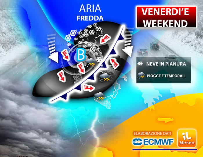
Until the weekend we don't get out of it, in fact a new cyclone is coming that will bring another dose of rain, thunderstorms and snowfalls at very low altitudes.
Andrea Garbinato, editor of the website www.iLMeteo.it informs that after a Thursday still very uncertain in the Triveneto and markedly unstable in the Center-South (especially on the Tyrrhenian side), a new and intense disturbance is expected from Friday. During the morning the weather will tend to worsen in the north with overcast skies and some snowfall up to the plains in Lombardy and Emilia. Clouds and precipitation gradually more consistent and very strong will soon reach Tuscany, Lazio, Campania, Calabria and Sicily.
The snow will fall abundantly on the Apennines, above 700 meters in the Center and over 1000 meters in the South. But that's not all! On Saturday, with the entry of strong winds from Bora, a rapid, but insidious cyclonic vortex will take place that will position itself on Central Italy. An intense phase of bad weather will hit Marche, Abruzzo and Molise with heavy rains and copious snowfalls up to above 3-500 meters, widespread rain also on the lower Tyrrhenian, as in Sicily and Calabria and Campania, also here with snow at hilly altitudes . At the same time, the high pressure will advance in the North and will gradually succeed in protecting all the regions over the course of Sunday. This will end this highly disturbed period for Italy.
IN DETAIL
Thursday 9. In the north: last instability in the Northeast with light rains in the plains and snow in the hills.
Center: highly unstable, snowfall at 700m.
In the south: heavier rains on the Tyrrhenian slopes, snow at 1000m.
Friday 10. In the north: weak snow in the plains in Lombardy and Emilia, rain in the lower Veneto.
Middle: intensely worsening in all regions, snow at 600m.
South: severe disturbance with bad weather and snow at 900m.
Saturday 11. In the north: sun.
Middle: intense bad weather on the Adriatic with dense snow at 400m.
In the south: heavy rains on the Tyrrhenian coasts, snow on the hills of the Apennines.
On Sunday, the last instability in the South, the high pressure on the rest of Italy returns.


