A drop in maximum temperatures from 25 to 10 degrees in the plains, abundant rains in the drought North, snow starting from 400-500 meters in the Center too: five days of bad weather are arriving from Wednesday.
The one underway, after 111 days without rain, will in fact be the week of the meteorological turning point according to the forecasts of Lorenzo Tedici, meteorologist of 'iLMeteo.it'.
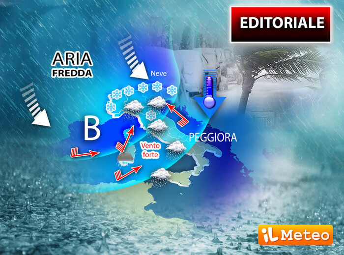
"The European situation - he explains - indicates from tomorrow a slow descent of cold Norwegian air towards Denmark, Germany, France and then Italy. The rains will begin to bathe the central regions as early as this evening / night and then move to the North and part of the South".
On Thursday, rains are expected all over the Peninsula with gradually decreasing temperatures, continues Tedici, "then for the first day of April we will have an even more lively entrance of icy polar air from the Rhone door, that is, from France: we expect a further thermal drop with snowfall which, over the weekend, could whiten the Centronord up to hilly altitudes ".
This meteorological change, the meteorologist continues, "will therefore be remembered for 2 main factors, the return after 111 drought days of significant rains in the North and the exceptional temperature difference. In fact, in the last days, with North African air, desert sand, high pressure and drought, the maximum temperatures had reached 25 ° C in the shade, about 10 degrees above the climatic average for the third decade of March; now with the anomalous descent of Arctic air, the maximum values will drop below the average even by 5-6 points: Temperatures could drop 15-16 degrees in 4-5 days.