
The ultimate route index for Passover
Lovers of panoramic views?
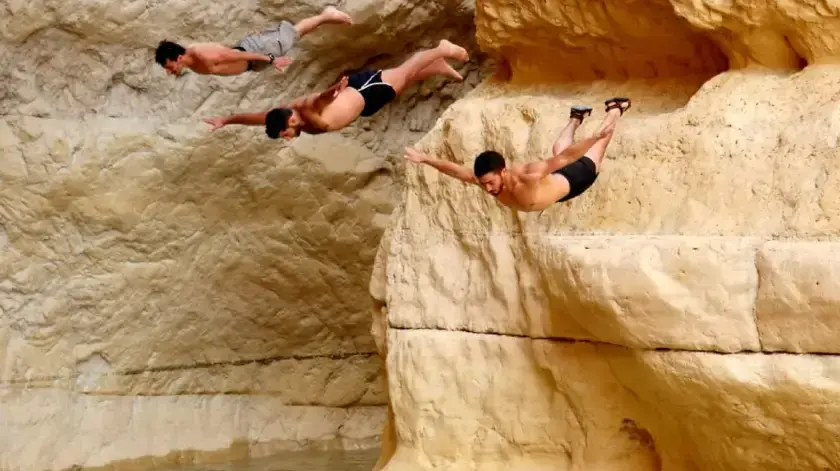
Addicted to flooded adrenaline?
Prefer light trails for the whole family?
Cave lovers?
And maybe you are even in the business of spring blooms?
Get our index of recommended holiday trips.
A special project
Eyal Shapira
10/04/2022
Sunday, 10 April 2022, 17:02
Share on Facebook
Share on WhatsApp
Share on Twitter
Share on Email
Share on general
Comments
Comments
True, every season is suitable for nature walks and any time of the year brings with it options for a variety of routes, but there is no doubt that the king of hiking is spring.
So without unnecessary words - take, cut and save our index of holiday trips, with recommendations for all types of routes: for lovers of flowers, lovers of challenge, lovers of family fun, lovers of observation and lovers of caves.
Our recommendation:
Love everyone.
Important: The routes offered here are a general recommendation.
Did you choose a specific route?
It is mandatory to have a relevant map and a detailed "road story".
Looking for more itineraries and activities for the holiday?
Everything is waiting for you on our special "Passover 2022"
page for the Passover recipes page at Walla!
Food
More on Walla!
Everyone will be hiking this Passover: here are some routes you will not find people on
To the full article
Watch the amazing back in Lower Floating Creek
Lower Rahaf River (Photo: Jamil Alatrash, Nature and Parks Authority)
Trips for flowering lovers
Peony Trail:
A trail named after a flower brings with it loud cries of admiration.
The easy circular route (4.5 km) passes through Mount Hillel in the Mount Meron Reserve. It starts and ends at Beit Jann (arrival from road 864). It starts on a black trail and continues in blue. Pile of stamens in bright yellow. Second ridge
:
This volcanic ridge in the Golan, adjacent to the Syrian neighbor, is decorated with oak forests and offers in spring a wonderful blossom of blue sage, an impressive flower in blue and brown, reaching a height of up to half a meter.
From Highway 98, about a kilometer and a half north of Alonei HaBashan, turn east and camp at the junction on the way to Har Hozk post.
From here, walk south on the green-marked path and return to the car in a circular circle.
Nahal Kalach in Carmel:
One of the most beautiful places to watch the white lily, which boasts its bright white color.
The length of the circular route is only 1.8 km. It starts at the Mevo Kalach parking lot (arrival from 672, near Hai-Bar Carmel), and includes a walk in a beautiful forest, high views and also an encounter with a huge and impressive rocky pipe. Hadera
Forest:
For those who live in the central area and do not want to travel far - this is the place for easy hikes in Izzy. This season it blooms in a yellow lupine area, which appears in dense and impressive groups. , Beautiful picnic areas and what is left of the large winter pool. Arrival: East of the train station in Hadera
.
A desert bloom of Samson the generation and a desert goat-beard, along with other friends, awaits you in the Negev, where the amount of precipitation is respectable relative to the area.
The route (4 km) starts next to road 171, according to the signs. Start and end at the night parking lot of the Lutz cisterns, and on the way pass next to ancient cisterns that were used by the Nabataeans. The circular path is marked in red.
The woodland peony.
Blooms only in April (Photo: Nature and Parks Authority)
Wind turbines on Mount Bnei Rasan (Photo: Creative Commons, Giagiagia)
Nahal Kalach (Photo: Walla! NEWS system, Eyal Shapira)
The winter pool in the Hadera Forest (Photo: Nature and Parks Authority, Nature and Parks Authority)
Rash in the Lutz Pits (Photo: Nature and Parks Authority, Oren Amit)
Trips for lovers of challenges
Nahal Zavitan: A
challenging northern classic - a walking route in the lower corner, with a recommended extension option to the hexagonal pool (linear route, requires a car bounce. You can also shorten and make a shorter circular route).
The road is dotted with streams, waterfalls, plunge pools and an abundance of rocks and basalt cliffs.
At the entrance to the reserve (for a fee) you will receive a leaflet with a map and details of the routes.
Just choose according to your level of difficulty and interest.
Arrival from Highway 87. The
length of the linear route: 6 km, and it is intended for
those who enjoy hiking. 5 km) starts with a red marking and is intended for families with well-traveled children.
Starting point at Avnei Eitan, off Route 98. Bring swimwear.
Nahal Kina:
A large, deep water ridge (in the heart of the desert is always a happy thing, and this is what awaits hikers in Nahal Kina in the Judean Desert. You can walk to the back and return the same way (about 2.5 km in each direction).
Arriving
from
the industrial area of Arad, on a dirt road marked in blue. Start with a blue marking and then turn green.
Partly arduous, starting with a red trail.The highlight of the hike is a challenging descent from a towering cliff, from which there are stunning views of the Lower Galilee. Green. Camp next to road 854, between the 7-6 km markings, walk along the road and turn south on the red trail. Not intended for small children.
Lower river stream:
How short - so tedious (but definitely worth it).
The linear route (2.5 km) requires great care, as you walk along narrow paths, high above the stream, which empties into the Dead Sea. Between the 225-224 km mark and walk east on a green path, continue in blue and descend into crevices with green pools, to a waterfall that will stop your progress and signal you to return.
Nahal Zavitan (Photo: Walla! NEWS system, Dan Saida)
The White Waterfall in the Nahal El-Al Nature Reserve (Photo: Nature and Parks Authority, Mazi Magnazi Moskowitz)
Nahal Kina (Photo: Eyal Shapira, Eyal Shapira)
Al-Khader Cave on the Tzurim Hill (Photo: Eyal Shapira, Eyal Shapira)
Lower Rahaf River (Photo: Nature and Parks Authority, Jamil Alatrash, Nature and Parks Authority)
Trips for family trip lovers
Nahal Aviv:
As the name implies, this is one of the most charming spring trips you can find in the Eastern Upper Galilee.
It does require a symbolic bounce of vehicles, but the cliffs, stone pillars, picturesque canals and impressive caves are well worth it.
The length of the route is about 5 km, starting with a blue trail and continuing in red. Camp next to Road 899, north of Yaron. Another vehicle will wait at the entrance to Nahal Dishon (Road 899, about half a km north of the junction with Road 8966).
Basalt Canyon in Nahal Tavor:
A beautiful family trip to green carpets, towering cliffs, a flowing stream and also a basalt canyon to glory.
In this area of the Lower Galilee, one of the most beautiful parts of Nahal Tavor awaits you, which includes waterfalls and small pools.
Park in the parking lot at the back exit of Kibbutz Gazit (arrival from Road 7276).
Walk east on a red trail, turn north with the blue and climb back with the green.
The ascent at the end is short but a bit grueling.
The length of the route is about 6 km.
Nahal Zalmon:
A short, endearing trip without scenic dramas that is also suitable for the little ones.
It is only about 2 km in each direction and offers streams, a beautiful channel, orchards, a Mediterranean grove and old flour mills. Camps next to Road 804, about 2.5 km south of the Rama junction.
Return the same way or send a driver on duty to return the vehicle.
Og River:
The place to challenge your kids by climbing high rock falls.
Here they will require acrobatic skills and will be assisted by metal pegs, in order to climb from one rockfall to another - with the highest of them rising to a height of 10 meters.
Enjoyment is guaranteed.
The route is circular and about 3.5 km long. Suitable for ages 6 and up. From Highway 1 (Jerusalem-Dead Sea), turn in the direction of Kibbutz Almog and camp a few hundred meters after the kibbutz. There is a danger of floods.
Nahal Tzafit:
Before being immersed in the Nahal Tzin gorge, these two streams offer great experiences for families who love exciting climbing waterfalls at different heights, with the help of metal ladders.
And all in the heart of great malls.
There are several hiking options here.
For example, the length of the route in Nahal Tamar is about 1.3 km in each direction and is suitable for children aged 7 and up. This is a linear route (back and forth or bouncing a car). Green. End point at the gas station south of the Arava junction. Do not walk when there is a risk of flooding.
Nahal Aviv (Photo: Ziv Reinstein, Ziv Reinstein)
Basalt Canyon in Nahal Tavor (Photo: Zahav.ru, Gary Reznikovsky)
Nahal Zalmon (Photo: Walla !, Eyal Shapira)
Nahal Og (Photo: Walla! NEWS system, Ziv Reinstein)
Nahal Tzafit (Photo: Walla! NEWS system, Ziv Reinstein)
Excursions for cave lovers
Tiger Cave:
High above Nahal Nimar in the Western Galilee, hidden in the heart of the cliff is a tiger cave, with deep halls, impressive stalactites and stalagmites as well as narrow passages that will require you maximum flexibility.
Leave the bag at the entrance to the cave, and dive the soil thicker with a headlamp.
The fun is great, but the track is not suitable for small children or claustrophobic types.
From road 899 go up to road 8993
and after about 2 km camp, cross the road to its northern side and go down towards the stream with the green marking. The road to the cave takes about 15-20 minutes
.
Does not require challenging skills and acrobatic ability. The Twin Cave in the Dolev Reserve is inhabited by masses of bats, including dragonflies, foxes and fallers. South of an abandoned moshav, and walk about half an hour to the cave.
The Six Shafts Tunnel (Birdy National Park):
Most of the publicity of the old city of Birdy came to it thanks to its rich mosaic, but a few years ago an impressive water reservoir was discovered here and next to it a tunnel that stretches to the ground for almost 100 meters.
This is a classic route for young children who are afraid of huge caves that never end.
Flashlights must be provided.
Entrance to the national park for a fee.
Getting there from Route 79.
Finger Cave:
One of the most beautiful and popular caves in the Carmel will require you a little effort in climbing it, but a walk up the cliff is definitely worth the view from above.
The cave has three large halls and offers a beauty of a trip for the whole family.
You can expand and make a circular route on the cliff, or go back the same path.
From Highway 4, turn east to Highway 721 and immediately park according to the signs.
The road to the cave (about 750 meters in each direction) is also controlled.
Zedekiah's Cave:
And finally, a little enchanted, located under the Old City of Jerusalem.
It is in fact a huge quarry, which was used by the builders of the city in ancient times.
It is more than 200 meters long and is superbly lit, well marked and full of mysterious fragrance, thanks to the abundance of stories and stories associated with it.
Arrival: next to the city walls, east of the Nablus Gate.
Entrance fee.
The route passes under the Muslim Quarter.
Tiger Cave (Photo: Walla! NEWS system, Photo: Eyal Shapira)
The Cave of the Twins (Photo: Walla! NEWS system, Eyal Shapira)
The Six Shafts Tunnel (Photo: Walla! NEWS system, Eyal Shapira)
Zedekiah's Cave (Photo: Walla! NEWS, Eyal Shapira)
Hikes for lovers of peaks
Mount Tabor - Peak Trail:
A sacred church complex awaits you at the top of Mount Tabor in the Lower Galilee, and it is recommended to visit it before or after this pastoral and easy hike, which is about 2.5 km long. Visit the Church of the Transfiguration and set off with the black path, which exits the Wind Gate, which passes through a beautiful forest and overlooks the lower Galilee and the Jezreel Valley, as well as the Gilboa area and even the distant Golan Heights
.
Ramat Sirin, do you know?
It's your time to get to know it and discover a beautiful region that does not receive high ratings.
One of the most beautiful points here is Mitzpe Alot, from which the Sea of Galilee is fully visible, as well as the Golan Heights and the Jordan Valley.
Do not miss an encounter with the "spaceship", a strange-looking but incredibly cute observation tower.
From Highway 90, turn in the direction of Menahemia, continue on a winding road to the east, reach the turbine farms, camp and walk along the Israel Trail in a northwesterly direction.
You can also reach on foot, on a long linear route, directly from Menahemia.
Tel Shocha:
A circular path about 5 km long, which offers hikers colorful spring scenes of the Ella Valley, the place where David and Galit fought. Meet silent ruins and cisterns, penetrate the heart of the forest and receive impressive views towards the lowlands and the Mount Hebron area. Continue with a green marking and return to the starting point.
Mount Meron - Peak Trail:
A classic and unforgettable observation trail, in one of the highest places in Israel: the summit of Mount Meron.
From Highway 89, drive to Sde Meron School and climb to the top of the mountain.
From here, at an altitude of about 1,200 meters and out of the dense forest, you will get great proportions and refreshing views of the Galilee, the Golan, Lebanon and everything in between.
Just stay on the red circular path that will take you back to the vehicle.
Length of the route: about 2 km.
Mount Sodom:
The summit of this mighty Dead Sea provides unforgettable views of the Dead Sea, the Judean Desert and the Jordanian neighbor. The route is linear (about 4 km) and requires a car jump.
From Highway 90, follow the signs to Mishor Amiaz and Mount Sodom.
Another vehicle will wait at the foot of the mountain, on Route 90 (near the 199 km stone). From the starting point, walk along a blue path to the east, model a beautiful gorge, wind back and forth and reach the edge of the cliff - to a breathtaking desert view. You to the foot of the mountain.
View from the summit trail on Mount Tabor (Photo: Walla !, Eyal Shapira)
The spacecraft in Ramat Sirin (Photo: Walla! NEWS system, Eyal Shapira)
Tel Shocha (Photo: Walla !, Eyal Shapira)
View of the city of Safed from the summit trail on Mount Meron (Photo: Erez Michaeli)
Mount Sodom (Photo: ShutterStock, Shutterstock)
* Please note: For the routes described here briefly, trail maps and a detailed "road story" must be provided.
Tourism
Passover 2022
Tags
Excursions in the country