
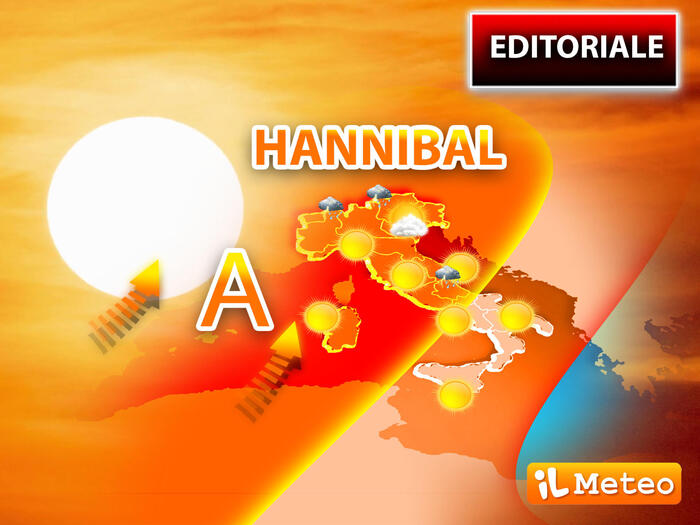
Hannibal or Hannibal, a famous Carthaginian leader for the crossing of the Pyrenees and the Alps with elephants towards Rome: the homonymous anticyclonic field runs along the same road and for this reason it takes the name of the 'Tunisian' leader, the letter A of Hannibal also indicates
the first fort heatwave of 2022
.
In these hours, in fact,
hot currents from Tunisia and Algeria are heading towards Italy
, passing through Spain and France with high thermal values:
we are already 8 degrees above the average for the period
and
the peak of African heat is expected next Tuesday.
.
We will reach well above 32-33 ° C especially in Northern Italy, but the heat will expand during the weekend also towards the central-southern regions.
If we had been in August, when the sea is already warm, with this configuration we would have touched 37-39 ° C.
At this moment we are saved by the Mediterranean basin which still has fresh water, around 20-22 ° C: this reserve of cool will partly protect us from this heat wave by affecting the North African currents in transit on the Mare Nostrum. synoptic that explains the anomalous and early ascent of Hannibal sees the rapid deepening of the Icelandic cyclone up to a minimum of 990 hPa, this low pressure brings bad weather to the British Isles and sucks hot currents from North Africa to Italy: a configuration that will remain blocked at least until next week with Hannibal's domination of Central Europe.
Antonio Sanò, director and founder of the iLMeteo.it site, foresees the reinforcement of the 'Hump of the Camel' in Italy, as the African Anti-cyclone is nicely called, with an extension towards the North that touches Denmark and Poland: to be exact having the camel two humps it would be better to indicate the African Anti-cyclone as 'Hump of the Dromedary'.
Beyond the animal with the hump, this anticyclonic promontory will cause an exceptional heat wave for the period in Italy:
we are in fact still in mid-May and the typical maximum temperatures of July will be reached.
Only in the weekend short moments of afternoon refreshment are expected in the Alps and locally on the Po Valley, with patchy thunderstorms, just like in the middle of summer.
Many similarities with July, Hannibal is crossing the Pyrenees and points to the Alps, this time instead of elephants he has many dromedaries, the hump of the African anticyclone will bring very sultry conditions already in mid-May.
Friday 13
In the North: sun and summer heat, but with afternoon thunderstorms in the Triveneto Alps.
In the Center: good weather, warm.
In the South: clear or partly cloudy sky.
Saturday 14.
In the North: immediately showers on Lombardy and Triveneto, improves from the afternoon.
In the Center: good weather, warm.
In the South: good weather, warm.
Sunday 15.
In the North: sun and summer heat, but with isolated thunderstorms from the Alps towards the adjacent plains, more likely in the North-West.
In the Center: good weather, warm weather, isolated storms on the Abruzzo hills.
In the South: good weather, warm. Trend.
Dominated by the Anticyclone Hannibal, the North African high pressure will bring a further increase in temperatures with predominantly sunny conditions at least until mid-week.