Starting this evening, the red-hot grip of the
African heat
- brought by the
anticyclone Apocalypse 4800 -
is loosening on the
northern
regions
with the arrival of an
Atlantic perturbation
that will make its entrance from the Alps and will bring
rain
and
storms
to spot. leopardo, up to the Po Valley, where the
Po
continues its summer of suffering, in the sixth wave of drought of the last twenty years.
YELLOW ALERT IN NINE REGIONS
In anticipation of rain, the
yellow warning
signal was issued for tomorrow 26 July by the Civil Protection
in nine regions
:
Abruzzo
,
Emilia-Romagna
,
Friuli Venezia Giulia
,
Lombardy
,
Marche
,
Piedmont
,
Autonomous Province of Bolzano
,
Umbria
and
Veneto
, and by hydrogeological risk on north-eastern Piedmont and the Autonomous Province of Trento.
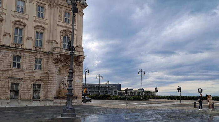
The announced disturbance arrived in the province of
Alessandria
.
The Casalese
was particularly affected
.
The
strong wind
brought down the Fanfarino in piazza degli Alpini in nearby Occimiano, but there were no parked cars or people.
The Municipality staff has already carried out an inspection and the tree will be removed tomorrow morning.
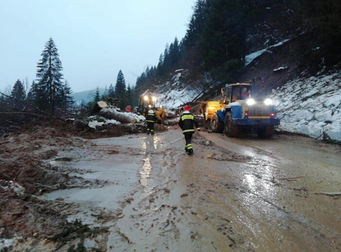
A series of trees have fallen on the roads
, with criticalities for the viability, as they know from the operations room of the firefighters.
Discomfort due to thunderstorms in Val Cerrina and in the Lower Monferrato, with interventions in Castelletto Merli, Pontestura and Camino.
A
violent hailstorm hit
the town of
Saluzzo
, in the province of Cuneo.
In the
South
we will continue to suffer from
high temperatures
, the cool front will not reach them, at least for now.
WEATHER FORECAST IN DETAIL
Starting from Tuesday 26 and at least until Friday 29 July, the African anticyclone will lose its strength, an instability that will lead to storms in the north that
can descend from
the Alps to
the Prealps
and also to some areas of the
Po Valley
.
The perturbed systems will hit the northern regions in patches, but they can be very strong and be accompanied by exceptional
hailstorms
and, in rarer cases, by tornadoes.
This is what
Antonio Sanò
, director and founder of the site
www.iLMeteo.it announces
.
The Center-South, on the other hand, will continue to be protected from the anticyclone even if there will be heat storms on the Apennines and nearby areas (locally also on the Adriatic coasts), also very strong here (especially on Wednesday).
From a thermal point of view, the maximum temperatures will begin
to drop by even 4-5 ° C
starting from Wednesday 27, especially in the North and a few degrees less it will also be recorded in the Center.
On the other hand, the situation in the south is stable, where no substantial change is expected.
Monday 25
.
In the north: it gets worse on the Alps and Prealps, in the evening also on the medium and high plains.
In the center: sun and intense heat.
South: sunny and warm.
Tuesday 26
.
In the north: unstable in the Triveneto, in the evening also in the north-west and in Emilia.
Hot weather.
Center: mostly sunny.
In the south: prevailing and hot sun.
Wednesday 27
.
In the north: unstable with scattered thunderstorms and less hot weather.
Center: afternoon thunderstorms over the Apennines and adjacent areas.
South: sunny.