
During the week that has just begun, the weather on Italy is destined to change once again: goodbye to long periods dominated by vast anticyclones, now the protagonists of the time are the unstable impulses coming from Northern Europe and Russia.
And just one of these will undermine Italy in the coming days.
Antonio Sanò, director and founder of the site www.iLMeteo.it announces that today's day will continue under the banner of renewed atmospheric stability thanks to the advance of the Azores anticyclone which from the west has managed to spread over much of Western Europe , Including Italy.
In short, more sun for everyone (except for some quick rains in Tuscany, Umbria and Marche), even if temperatures will tend to remain on rather low values, especially during the early hours of the day.
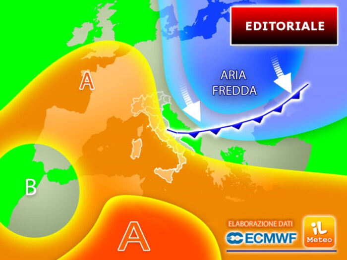
As mentioned, however, the absolute atmospheric stability will not last long: from Wednesday 21 September in fact a new cold attack coming from the Balkans will undermine Italy.
Given the type of configuration, with the cold and unstable currents arriving from the Scandinavian Peninsula and Russia towards the Balkan area, the regions most exposed will be the Adriatic ones and part of those in the South: on these sectors, given the mass of air at the entrance, really cold, the temperatures will further decrease and on the Adriatic coasts it will be difficult to exceed 20 ° C in broad daylight.
In terms of rainfall, on the other hand, showers and local thunderstorms are expected in Puglia, Abruzzo and then on the Tyrrhenian coasts of Calabria and Sicily, they will be more occasional but still possible on eastern Sardinia and locally on Lazio.
IN DETAIL
Monday 19.
In the north: prevailing good weather, stable and sunny.
In the center: some rain on Tuscany, Umbria, Marche and then Abruzzo and Molise.
South: good weather, some clouds in the Apennines.
Tuesday 20.
In the north: partly cloudy, good weather.
In the center: more clouds and some showers on the Adriatic sectors.
South: unstable over Puglia.
Wednesday 21.
In the north: more clouds in the Northeast, sunny elsewhere.
In the center: cold eruption from the Balkans, more clouds on the Adriatic and some rain in Abruzzo and on the Lazio coasts.
In the south: widespread instability on the Ionian sectors of Sicily and Calabria.
Trend: in the following days still often unstable weather on the major islands, with even intense phenomena, drier on the rest of Italy.