
A disturbed start to the week especially in the central regions but as early as tomorrow, and also for Wednesday, an improvement in the weather conditions is also expected in the North which will favor the formation of fog banks in the plains.
Some downpours may occur only locally in Umbria, the Marches and Tuscany.
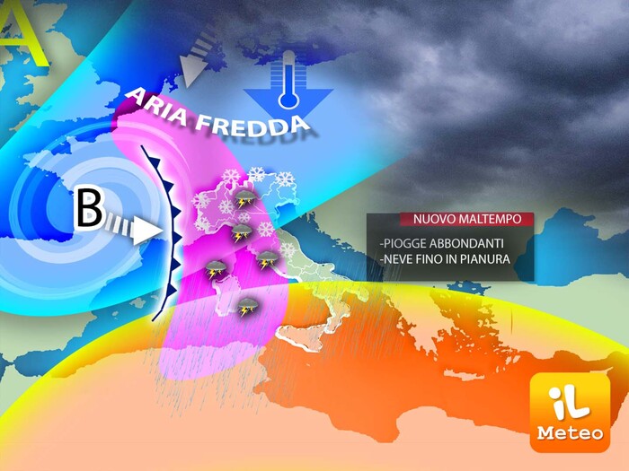
Then, for the Immaculate Conception, a new intense perturbation will hit the Center-North bringing rain and snow even at low altitudes.
This is announced by Antonio Sanò, director and founder of the site www.iLMeteo.it.
according to which today Tuscany and Northern Italy will be crossed by a fast unstable front with more rain and snowfall in the Alps, but the weather will improve as early as the afternoon.
As for the bridge, however, snow could also fall in the plains of Piedmont and western Lombardy,
flakes could also descend in Milan and Turin as well as in Cuneo.
It will instead be widespread rain on the rest of the North below 900 meters and on Tuscany and Umbria.
Finally, the perturbation will still act on Friday 9, mainly affecting the Tyrrhenian regions, with locally intense phenomena.
In detail - Monday 5. In the north: unstable in Lombardy and Triveneto, snow at 1100m.
In the middle: showers in Tuscany and Umbria, scattered clouds elsewhere.
In the south: good weather and mild climate during the day.
- Tuesday 6. In the north: dry weather, but fog arrives in the plains.
In the middle: some rain in Umbria, lower Tuscany and the Marches.
In the south: very cloudy and mild climate.
- Wednesday 7. In the north: mists in the plains with a cold climate, sun in the mountains.
In the middle: some rain in Umbria.
In the south: stable weather.
Trend.
Disturbance Thursday 8 and Friday 9, then still unstable.