
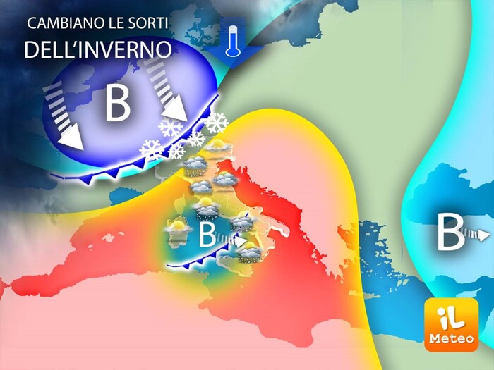
The turning point towards decidedly more wintery weather conditions is approaching: January 15 could in fact be the date of the first meteorological inversion towards a decisive change of season.
From Sunday colder and unstable air could gain ground towards the Mediterranean bringing back more typical conditions of the current season.
Lorenzo Tedici, meteorologist of the website www.iLMeteo.it, confirms that, after some rain expected between tonight and tomorrow, the comeback of the anticyclone will be short-lived.
From Sunday 15 January it is probable, but to be confirmed, a change of season with snow not only in the Alps but also in the Apennines: good news for the ski tourism sector of the central-southern regions, with the arrival of maritime polar currents from the Sea of the North.
Rainfall is therefore expected from Sunday, snow locally even at low altitudes at the beginning of the new week in the Po Valley and at hilly altitudes on the Apennine ridge with temperatures towards the average for the period.
While waiting for the change of season, says the meteorologist, "however, we still expect days with highs above 15°C, which will be more reminiscent of autumn than winter".
In detail, the weather today will be mostly clear with peaks of 17 degrees in Sardinia, Sicily and Calabria
From the evening a rapid perturbation will bring some rain to the North and to Tuscany;
during the night the rains will cross the central regions and tomorrow there will be fleeting bad weather in the South with some new snowfall on the 1200 meters between Abruzzo and the southern ridge.
Given the speed of this mild Atlantic perturbation, the sun will be the protagonist again between Friday and Saturday but, as mentioned, from Sunday 15 January we will be able to see a general change: rainfall is expected first over Liguria and the North-East and from Monday also along the Tyrrhenian;
finally, from Tuesday bad weather could affect a large part of Italy in a widespread way with possible snow at low altitudes in Piedmont.


