Here comes the real winter in Italy.
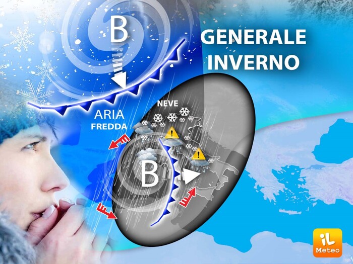
From Sunday 15 January, as widely expected already in recent days, the synoptic picture will change substantially. We will go from a long period in the company of the African anticyclone with highs of up to 20°C in the South, and even 15°C in the Po Valley , to a winter phase with very heavy rains and a gradual drop in temperatures.
Mattia Gussoni, meteorologist of the website www.iLMeteo.it, confirms that the drop in temperatures will be slow but widespread, while the winter-style bad weather, with lots of rain on the Tyrrhenian side and in the South, will come to life quickly.
To follow this winter passage we point out where it will be possible to find snow: from Sunday afternoon it will snow in the Alps above 700-900 metres, in particular in Valle d'Aosta and then in the evening also in the Triveneto.
The new week will finally see some 'convinced' flakes also on the northern and central Apennines above 700 meters, from Tuesday with a significant worsening of the cold, snow will be possible up to 300 meters in the North and above 500-600 meters also in the Center From mid-week the cold air will also gradually spread towards the South with the first snowfalls at hilly altitudes on Thursday and Friday when the white lady could be the protagonist up to the plains of Lower Piedmont, Lower Lombardy, Emilia and also between Liguria and Tuscany.
At the moment Thursday and Friday seem to be the coldest and snowiest days but still the time distance is wide and we will monitor the general picture. Before reaching this winter phase we will have some rains in the next few hours on the middle Adriatic and on the southern regions followed by an improvement, while the weather will be pleasant elsewhere.
On Sunday, as mentioned, he will have the honor of opening the doors to General Winter who, being an old man, will enter Italy very slowly.
Rain is expected in the morning on Liguria, Tuscany and the Aosta Valley, then moving eastwards.
In conclusion, and in summary, for the new winter week here are the Highlights, the main aspects expected: gradual drop in temperatures (initially not very marked), torrential rains on the Tyrrhenian side in particular in the Centre-South, snow down to the plains possible on Tuesday 17 in the north, snow at low altitudes between Thursday and Friday also on part of the power stations with intensification of frost throughout the boot.
We just have to make the change of season, with a couple of months of delay we will take out the waterproof wardrobes in the South and duvets in the Center;
the North was already ready.
IN DETAIL
Sunday 15th
: in the North, worse in the evening in the Northeast.
In the centre
: rainfall from upper Tuscany towards the rest of the region.
In the south
: partly cloudy and worsening skies.
Monday 16:
in the North, bad weather with snow in the Alps.
In the middle
: bad weather with snow in the Apennines.
In the South
: rains especially in Campania and Calabria, variable elsewhere and mild.
Trend
: during the new week, the true Italian Winter arrives from North to South.