
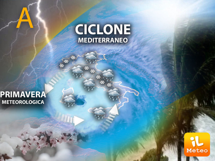
The Mediterranean cyclone persists over Italy bringing widespread rain, snow and strong winds until Thursday, especially in central-southern Italy and in Romagna.
From Friday, the situation should gradually become more stable.
This was announced by Lorenzo Tedici, meteorologist of the www.iLMeteo.it site, confirming a bad weather at the beginning of March.
At the moment the eye of the cyclone, which can also be easily identified from satellite images, is located in southern Sardinia and causes more intense rains in the centre-south.
During the day, moving east-northeast, the minimum will be found off the Lazio coast, on the central Tyrrhenian Sea, and from here it will push a widespread deterioration also towards Northern Italy.
Tomorrow morning the eye will be on the Tuscan Archipelago with the most intense bad weather towards the central regions but patchy also on the rest of the country, alternating with clear spells.
On Friday it will return to Sardinia again and locally heavy rains are expected in the central and part of the southern regions.
Finally, during the weekend and with the vortex towards the south, the rains will leave the Center-North free with prevailing sunshine, while they will wet the southern regions accompanied by a gradual decrease in temperatures.
Over the weekend the vortex, much weaker, will remain the protagonist only in the South.
In detail:
- Wednesday 1.
In the north: rains from Emilia Romagna towards the rest of the regions, snow also in the plains of Emilia.
Middle: diffusely unstable.
In the south: rains in Campania, Basilicata and Puglia, but only in the morning.
- Thursday 2. In the north: unstable until the afternoon.
In the centre: unstable with rainfall especially in Sardinia, Lazio, Abruzzo and Molise.
In the south: rains in Campania, Basilicata and Puglia.
- Friday 3. In the north: good weather.
In the middle: clouds and downpours, then improves.
In the south: unstable with frequent showers and snow on the hills.