Marking the Megiddo Trail (Photo: Omri Selner, Society for the Protection of Nature)
In honor of Passover and the upcoming travel season, a new trail was recently marked in the north -
the Megiddo Trail
- along about 70 km in the Ramot Menashe Biosphere Reserve, which received international recognition by the UNESCO World Council in June 2011, together with the Megiddo Regional Council.
The path passes through natural landscapes and heritage sites between Ramot Menashe settlements, kibbutzim and moshavim, and several fascinating points of interest such as flour mills in Nahal Kini, Givat Yashihu-Tel al-Asmar (volcanic hill), Olmos and Tabor oak groves, Ein Nili, Nahal Shelf, Emek HaShalom, Nahal Hashofet and Nahal Gahar, Joara, the kibbutzim monument and the Mishmar Hamemek battle monument.
More
trips for Passover
on the special page of Walla!
Tourism
after 4 years has finally been inaugurated: the perfect family route for Passover
activities for children in Passover 2023: all the attractions for the holiday
just before it gets hot: tours of flows and blossoms especially for spring
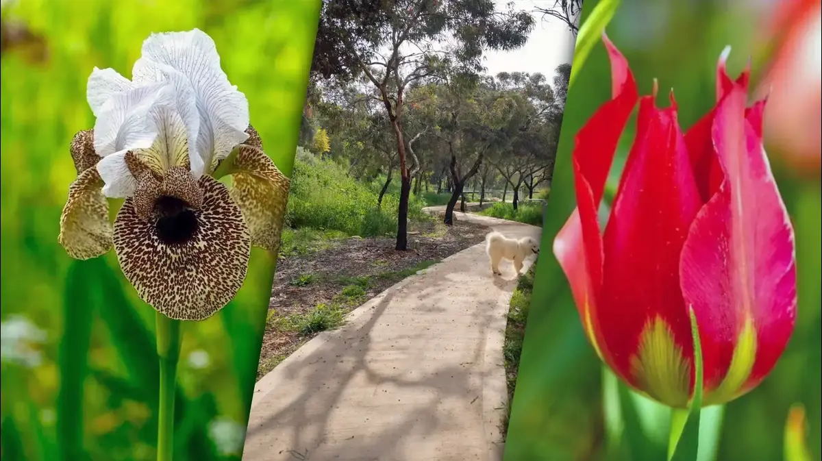
Also, the travelers on the new path will enjoy beautiful views of the area and its surroundings: Tel Megiddo, Gilboa, Mount Tabor and Givat Hamora, Carmel, Mount Amir and more.
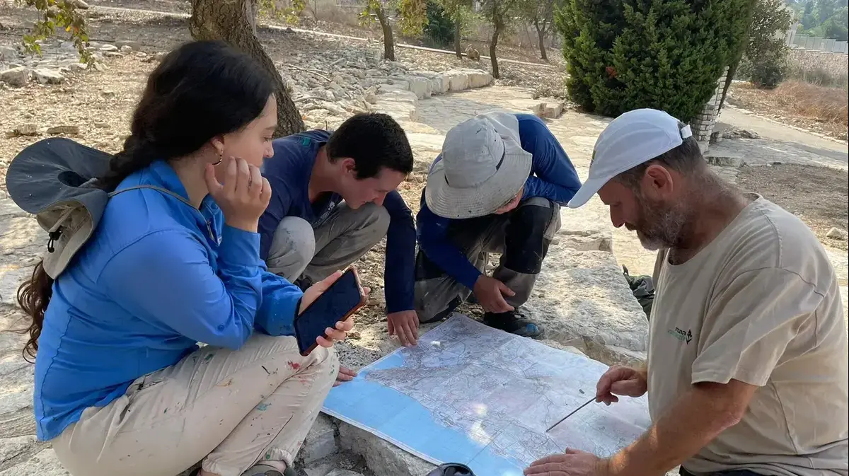
The trail was designed by the Megiddo Regional Council and its residents in collaboration with the Israel Trails Committee, KKL and RTG,
and it was marked in white-purple-white
by the trail marking team of the Society for the Protection of Nature. The trail starts and ends at the Megiddo intersection, behind the bus station, i.e. Fully accessible by public transportation. In honor of the inauguration of the Megiddo Trail, the Society for the Protection of Nature launched a new and updated hiking map for the Carmel area and it can be purchased on the website.
They mark the Megiddo trail, which is white-purple-white in color (photo: Society for the Protection of Nature, Omri Selner)
A beautiful vantage point as part of the Megiddo Trail.
The kibbutz monument in Ramot Menashe (photo: Society for the Protection of Nature, Itzik Ben Dov)
View along the Megiddo Trail (Photo: Society for the Protection of Nature, Itzik Ben Dov)
"What you feel through sandals will never be forgotten"
The Megiddo Biosphere Reserve covers 197,000 dunams - double the area of Gush Dan.
The area includes pastures, agricultural areas, planted forests and natural oak forests, a variety of plant owners and rare natural vegetation.
Noa Eshkol, director of projects and initiatives in the education department of the Megiddo Council, who pushed and led the planning and implementation of the trail, says that the council and representatives of the localities - Elad Tesler from Ramat Hasofet Viniv Schreiber, who walked and rode the route before it was marked - along with representatives from KKL-Junk and RTG, did All in order to make sure that the chosen route is the most correct for residents and travelers who are expected to visit the trail.
"This project turned from a dream into a reality thanks to many people who mobilized for the task. As someone who grew up and was educated on hiking trails, this is what I want for the children of Megiddo and the region - that they smell the spring blossoms, feel the soil, taste the edible plants, see the changes in the environment according to the seasons and listen To the sounds of nature. What you feel through the sandals will never be forgotten. I intend to make the concept of biosphere education an experience for children, people and communities who will walk on it in the area that is the most beautiful in Israel," she adds.
A marker of the Committee for Marking Trails in action (photo: Society for the Protection of Nature, Omri Selner)
A lovely spot on the trail.
Ein Nili (photo: Society for the Protection of Nature, Itzik Ben Dov)
Trail marking team of the Society for the Protection of Nature (Photo: Society for the Protection of Nature, Omri Selner)
We hope that a "walking lane" will be created
Itzik Ben Dov, the trail marking coordinator at the Society for the Protection of Nature, points out that this is a very diverse path, with special landscapes, between thick forest and plains with low vegetation, between blossoms and flowing water, between high lookouts, stream channels and archaeological and historical sites.
"After joint thinking, study of the area, tours and consultations, at a good time we finished the planning and marking of the 'Megiddo Trail', in an area with extensive open spaces that is relatively close to the center of the country. During the winter and spring, the Ramot Menashe area is covered in a green carpet and spectacular flowers: daffodils, marigolds, anemones In many colors, lupins and more, the streams flow and the springs are abundant. I have every hope that many travelers will travel on the trail who will get to know the area and enjoy what the trail has in store for them along its length," he says.
Itzik Holevsky, head of the Megiddo Regional Council: "The council, in a combination of forces between the Biosphere Reserve Department headed by Hagar Reuvani and the Education Department headed by Karin Stern, are promoting the beautiful project, which is a community-social-educational and environmental project, which creates wonderful connections between the localities, the residents, systems Education and the unique values of the landscape and heritage in Megiddo, and all this in partnership with the National Fund for Israel, the Nature and Parks Authority and the Society for the Protection of Nature."
The Committee for Israel Trails next to the Society for the Protection of Nature has been marking hiking trails throughout Israel for decades, to allow travelers the full experience of getting to know the country's natural treasures and its heritage while maximally preserving nature and the safety of the travelers.
Ben Dov points out that the first hikers to cross the trail will walk and mark the trail's route with their feet as well in the hope that when the spring vegetation covers the area, the trail's route will also be visible in the "walking strip" that will be created: "The hikers along the entire length of the trail will get to know the Menashe Plateau in aspects of topography, Geology, morphology, streams, springs, flora, fauna, Bible, archeology and heritage, and also the settlements of the area.
The fact that this is a beautiful and interesting area leads to the hope that the path that will be marked will attract many hikers.
Guaranteed for travelers for an enriching and unique travel experience."
Visuals - https://drive.google.com/drive/folders/1r0xcCQjE8K5WU9aG1ukNIanKCWAaMBVg?usp=sharing
tourism
Trips in the country
Trips in the north
Tags
Trips in the country
Megiddo
Tracks