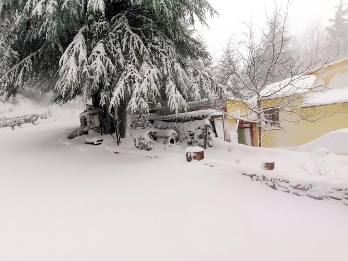
Heavy rainfall, even in the form of cloudburst, and violent gusts of wind: these are the main effects, at least throughout the week, of the violent cyclone that is affecting Italy especially the Northeast and the Tyrrhenian side of the Center-South. "The week that has just begun - explains Antonio Sanò, founder of the 'iLMeteo.it' site - will be unstable and disturbed on several occasions, from North to South", due to a "large area of low pressure present over Europe, which throughout the week will continue to drive air masses of polar origin towards the Mediterranean basin. The incoming cold currents - he specifies - will feed an explosive cyclogenesis on the Tyrrhenian Sea". Explosive cytogenesis, also called bomb cyclone, adds Sanò, occurs when an area of low pressure located at mid-latitudes sees atmospheric pressure drop to its minimum at a rate of at least one millibar (hPa) per hour for at least 24 hours. The risk is that extreme weather events occur such as storms and, in the most exceptional cases, the so-called 'flash floods' that usually affect narrow swathes of territory, discharging large quantities of water to the ground. On the Northeast and the Tyrrhenian Sea of the Center-South could fall in a few days the equivalent of the precipitation expected in over 2 months.
In detail: Monday 15 - In the north: sunnier. In the middle: it gets worse towards evening. In the south: Tunisian cyclone arriving with strong bad weather, starting from Sicily.
Tuesday 16 - In the north: widespread instability with bad weather in Emilia Romagna. In the middle: severe weather in all regions. In the south: scattered rains and thunderstorms.
Wednesday 17 - In the north: scattered rains and thunderstorms especially on Emilia Romagna. In the middle: many regions in the grip of bad weather. In the south: rain and thunderstorms on Campania, Puglia, Basilicata.
Trend - instability that persists in the Center-North for several more days, less present bad weather and more dry spaces in the South.