
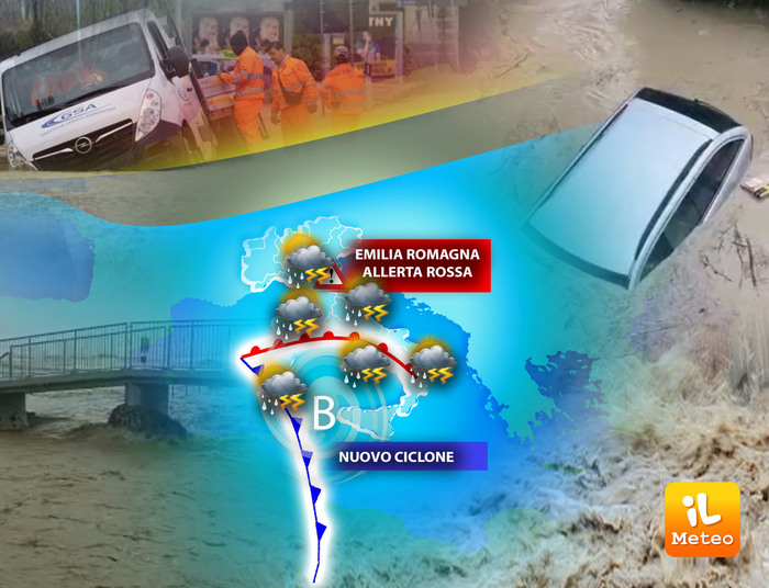
Brief respite of bad weather: there is a temporary improvement but a new cyclone is approaching on the horizon. These are the forecasts of Andrea Garbinato, responsible for the editorial staff of the www.iLMeteo.it website. In the next few hours the most widespread rains will leave the flooded areas and will move towards the middle Adriatic with some patchy showers also on the rest of Italy; The weather will therefore not improve completely and this 'stormy May' will continue.
From tomorrow a new cyclone will move from Algeria towards Southern Italy and will be able to push even heavy rains first towards Sardinia and the North-West then between Saturday and Sunday on most of Italy: dry phases are expected on most of the North-East, also on Emilia Romagna. Today some more widespread downpours on the middle Adriatic, rains from Sardinia to the North-West tomorrow, abundant and widespread rains over the weekend with the exception of Emilia Romagna and Triveneto. Also expected early next week.
In detail
Thursday 18. In the north: isolated rains in the Northwest, especially in the mountains. In the center: rains on lower Tuscany, Lazio, Abruzzo and Molise. In the south: some scattered downpours, more likely over Campania, Basilicata and Puglia.
Friday 19. In the North: unstable with bad weather in the Northwest. In the center: rains on Tuscany and Sardinia, scattered elsewhere. In the south: many clouds, rain in Sicily.
Saturday 20. In the North: heavy rain over the North-West, it will also worsen elsewhere. In the middle: widespread rains. In the south: widespread rains, more intense on Sicily and Calabria.
Trend: cyclone with locally heavy rainfall on the Major Islands and in the North-West; Instability expected until at least the middle of the new week.