
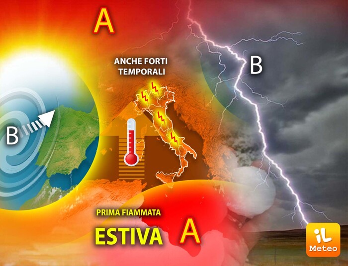
(ANSA) - ROME, JUNE 09 - The cyclone that rages over Portugal, Spain and France will be responsible for a brief African heat wave starting Friday, especially in the South and in Sicily. But strong thunderstorms are always lurking, especially in the Alps and Apennines. From next Wednesday the situation will change with the entry of a new cyclone. These are the predictions of Antonio Sanò, founder of the www.iLMeteo.it website.
"With the arrival of the sub-tropical anticyclone - he observes - temperatures will rise above the average for the period even by 3-5 ° C. The heat will be felt especially in Sicily where it will be possible to touch 34 ° C on inland areas and in Syracuse.
Over 28-30 ° Csi will be recorded in Puglia, in some areas of Calabria, in the inland areas of Tuscany, such as in Florence, in the Po Valley and on the valleys of South Tyrol. The hottest day seems to be Sunday, June 11 when the sun will prevail over most of Italy". But the African anticyclone will also favor the outbreak of strong thunderstorms. "Given the so much energy involved, humidity and heat in the lower layers of the atmosphere - adds Sanò - ideal conditions will be created especially during the afternoon hours for the development of strong thunderstorms, with gusts of wind and hail, especially in the Alps and the Apennines. Particular attention starting from Friday in the North, even in the plains, and then in Piedmont, on the Alps and central-southern reliefs. The situation will continue in the first two days of next week, from Wednesday it will change. The entry of cooler air from northern Europe will favor the genesis of a cyclone that could hit the center-south."
(ANSA).
Weather: first summer flare-up, but with strong thunderstorms lurking
2023-06-09T08:21:48.777Z
Highlights: The heat will be felt especially in Sicily where it will be possible to touch 34 ° C on inland areas and in Syracuse. The hottest day seems to be Sunday, June 11 when the sun will prevail over most of Italy. But the African anticyclone will also favor the outbreak of strong thunderstorms. Particular attention starting from Friday in the North, even in the plains, and then in Piedmont, on the Alps and central-southern reliefs. From Wednesday the situation will change with the entry of a new cyclone.
The cyclone raging over Portugal, Spain and France will be responsible for a brief African heatwave starting Friday, especially in the south and Sicily. But strong thunderstorms are always lurking, especially in the Alps and Apennines. (ANSA)


/cloudfront-eu-central-1.images.arcpublishing.com/prisa/S7ERVSCT4FUVX6R7TUVBDNTH5Y.jpg)


