
A fast train of cyclones is on the way at least until mid-March.
This was announced by Lorenzo Tedici, meteorologist of 'iLMeteo.it', specifying that the first cyclone, still ongoing, will end tomorrow, moving its attenuated effects from Northern to Southern Italy.
On Friday 8 March a new disturbance will reach Sardinia in the morning (coming from the west) and in the evening the north-western and Tyrrhenian regions;
and if no widespread phenomena are expected for March 8th (with the exception of Sardinia), we will experience the third disrupted weekend in a row.
From Saturday, in fact, the depression area will gain more and more strength, reinvigorated by the so-called 'Polar Jet Stream', which in the meantime will have dived into the Mediterranean: 2 disturbances will develop, one on Saturday and one on Sunday with the same trajectory and the same dynamic.
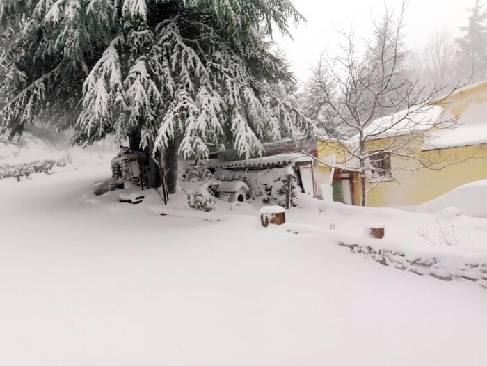
Bad weather in the Centre-North and with lots of snow in the Alps, there will still be moderate snowfalls in the central-northern Apennines and larger clearings only in the South and, at times, on the Adriatic side.
"The Polar Jet Stream - explains Tedici - represents an area with very strong winds (at around 9000 metres) which delimits the polar air masses and governs atmospheric circulation, often also affecting Italy".
In detail: - Wednesday 6. In the north: unstable at times, especially in the mountains and in the Northwest.
In the centre: showers in Tuscany, Umbria, Marche and Abruzzo, snow at 1000 metres.
In the south: good weather prevailing.
- Thursday 7. In the north: sunny.
In the center: sunny on the Tyrrhenian Sea, many clouds elsewhere, but with rare rain.
In the south: a little unstable in Calabria.
- Friday 8. In the north: sunny, increasing clouds in the North-West with the first phenomena from the afternoon to evening.
In the center: sunny with slowly increasing clouds, rain arriving in Sardinia from the afternoon.
In the south: good weather except for local clouds in the morning over Puglia.
- Trend: new cyclone over the weekend with two similar disturbances, the 'twin storms'.
Reproduction reserved © Copyright ANSA