
In the video: Berkat Tzafira and Nahal Tzalim in the Yehuda desert/photo: Eyal Shapira, editing: Nir Chen
Nahal Kina, one of the streams bordering the Arad valley to the east, drains the valley and flows eastward while crossing the edge of Zohar Ridge - and simply great these days.
Kina is a city mentioned in the list of Judean cities, in Aramaic the meaning of the words is metal potter, or blacksmith, blacksmith.
Cain is mentioned in the Bible as the father of the blacksmith trade.
Already on the way down to the stream, we will see the beautiful landscape, which includes the formation of 'Mashash' flint rocks that twist to create a cliff studded with bulbs - large round rocks, near which there are rock deposits rich in the mineral phosphate.
The presence of phosphate in the area of the Arad Valley is called "Brir field" and a mining plan hangs over it, which entails a health hazard and of course fatal landscape damage.
According to the position of the Society for the Protection of Nature on the subject, a strategic plan should be formulated to limit the mining of phosphate production because dealing with the ecological-climatic crisis requires us to think and act differently, and one of the main changes is to stop exploiting Israel's perishable natural resources, whose production and products are destructive to man and the environment, and to move for a clean and sustainable economy.
The mining plan was also met with great opposition from the residents of the diaspora and the residents of nearby Arad.
During the trip, we will walk in the river channel and see how the calcareous rock surfaces that store the flood water, create ridges that are good for bathing, in season.
The stream has flowed several times this year and during the walk we will see vegetation typical of the desert plateau - the desert house that blooms yellow now, a sharp wall, a couple and more.
From the ruins of Uza comes a steep, short and challenging descent/Ziv Reinstein
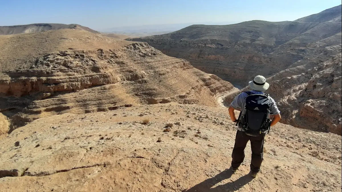
A hiker overlooks Nahal Kina/Ziv Reinstein
What do you do and how do you travel?
The route begins near Khirbat Uza, a fortress from the Israeli period
(6th-7th centuries BC), which was also used in later periods.
), we will continue with a steep, short and challenging descent into the stream and from there a comfortable walk through it until we reach a high waterfall at the bottom of which is Gev Kina. The path bypasses the waterfall (green trail markings) and goes down to the back - a large pool (its depth changes every year) and good for bathing.
Those who want a short route - will return from here back to the vehicle. Those interested in a long route - will continue down the stream and walk in the narrow gorge between the high limestone walls, until the split channels where you continue in the channel that goes up to the north. Further on there is a short ascent to a flat level, and a descent on the other side back into the stream. The path rises a little within the route The stream then rises and connects back to the jeep trail from where the route started.
A strategic point located on the border of Judea and Edom.
The ruins of Uza in Nahal Kina/Ziv Reinstein
Catch some shade in the middle of the track.
Helical method/The Society for the Protection of Nature, Emil Israel
to the trip we went
Technical details:
You can walk the round-trip route, or the circular route
How to get there by WAZE:
Nahal Kina, requires traveling on comfortable dirt roads from the Arad airstrip area, parking near the Bedouin encampment.
Difficulty level:
medium
Length:
1.5 km round trip, 9 km for the full circular route
Intended for:
everyone, tiny ones preferably in a baby carrier.
Those who choose the full route - hiking enthusiasts
recommended period:
fall, winter, spring.
You must check the forecast before going on a trip.
Accessibility:
The route is not accessible
Important highlights:
In this season it is important to walk with closed shoes, it is also important to have water and a hat.
Do not pick wild flowers, preserve nature and take the waste with you.
It is recommended to travel with a trail marking map or a navigation app.
More on the same topic:
streams
Yehuda desert
Tracks