- Click to share on Facebook (Opens in a new window)
- Click to share on Twitter (Opens in a new window)
- Click here to share on LinkedIn (Opens in a new window)
- Click to email a friend (Opens in a new window)
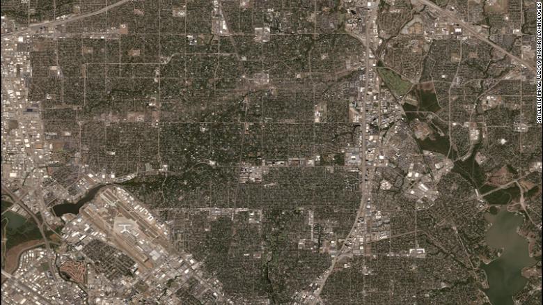
(CNN) - New satellite images show the path of destruction that a tornado left while crossing Dallas on Sunday night.
The tornadoes that swept the Dallas area constitute the most expensive tornado outbreak in the history of Texas, according to the Texas Insurance Council. The council told KTVT, a CNN affiliate, that the expected loss will be approximately US $ 2 billion in total.
Maxar Technologies satellite images show the scar that a tornado left on earth.
The rubble path is seen in the center of the photograph.
When the image approaches, the destruction left by the tornado when it passed through the Dallas North Highway is clear.
Most of the houses on Urusla Lane, Lobello Drive and Orchid Lane seem to have suffered significant damage as the tornado swept through the community.
As they got closer in Orchid Lane, it seems that some houses were left with destroyed roofs.
A little less than 4.8 km northeast, the tornado also hit a Home Depot.
The satellite image shows the roof detached and the structure badly damaged.