Social News
Written by: Xiaobin Bin
2020-02-04 10:38
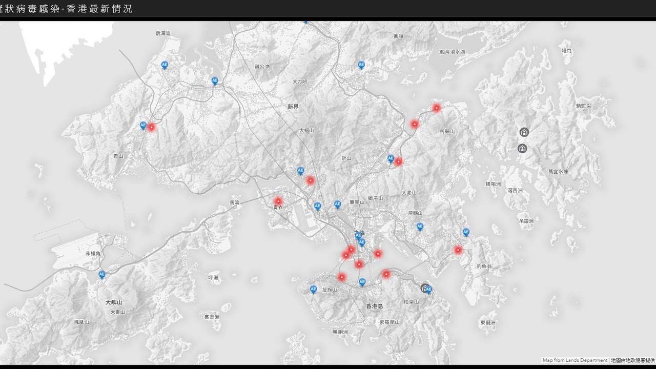
Last updated: 2020-02-04 10:38The pneumonia epidemic of the new coronavirus outbreak in Wuhan has continued to spread, with more than a dozen confirmed cases and one death in Hong Kong. The Hong Kong Government's "Spatial Data Sharing Platform" recently launched an "Interactive Map of Local Situation of New Coronavirus Infection" detailing confirmed cases, details of confirmed cases, places and dates of stay of confirmed cases.
The Hong Kong Government's "Spatial Data Sharing Platform" has recently launched the "Interactive Map of Local Situation of New Coronavirus Infection", which details the confirmed cases. (webpage Screenshot)
The Hong Kong Geographic Data Station and the spatial data sharing platform were developed by the Lands Department. The "Interactive Map of Locality of New Coronavirus Infection" data provided by the Centre for Health Protection of the Department of Health. Figures of inspection cases, exclusion of infection cases, and cases that meet reporting criteria are shown on the map with red dots showing the buildings where confirmed cases have stayed in the past 14 days.
Interactive Map Website: https://chp-dashboard.geodata.gov.hk/nia/en.html
[Wuhan Pneumonia. Latest] The first fatal case, a 39-year-old male patient living in Huangpu, has a cardiac arrest
[Open Data] No Longer Misunderstanding PDF as Open Data Assets Management Office
[Open Data] The top ten most popular real-time live data of the government in the first year are ...
[Open Data] The government has distributed 695 data sets with an open data monitoring page this year
Wuhan Open Data