Puerto Rico and Florida in the sights of new tropical storm 2:13
(CNN) - The National Hurricane Center (NHC) believes Isaias, the ninth named storm of 2020, will form in the Atlantic at the end of Wednesday.
"The system is expected to become a tropical storm when it is near the Leeward Islands on Wednesday," said NHC.
The announcement triggered tropical storm warnings for Puerto Rico, the Leeward Islands and the Virgin Islands.
In addition, a tropical storm alert was issued for the Dominican Republic, from Cabo Engano to the northern border with Haiti.
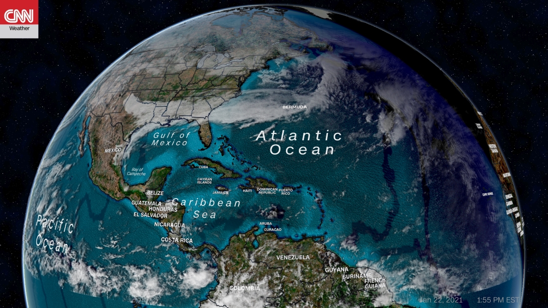
At the end of Tuesday morning, the storm was located 940 km (585 miles) east-southeast of the Leeward Islands and was moving west at approximately 37 km / h (23 mph).
It will impact the Leeward Islands on Wednesday and Puerto Rico on Wednesday night toward Thursday.
It is already causing winds with a tropical storm force of 64 km / h (40 mph) that extend 370 km (230 miles) outward from the center of the storm system. Winds are forecast to increase in intensity.
Rainfall of 8 to 26 cm (3 to 6 inches) is likely to occur and is expected locally up to 25 cm (10 inches) in the coming days in the Leeward Islands, the Virgin Islands and Puerto Rico. Heavy rains could cause flash floods and mudslides.
- LOOK: Recommendations to face the hurricane season in time of pandemic
Why is it called potential tropical cyclone Nine
It is not yet a tropical storm. The reason it is called "Tropical Cyclone Potential Nine" is that the storm does not have a circular center of circulation, says CNN meteorologist Chad Myers. Instead, it is very long. "When a circular center finally forms is when it will be called a tropical storm," he explained.
Calling it a possible tropical cyclone allows countries to issue warnings.
Once given the name Isaiah, it will be the earliest storm to begin with an "I" on the record. The previous record was set on August 7, 2005, part of the busiest season to date.
This would continue with the records of the 2020 Atlantic hurricane season. Hurricane Hanna broke the record for the earliest storm with an "H" name for 11 days.
Texas, between Hurricane Hanna and covid-19 2:57There is uncertainty about where and how strong the storm will be when it approaches Florida.
"All the models I looked at today develop this area in some kind of tropical system and show it to or to the north of Puerto Rico," Myers said.
Although the storm will not threaten to set foot on land for a few days, the models are consistent in showing that the storm takes advantage of the warm waters and strengthens itself.
"You can rarely see the convergence of models that is being seen with this next storm," Myers said. "There is a consensus with this that the storm is going to do something and that it is going to enter the Bahamas area," she added.
How you interact over the Leeward Islands and Hispaniola could affect the intensity of the storm.
Hispaniola, the Bahamas, Cuba and Florida should continue to monitor the forecasts as changes in both trajectory and intensity are likely, says NHC.
"It cannot be emphasized enough that, since the system is still in the formative stage, there is greater than average uncertainty regarding short and long-term intensity and trajectory forecasts," the NHC explained.
National Hurricane Center Puerto Rico