the weather
Written by: Lao Xianliang, Deng Yinglin, Leung Huanmin, Golden Chess, Deng Haixing, Lin Zhenhua, and Huang Weilun
2020-08-18 14:20
Last update date: 2020-08-19 11:15Typhoon "Hygoss" struck Hong Kong. At 1:30 am on Wednesday (19th), the No. 9 Gale or Storm Strength Signal was issued, and the No. 10 typhoon signal was issued at 5 am in Macau.
After the registration of "Hygoss" in Zhuhai, the local wind continued to weaken. The Observatory changed the No. 8 southeast gale or storm signal at 07:40, and the No. 3 strong wind signal at 11:10.
[11:10] The observatory changes the No. 3 strong wind signal. The Hong Kong Stock Exchange will resume trading in the afternoon.
+7
+6
+5
[10:50] The observatory cancels the yellow rainstorm warning.
[10:45] The No. 8 southeast gale or storm signal is now in effect. The southeast wind is expected to blow in Hong Kong with an average wind speed of 63 kilometers per hour or above. At 11 am, Severe Tropical Storm Hagos gathered about 150 kilometers west of Hong Kong, that is, near 22.5 degrees north latitude and 112.7 degrees east longitude. It is expected to move northwest or west northwest at a speed of about 25 kilometers per hour, moving inland and gradually weakening.
In the past few hours, local winds have weakened rapidly. The Observatory will issue a strong wind signal No. 3 before noon. There are very large waves and swells on the sea. People should stay away from the shore and stop all water activities. In the past hour, the highest sustained wind speeds recorded at Waglan Island, Tap Mun and Tate's Cairn Shan were 63, 56 and 45 kilometers per hour respectively, and the highest gusts exceeded 75, 68 and 65 kilometers per hour respectively.
[10:02] The Macao Meteorological Bureau will forward Typhoon Signal No. 3 at 11:30.
[09:45] The No. 8 southeast gale or storm signal is now in effect. The southeast wind is expected to blow in Hong Kong with an average wind speed of 63 kilometers per hour or above. Typhoon Hagos has weakened into a severe tropical storm. At 10 am, Hygos assembled about 140 kilometers west of Hong Kong, that is, near 22.4 degrees north latitude and 112.8 degrees east longitude. It is expected to move northwest or west northwest at a speed of about 25 kilometers per hour, moving inland and gradually weakening.
In the past few hours, local winds have weakened rapidly. The Observatory will issue the Strong Wind Signal No. 3 between 11 am and noon. Initially, the wind in the western highlands of Hong Kong will still be relatively strong. There are very large waves and swells on the sea. People should stay away from the shore and stop all water activities. Affected by the storm surge, some low-lying areas may experience flooding or seawater intrusion in the morning. In the past hour, the highest sustained wind speeds recorded at Tap Mun, Sha Chau and Waglan Island were 55, 48 and 46 kilometers per hour respectively, and the highest gusts exceeded 67, 62 and 64 kilometers per hour respectively.
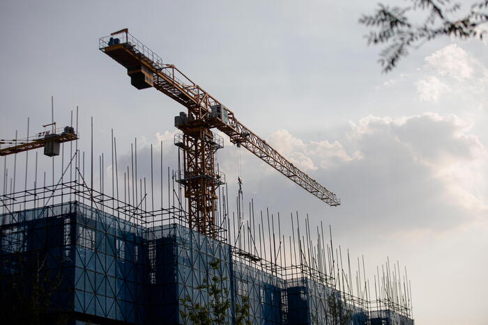
[09:30] The MTR stated that the inspection of the open-air section is still in progress. Because the road section is long, and during the inspection period, the construction vehicles need to drive at a slow speed for inspection, so it takes a while.
Higos Ball・Traffic News|Resume service of MTR overhead section
Hygos Ball・Public Services|Depth Throat Saliva Sample Clinic Closed by the Department of Health
+9
+8
+7
[08:04] Tai O hit directly and the water level rose to 2.9 meters. The restaurant clerk returned to the shop early in the morning to guard the shop. The wind in Xinghua Village weakened, but there were white-headed waves on the sea.
After Higos landed in Zhuhai, he moved inland, and the observatory changed the number 8 typhoon signal. (Photo of the Observatory)
[07:50] The Observatory said that Hygos is gradually moving away from Hong Kong, and the wind in Hong Kong will gradually weaken. When Hong Kong is no longer generally affected by gales, the Observatory will issue the No. 3 strong wind signal from 11 am to 1 pm. Initially, the wind in the western part of Hong Kong will still be relatively strong, and the public should remain vigilant.
[07:43] The MTR stated that since the Observatory has issued the No. 8 gale or storm signal, additional staff have been sent to inspect the conditions of overhead cables, rails and open sections. After ensuring safe driving, the open sections will be restored. And MTR bus service.
[07:40] After Zhuhai, the High Stearns team gradually moved inland, and the Observatory issued the No. 8 southeast gale or storm signal.
+2
【07:30】Macau changes the number 8 southeast typhoon signal .
[07:00] According to the Information Services Department, the Home Affairs Department has opened 25 temporary shelters in various districts, with a total of 97 people staying; as of 6 am, the Government’s 1823 Call Center and the Leisure and Cultural Services Department received 9 1 case and 1 case of tree collapse; Drainage Services Department confirmed 1 case of flooding. The Hospital Authority said that as of 5 am, 1 man and 1 woman were injured during the storm and went to the emergency department of a public hospital for medical treatment.
[06:53] The Macao Geophysical and Meteorological Bureau stated that the No. 10 typhoon signal is still in effect, but the No. 8 southeast typhoon signal will be issued in a short time.
[06:45] The Observatory said that Typhoon Hagos has landed in Zhuhai, Guangdong and is gradually moving away from Hong Kong. It is expected that the wind in Hong Kong will gradually weaken. The Observatory will issue the No. 8 southeast gale or storm signal in the next one or two hours.
[05:45] Macau Friendship Bridge, Governor Gallupe Bridge and Sai Wan Bridge, all three bridges recorded average wind speeds of over 135 kilometers of hurricane intensity.
[05:15] The Observatory said that in the next few hours, Hygos will begin to move away from Hong Kong and then make landfall west of the Pearl River Estuary. However, Hygos will still bring squally heavy showers to the coast of Guangdong. The wind in the western part of Hong Kong is relatively high. Gale No. 9 is expected. Or the storm wind signal will be maintained for a period of time in the early morning .
[05:00] The Geophysical and Meteorological Bureau of Macau dispatched Typhoon Signal No. 10 at 5:00 in the morning . At present, Hygos is gathering about 30 kilometers south-southwest of Macau.
+4
+3
+2
[04:00] At 4 am, Typhoon Hagos gathered about 80 kilometers southwest of the Hong Kong Observatory and is expected to move northwest or west northwest at a speed of about 20 kilometers per hour. In the past hour, the highest sustained wind speeds recorded at Cheung Chau, Waglan Island and Cheung Chau Beach were respectively 93, 89 and 85 kilometers per hour, with the highest gusts exceeding 112 kilometers per hour.
[03:00] At 3 o'clock in the morning, Typhoon Hagos gathered about 80 kilometers southwest of the Hong Kong Observatory. It is expected to move northwest or west-northwest at a speed of about 20 kilometers per hour to the west of the Pearl River Estuary. According to the Observatory, the wind direction in Hong Kong is changing from northeast to southeast. The originally sheltered areas may become windy, and the wind will be stronger in the western part of Hong Kong. In the past hour, the highest continuous wind speeds recorded at Cheung Chau, Cheung Chau Beach and Tate’s Cairn were 89, 77 and 77 kilometers per hour respectively , The highest wind gusts exceed 124, 100 and 124 kilometers per hour respectively.
[02:40] The overnight bus services of all franchised bus companies have been suspended; the Home Affairs Department stated that a total of 36 temporary shelters have been opened in various districts with a total of 50 people living in; the government’s 1823 call center has received 5 reports of tree collapse ; No reports of landslides, flooding and casualties have been received yet.
[02:30] The Macao Geophysical and Meteorological Bureau changed the number of typhoon signal No. 9 at 2:30 in the morning and stated that the tropical cyclone center is getting closer to Macau. The continuous wind speed in Macau has reached 63 km/h to 117 km/h, and The current or forecast will be significantly strengthened; the chance of issuing the No. 10 typhoon signal is expected to be "medium".
[01:40] The Observatory said that in the past few hours, Hygos moved in a more northwestern direction and increased. It is currently the closest to Hong Kong, passing about 100 kilometers southwest of the Hong Kong Observatory. The wind in Hong Kong will increase further. It is expected on the 9th. Strong winds or storm wind signals will be maintained for a period of time in the early morning. The wind direction in Hong Kong is turning from northeast to southeast. The originally sheltered areas may become windy, and the wind will be stronger in the western part of Hong Kong.
[01:30] The Observatory changed the No. 9 gale or storm enhancement signal at 1:30 am ; this is the first No. 9 wave since the super typhoon Mangkhut hit Hong Kong in 2018. The Observatory expects that the wind in Hong Kong will increase significantly, and it urges the public not to go out, stay away from windy doors and windows, and take shelter in a safe place.
[01:20] The Transport Department stated that the Hong Kong Link Road of the Hong Kong-Zhuhai-Macao Bridge was closed at 0:30 in the morning and vehicles were banned; Macau quoted the Zhuhai Municipal Government’s Flood Control, Drought, and Wind Control Headquarters as saying that Hong Kong-Zhuhai was affected by Hagos The Macau Bridge will be closed at midnight today (19th).
[01:00] The observatory stated that the severe tropical storm Hagos has intensified into a typhoon . At 1 o'clock in the morning, Hygos gathered about 90 kilometers south-southwest of the Hong Kong Observatory, that is, near 21.5 degrees north latitude and 113.9 degrees east longitude. It is expected to move northwest or west-northwest at a speed of about 20 kilometers per hour to the west coast of the Pearl River Estuary. Around.
[00:40] A reporter from "Hong Kong 01" hit the storm directly in the Tai O area. The wind and rain at the scene were obviously intensified, the sea surface was quite heavy, and the water level rose to about 2 meters. Some residents expressed that they were worried that severe flooding would occur when the storm hits the first tide at the same time. Although they have taken precautions, they will still pay attention to the situation overnight. Earlier, there were also government officials who piled sandbags at the scene and were on the bridge. There were iron slabs on the side, and police officers were also present to patrol the scene.
[August 18th 00:00] At 12:00 midnight, the severe tropical storm Hagos gathered about 100 kilometers south of the Hong Kong Observatory, that is, near 21.4 degrees north latitude and 114.1 degrees east longitude. It is expected to move northwest or west northwest at speeds per hour. About 20 kilometers, it moves to the west coast of the Pearl River Estuary.
At 10:40 pm on August 18, Typhoon Signal No. 8 took effect and the Star Ferry was suspended. (Photo by Li Zetong)
[23:30] The Macau Geophysical and Meteorological Bureau stated that the No. 8 northeast typhoon signal was issued at 11:30 pm and is expected to remain until tomorrow morning, and stated that the chance of issuing the No. 9 typhoon signal is "moderate to high". It is predicted that the wind force in Macau will increase. At 11 o'clock in the evening, Typhoon Hygos gathered about 130 kilometers southeast of Macau, generally heading west of the Pearl River Estuary.
[23:24] NWFB and Citybus announced that overnight bus services will be suspended from 1 am.
[23:20] The observatory issued a yellow rainstorm warning.
The Observatory predicts that Hygos will be the closest to Hong Kong in the next few hours, passing about 100 kilometers southwest of Hong Kong. (Photo of the Observatory)
+5
+4
+3
[22:48] The Observatory said that Hygos will be the closest to Hong Kong in the next few hours, passing about 100 kilometers southwest of Hong Kong. The wind in Hong Kong will be further strengthened. It is expected that the No. 8 gale or storm signal will be in the evening to tomorrow morning (19th) Maintain for a period of time. Stay tuned for the day when people go out tomorrow morning
air messages.
[22:40] The Observatory issued the No. 8 Northeast Gale or Storm Signal, and the severe tropical storm Hygos gathered about 130 kilometers south-southeast of Hong Kong.
[22:30] The Outlying Islands District Office announced that the Observatory predicts that Tai O may experience severe flooding, and the flood warning system, especially for residents of Tai O, has been activated. The sea level of Tai O may reach 3.3 meters or above the chart base at about 8 am tomorrow (19th), which may cause seawater intrusion and serious flooding in low-lying areas of Tai O.
The Civil Affairs Department has activated the Emergency Coordination Center at the Tai O Rural Committee Office. The center is established by the Civil Affairs Department, Fire Services Department, Police Department, Social Welfare Department, other relevant government departments and non-governmental organizations to coordinate evacuation, rescue and Emergency support work. In addition, the Temporary Shelter Center of the Tai O Community Work Office of the Hong Kong Young Women’s Christian Association and the Lung Tin Temporary Shelter Center, located on the ground floor of the Tai O Rural Committee Office and Lung Tin Shopping Centre respectively, have been opened for temporary use by residents in need.
[22:18] KMB and Long Win Bus announced that daytime services will be maintained until the end, while overnight services will be suspended.
[22:03] New Ferry announced that the last ferry service between Central and Cheung Chau and Mui Wo will depart at 11.30pm.
[21:55] The Observatory said that at 10 o'clock in the evening, the Severe Tropical Storm Hagos gathered about 130 kilometers south-southeast of Hong Kong. It is expected to move northwest or west-northwest at a speed of about 20 kilometers per hour and move to the western coast of Guangdong. According to the current forecast path, Higos will be in Hong Kong when the West in the early morning
150 kilometers south passing.
[21:52] NWFB and Citybus announced that all daytime routes will operate normally until the last train.
+4
+3
+2
[21:00] The Macao Meteorological Bureau announced that it will transfer the No. 8 typhoon signal at 11:30 pm.
[20:55] MTR said that the Observatory has announced that it may be necessary to issue the No. 8 Gale or Storm Signal at a later time. MTR trains, light rail and MTR bus services will remain normal until the end of the night. MTR buses will continue to maintain service until the end of the service time.
[20:40] The Observatory announced that the first typhoon signal No. 8 will be issued at or before 10:40 tonight. Severe tropical storm Hagos is approaching about 150 kilometers south of Hong Kong.
+6
+5
+4
[20:30] At about 8 o'clock in the evening, it rained slightly in Tai O and the wind was not strong. Some residents and businesses were busy preparing to deal with the No. 8 typhoon signal. Brother Hui, who opened a store near the Tai O Ferry Pier, and his family have prepared iron fences, etc., to "lock water" before the storm arrives tonight.
Because tomorrow morning is the astronomical tide, Hui Ge said that he has already paid attention to the report of the Observatory. The water depth is estimated to be about 3.2 meters. Based on years of experience, I believe the water level will rise. "We are considered to be a low-lying area, which should be stronger than what the Observatory said. Shao Shao, we all foresee the need to push furniture into the house at any time. I don’t have enough experience, but I have to prepare mentally.” He said that most residents in Tai O are elderly, and many young residents have already returned home for their families. Prepared, "The shack in front should be more serious. Everyone is ready to sunbathe, and the family is tight." He said frankly that he wouldn't be too worried, but he believed that the whole night was "watching" and paying attention to the situation.
The staff of nearby banks and pickup service stations were also busy preparing for the flood. They blocked the door with iron plates and wooden boards. Some staff laughed and said that they would stay at the company tonight to prevent floods.
On the afternoon of August 18, the strong wind signal No. 3 came into effect and the weather gradually deteriorated. The Observatory stated that it would consider changing the No. 8 typhoon signal from 10 pm to midnight. (Photo by Yu Junliang)
[20:00] Hygauss intensified into a severe tropical storm, with the highest sustained wind speed near the center of 90 kilometers per hour, about 160 kilometers southeast of Xiangyang.
The Geophysical and Meteorological Bureau of Macau announced that the wind in Macau is predicted to increase. Typhoon signal No. 8 will be re-issued from 10pm to 2am tomorrow, and the yellow storm surge warning will be upgraded to orange storm surge warning at 8:30pm. It is predicted that there will be severe flooding in low-lying areas from 5 am to 12 noon tomorrow, with the flooding height ranging from 1 to 1.5 meters
Gauss intensified into a severe tropical storm, about 160 kilometers southeast of Xiangyang at 7pm. (Photo of the Observatory)
[16:45] Strong wind signal No. 3 is now in effect. The average wind speed in Hong Kong is expected to be 41 to 62 kilometers per hour. At 5 pm, Tropical Storm Hagos assembled about 210 kilometers southeast of Hong Kong, that is, near 21.0 degrees north latitude and 115.6 degrees east longitude. It is expected to move northwest or west northwest at a speed of about 20 kilometers per hour, crossing the northern part of the South China Sea and gradually intensifying , Moved to the western coast of Guangdong.
According to the current predicted path, Hygos will pass by about 150 kilometers southwest of Hong Kong from tonight to tomorrow morning. As Hygos takes a path closer to Hong Kong, the intensity has also increased. Hygos will pass by about 150 kilometers southwest of Hong Kong from tonight to tomorrow morning. The wind in Hong Kong may increase further at night. The Observatory will consider issuing the No. 8 Gale or Storm Signal from 10 pm to midnight. In the past hour, the highest sustained wind speeds recorded at Waglan Island, Tate's Cairn and Cheung Chau Beach were 59, 57 and 57 kilometers per hour respectively, and the highest gusts exceeded 66, 83 and 76 kilometers per hour respectively.
[14:45] Strong wind signal No. 3 is now in effect. The average wind speed in Hong Kong is expected to be 41 to 62 kilometers per hour. At 3 pm, Tropical Storm Hagos assembled about 250 kilometers southeast of Hong Kong, that is, near 20.7 degrees north latitude and 115.9 degrees east longitude. It is expected to move west-northwest at a speed of about 20 kilometers per hour, crossing the northern part of the South China Sea and gradually intensifying. To the west coast of Guangdong.
According to the current predicted path, Hygos will pass by about 150 kilometers southwest of Hong Kong from tonight to tomorrow morning. There will be strong winds in Hong Kong, and occasional gales offshore and on high ground. If Hygos moves closer to Hong Kong or continues to strengthen, the wind in Hong Kong will further strengthen. It is expected that the weather in the port of Japan will deteriorate, with squally heavy showers and thunderstorms, and large waves and swells on the sea.
[15:45] Strong wind signal No. 3 is now in effect. The average wind speed in Hong Kong is expected to be 41 to 62 kilometers per hour. At 4 pm, Tropical Storm Hagos assembled about 240 kilometers southeast of Hong Kong, that is, near 20.8 degrees north latitude and 115.8 degrees east longitude. It is expected to move northwest or west northwest at a speed of about 20 kilometers per hour, crossing the northern part of the South China Sea and gradually strengthening , Moved to the western coast of Guangdong.
[15:25] The Macao Meteorological Bureau sent out Typhoon Signal No. 3 at 3:25 pm. Macau expects that the chance of issuing typhoon signal No. 8 is "moderate to high" from tonight to tomorrow morning.
+3
+2
[14:25] The No. 3 strong wind signal was issued at 2:20 pm. The average wind speed in Hong Kong is expected to be 41 to 62 kilometers per hour.
At 2 pm, Tropical Storm Hagos assembled about 280 kilometers southeast of Hong Kong, that is, near 20.6 degrees north latitude and 116.1 degrees east longitude. It is expected to move west-northwest at a speed of about 20 kilometers per hour. To the west coast of Guangdong.
According to the current predicted path, Hygos will pass by about 150 kilometers southwest of Hong Kong from tonight to tomorrow morning. There will be strong winds in Hong Kong, and occasional gales offshore and on high ground. If Hygos moves closer to Hong Kong or continues to strengthen, the wind in Hong Kong will further strengthen. It is expected that the weather in the port of Japan will deteriorate, with squally heavy showers and thunderstorms, and large waves and swells on the sea.
[14:20] The strong wind signal No. 3 was issued at 2:20 pm. The average wind speed in Hong Kong is expected to be 41 to 62 kilometers per hour. The Observatory urged that objects that are easily blown over by the wind should be tied up or moved indoors, stay away from the shore and stop all water activities.
Acting Senior Scientific Director Jiang Wei told "Hong Kong 01" earlier that according to the current forecast path, Hygos will pass within about 150 kilometers southwest of Hong Kong from tonight to tomorrow morning. It is predicted that the wind will be strongest from midnight to tomorrow morning. He continued that the Observatory is assessing whether the No. 8 typhoon signal will be issued. As Hygauss is closer to the coast than the actual path, the chance of issuing the No. 8 typhoon signal will be higher than originally planned and is now reassessing.
[13:45] At 2 pm, Tropical Storm Hagos assembled about 280 kilometers southeast of Hong Kong, that is, near 20.6 degrees north latitude and 116.1 degrees east longitude. It is expected to move west-northwest at a speed of about 20 kilometers per hour and cross the northern part of the South China Sea. And gradually strengthened, moving to the western coast of Guangdong.
The outer rain belt of Hygos is affecting the coast of Guangdong. According to current forecasts, Hygos will increase slightly and will pass by about 150 kilometers southwest of Hong Kong from tonight to tomorrow morning. It is expected that the wind in Hong Kong will gradually strengthen later this afternoon, and there will be large waves and swells on the sea. The Observatory will issue a strong wind signal No. 3 in the next one or two hours
High Goss Ball | The Observatory will issue the first typhoon signal No. 8 this year. Gale will continue until tomorrow morning
High Goss Ball | The path gradually strengthens to the north, passing the bright offshore within 150 kilometers, blowing the 8th gale
Hygos Ball | The Observatory will issue a strong wind signal No. 3 in the next one or two hours
Typhoon Hagos Tropical Cyclone News Hong Kong Observatory Weather Forecast My Home


/cloudfront-eu-central-1.images.arcpublishing.com/prisa/2C5HI6YHNFHDLJSBNWHOIAS2AE.jpeg)