Instant sports
Written by: Yan Minghui
2020-12-29 11:41
Last update date: 2020-12-29 11:41
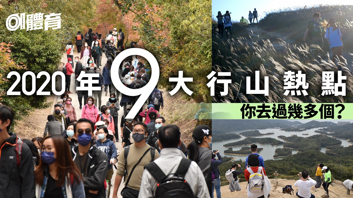
The new crown pneumonia epidemic has enveloped the entire year of 2020. Many citizens went to the mountains to escape the epidemic, hiking and outings, causing crowds in the countryside of Hong Kong.
Looking back on 2020, what are the hiking hotspots popular among Hong Kong people?
Some are scenic spots that must be crowded every year, such as Dadongshan and Datong, and some are new check-in spots this year, such as Green Egg Island.
1. Huangniu Mountain
Huangniu Mountain is 604 meters high and is located between Siu Lek Yuen and Sai Kung in Sha Tin, within the boundaries of Ma On Shan Country Park.
Huangniu Mountain itself is not a popular hiking spot, but in recent years, more and more people have gone to Huangniu Rock City, and the reputation of Huangniu Rock City has become more and more popular. Among them, the stone skylight has become a check-in spot.
At the beginning of this year, people from Shitian Chuang were busy coming to the mountain to have long queues to take pictures.
Huangniu Mountain's stone skylight becomes a hot spot for clocking in, grass slopes become bald, and it is difficult to walk with stomping feet, and the scars are difficult to recover
+20
+20
+20
Mountain hikers have already taken an obvious path from Dengdingshan Road to Shitianchuang, but the ramp approaching Shitianchuang is almost without vegetation and very slippery.
Visitors walk up to the stone skylight, some sit on the stone, and some will boldly make one-legged yoga movements on the stone.
Huangniu Mountain itself is quite high, and the roads up and down the mountain are not maintained and managed by the Fisheries and Conservation Department, making it difficult.
Introduction of Huangniu Mountain hiking route:
[Huangniu Mountain Hiking Route] Get ready to explore the stone skylight and enjoy the sea view of Maanshan Saigon
[Miscao Mountain Route] Exploring the Mystery of Upper Huangniu Mountain in Guangyuan, Sha Tin
[New Territories Hiking Route] Go up to Huangniu Hill and climb up to Ngong Ping Grand Admiralty to enjoy the sea view of Saigon
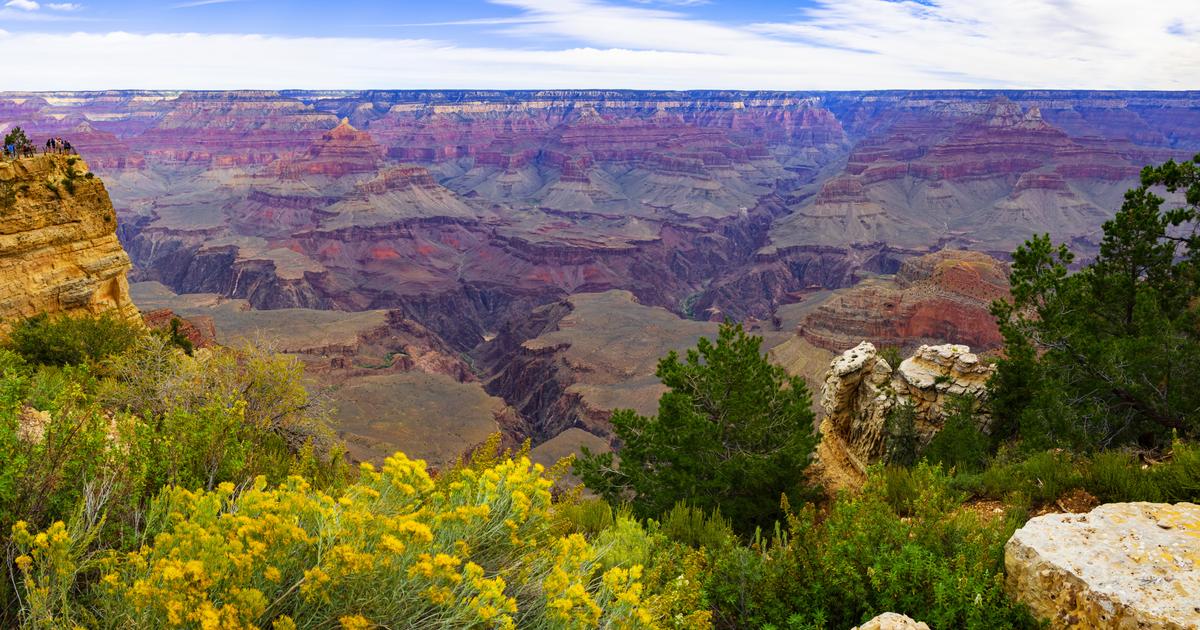
2. Qiandao Lake Qingjing Terrace
Ever since the Thousand Island Lake Qingjing Terrace in Tai Lam Country Park was completed last year, it has become one of the best check-in hotspots in the countryside of Hong Kong!
Firstly, the location of Ching King Terrace is indeed ideal, with a panoramic view of Tai Lam Chung Reservoir; secondly, Ching King Terrace is located next to section 10 of MacLehose Trail, not far from Tai Tong or Wat Kwan Wat, which is convenient and easy Go, suitable for a family outing.
[Xingshan] Qiandao Lake Qingjingtai site selection design with thoughtful interview behind the scenes Agriculture and Forestry Inspector of Fisheries and Conservation Department
Dalan Qiandao Lake Qingjingtai forced to fight for card punching, and smokers in the grass: many people crossed Nathan Road
[Hiking] Intensive outing footprints lead to degradation of mountain trails. The check-in path changes the Qingjingtai of Qiandao Lake
+8
+8
+8
From the beginning of the year to the end of the year, whether it is weekends or leisure days, the flow of people at Qingjingtai "surpasses Mong Kok", and there are often crowds of people at the level of the upper Qingjingtai.
Qingjingtai has been crowded for a long time. Tourists stepped over the fence and opened up mountain roads on their own to find a better place to take pictures.
After two years, the hillside outside Qingjingtai has been trampled on many paths and the topsoil has been lost.
The Fisheries and Conservation Department also added fences at some locations to enclose severely washed-out areas to protect newly planted saplings.
Introduction to the hiking route of Qiandao Lake Qingjingtai:
[New Territories Hiking Route] Depart from Tai Tong to the Thousand Island Lake Clear View Terrace overlooking Tai Lam Chung Reservoir
[Thousand Island Lake Hiking Route] Starting from Tai Lam Chung, climbing to Qingjing Terrace, enjoying the beautiful scenery of the pond, passing by Tai Tang downhill
[Hiking Route in the New Territories] Tuen Mun Station issued a wheat trail to visit Qingjing Terrace in Thousand Island Lake and then drop off at Tai Tong, Yuen Long
Datang Hiking Route|The Three-Diamond Secret Place by the Thousand Island Lake Dengshui, Po Po Mountain, Jie Mai Path, and Wat Down
🏃🏽♂01 Sports Hiking Page: Introduction to the beautiful scenery equipment introduction Interviews🏃🏾♀
🏃🏽♂Look at the route first before hiking: Curry Mountain hiking guide🏃🏾♀
🏃🏽♂Subscribe to the 01 Sports Youtube channel now to learn more about hiking and sports🏃🏾♀
3. Stone top
The stone top is located in Sai Kung East Country Park, on the north bank of Wan Yi Reservoir.
It is about an hour away from the second section of MacLehose Trail. In the past, it was not a popular place for outings. Tourists usually went to the nearby Langchi or Big Wave West Bay.
However, at the beginning of this year, more and more netizens on social networking sites shared photos of the top of the stone, even the TV show "Two Young Students Going to Camping" introduced it, Zhou Bohao and Yuan Weihao went up to drink coffee.
+5
+5
+5
On the top of the wormstone is a wormstone, which is actually composed of hexagonal stone pillars with clear texture and uniqueness. It is also a wonder of a geopark.
Standing on the rock, you can overlook the scenery of Wanyi Reservoir, the lakes and mountains are spectacular.
The mountain road from the Mai Trail to the top of the wormwood is more rugged and has no clear signs. It is suitable for more experienced hikers.
Introduction to the hiking trails at the top of the stone:
[Hiking Route in Saigon] The most convenient way to get started at Xiwan Pavilion is to enjoy the panoramic view of Mani Reservoir
[Hiking Route in Saigon] Depart from Xiwan Pavilion to enjoy the scenery of Wanyi Reservoir
Zeng Shuya, Jumbo Tsang, Zhou Baihao and Yuan Weihao have all been to Shiding this year:
+4
+4
+4
4. Maoping Tenghuang
In Maoping, Ma'anshan Country Park, there is a vine called "Tenghuang".
It was born leaning on the toilets of the abandoned village school. The cadres were strong and sturdy, rising from the ground like a pattern, and the vine branches spread in all directions, and some of them traversed the mountain trails like cables. It was very spectacular, so it got the reputation of the vine emperor.
I hope everyone will love the vine emperor, please refrain from climbing, and don't move your hands.
If everyone crawls, I believe that it won't take long for the emperor to bear it.
Maoping Tenghuang is easy to walk. You can go up the mountain from the Meizi Forest in Ma On Shan via the ancient road, or you can go up the Beigang Ancient Road from Sai Kung. When you arrive at Maoping Au, you will see a grassland.
This grassland is the site of the Lianda Five Township Public School. Now there are pavilions and benches next to the grassland. When you walk to the corner of the grassland, there is a mysterious ribbon intersection. Walk in for a few steps and you have already seen the famous vine emperor.
[TVB actress Lin Kain once went to "Maoping Tenghuang" to check in]
Introduction of Maoping Tenghuang Mountain Route:
[Hiking Route in Sai Kung] Explore the tree-shaded road along Maoping Tenghuang Road, Beigang Ancient Road and Bamboo Forest Tunnel
5. Green Egg Island
One of the most popular outing spots this summer is the Green Egg Island, which is even introduced on the TV show "Looking Around".
Green Egg Island is located on the east coast of the Clear Water Bay Peninsula. Its real name is Rotten Pai. It is also known as Green Egg Island as one of the reefs.
The island looks like a poached egg with a green yolk, so it got its name. The nearby waters are crystal clear. It is praised as "glass water" by netizens, and tourists usually rent boats or canoe to the island.
[Hiking] When will Green Egg Island become red?
Senior mountain friends named Boomlin and landed on the island 7 years ago
"Looking East and West" introduces the secret scenery of Saigon hiking excursion, host Lin Xiling personally responded to netizens’ concerns
+8
+8
+8
In addition to waterways, land routes are also available.
Hikers can start from Tai Hang Dun, climb Da Ling Tong along the Lobster Bay Country Trail, and then descend along the trail to the rocky beach by the sea.
When the tide goes out, some hikers will try to wade to the island.
However, the road from the country trail to the trail to the beach is more rugged and not suitable for novices.
Green Egg Island becomes a water resort in summer, but there are no cleaners there, so visitors are invited to take away the rubbish.
[Lin Xiling introduces Green Egg Island in "Looking Around"]
+2
+2
+2
Introduction to Green Egg Island Hiking Route:
[Mountain Route on Green Egg Island] The fastest way to get out of Lobster Bay by climbing Dalingdong to pick up the trail
Before hiking, learn about hiking etiquette:
+10
+10
+10
Zero trash in the mountains and wilds, starting from you and me.
(01 Art Drawing)
6. Twisted Hole
On the coast of Xia Shan Tuk in Clear Water Bay, a new tourist attraction called Twisting Cave.
Originally, Twisted Hole was a scenic spot only for people who can kayak or tie sides. However, this year, a mountain road was opened for people to fall directly from Daaomen Road to the beach, making it easier to go to Twisted Hole. The hot spot of mountain exploration.
Going out from the cave, the stone pattern is unique, and many people like to enter the cave to punch cards.
However, Twisted Hole is not suitable for novices. For example, the mountain trails that fall by the sea are extremely rugged, and there are also reports from mountain friends who have the opportunity to encounter wasps on the road.
It is very difficult to tie the sides to the beach, and it is best to approach the twist hole when the tide is low.
You must be prepared to get wet when you go to the twist hole. Those who are not familiar with water should do what you can. In addition, it is best to bring a waterproof bag and replacement clothes.
Even so, in the holiday weekend of this summer, there are often people who check in at the twist hole.
7. Dadongshan
In the autumn and winter, every year, Dadongshan will be full of people who appreciate Miscanthus.
Viewing the awns on Dadong Mountain seems to have become an annual activity for Hong Kong citizens. From October to November, when the miscanthus is in full bloom, tourists will flock to the mountain to check in with the miscanthus.
In the Miscanthus season, every weekend, there will be long queues of people from the bus station in Tung Chung to the trail to Tai Tung Shan.
Dadongshan Mountain Travels | Bogongao is crowded with people to appreciate the mang, dozens of people line up and it is difficult to approach the springboard
Dadongshan forces full of Miscanthus pilgrimage volunteers to go to the top to pick up mountain garbage
[On weekends and holidays in October and November, Dadongshan will be crowded with people]
+19
+19
+19
There is no trash can on Dadongshan. Please take away your trash.
When hiking, try to walk on the current path, do not trample on miscanthus just to check in, make a trail, let alone pick miscanthus.
In addition to Miscanthus, the springboard near the top of Dadongshan has become the most prosperous check-in spot in Dadongshan this year. Many people will take pictures of thrilling actions on the springboard.
[Hiking] Dadongshan must pay attention to the difficulty of admiring Miscanthus, with route, equipment, transportation, and photography strategy
[Photo of Carina Lau in December in Dadongshan]
+7
+7
+7
Dadongshan hiking route introduction:
The most common route is the Dadongshan route, from Pak Kung Au up the mountain, and Nanshan down the mountain: [Da Dong Shan Route] Ascend to the top of Pak Kung Au and see Miscanthus. The return journey is easier to take a car to Mui Wo
In the same way, Bogongao goes up the mountain and Nanshan goes down, but passing through the "Tianchi": [Hanging] Dadongshan Lantouying Appreciating Miscanthus and Seeking the Tianchi Trail is not suitable for novices
In addition to Dadongshan, you will also visit Lianhuashan: Hiking | Predicting Miscanthus hotspots in Dadongshan before crowds explode | Hikipedia
Starting from Dongchong, passing Sanshan Terrace, Lianhua Mountain and Dadongshan: [Dadongshan Route] Starting from Dongchong Station, go to Lantouying and enjoy Miscanthus. Remember not to step on the stone roof!
It is the most direct path from Tung Chung up and down to Tai Tung Shan, but it is very difficult: Tai Tung Shan hiking route|Wong Lung Hang Country Trail climbs a short distance and extremely high Tung Chung scenery
[Snippet of hiking route! Bogongao goes up to Dadongshan, then goes down Nanshan along Phoenix Trail]
8. Dongyang Mountain
While Dadongshan is "surpassing Mong Kok", tourists are looking for other miscanthus resorts. Among them, Dongyang Mountain, next to Tate's Cairn Mountain, is a convenient choice for the city.
Dongyang Mountain is 533 meters high, and the traffic is more convenient than Dadong Mountain, and the difficulty is also lower. Visitors can walk up Fei'eshan Road, and then a short section of Wilson Trail to reach the top.
However, the Miscanthus coverage area of Dongyang Mountain is larger than that of Dongshan Mountain, mainly in the area on the top of the mountain, which can accommodate fewer tourists.
[Hiking] Where is the end of the world without awn grass, why force it to Dadongshan
Miscanthus clock in|Don’t go to Dadongshan and queue up in Kowloon East, there is Miscanthus sea|Hikipedia
[November and Sunday Dongyangshan visitors enjoy the grand occasion]
+3
+3
+3
Introduction of Dongyangshan hiking route:
Hiking Route in Sai Kung|Enjoy Miscanthus on Dongyang Mountain
[Hiking Route of Fei'e Mountain] Climb to the top of Xiangshan via Dongyang Mountain to see the beautiful scenery of Kowloon, remember to pay attention to the Little Pig Rock
9. Tai Tong
Miscanthus withers, red leaves relay.
In December each year, as the red leaves season enters, Tai Tong has become the first choice for Hong Kong citizens for outings.
Whether it is a weekend or a leisure day, there is a sea of people in Datang. Tourists walk along the Datang Mountain Road into the Dalan Country Park, walk through the flat forest road to the Liquidambar Forest, and enjoy the scenery of the red leaf road.
In previous years, Hong Kong citizens liked to go to Japan to see the red leaves, but they could not go abroad during the epidemic, so they could only squeeze to Taitang to find the feeling of traveling abroad.
Red leaves in Taitang | Fengxianglin forced tourists to take pictures on the mountain for suspected violation of gathering orders
[Hiking] Datang still has a long line up the mountain during leisure days, please cherish the maple and red leaves and don’t climb trees|01 Mountain Notes
【December Zhongdatang Appreciation of Red Leaves】
+9
+9
+9
There are many people in Tai Tong, like Mong Kok. In addition to the beautiful scenery of the red leaves, it is also convenient.
From the bus stop to the Fengxianglin, the whole road takes only about 1 hour, suitable for men, women and children.
However, please be self-disciplined when viewing the red leaves. Do not climb trees or slopes, let alone pick red leaves.
When hiking, remember to take your trash away.
[Hiking] Datang Red Leaf Lazy Bag 3 recommended routes with the most cost-effective route and transportation guide
[Aerial photography of red leaves of Datang in mid December]
+5
+5
+5
Introduction to Tai Tong Mountain Route:
This long journey starts from Tsuen King Circuit:
Yuan Tsuen Ancient Road for a full day, first enjoy the Tsing Ma Bridge and then visit the Fengxianglin
This one is mainly downhill and the road:
[Yuan Tsuen Hiking Route] Start at Tsuen Kam Au and follow the Mai Path to Tai Tong Liquidambar Forest to enjoy the red leaves
Mountain hiking