The storm Filomena hits Spain.
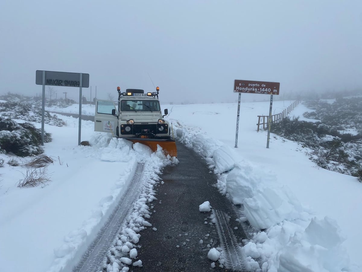
Snowfall and other inclement weather affect 414 roads, some forty on the main network, and has forced the cutting of points on two highways in Castilla-La Mancha and the Madrid ring roads M-30 and M-40.
Furthermore, all AVE trains heading to Valencia and Alicante have been suspended until noon tomorrow and Barajas airport has paralyzed all operations.
The worst of the formidable storm of snow, rain, wind, rough seas and low temperatures begins, arising from the interaction of the temperate and humid air mass of the storm Filomena with the cold air mass installed in the Peninsula.
Only Bizkaia, Álava, Córdoba, Huelva and Melilla are spared this Friday from the warnings.
The most serious is located in Madrid, Guadalajara, Cuenca, Albacete, Toledo and Valencia, on red alert, the maximum of a scale of three, due to the forecast that 20 centimeters of snow will accumulate in 24 hours.
In points of the Iberian system and the Ebro valley, more than 30 can be reached. These are "historical records", since the snow will cover an extension "unprecedented so far this century", from "the two plateaus to the interior of the Cantabrian communities, Aragon, Valencia Community, Catalonia and areas of eastern Andalusia and eastern Extremadura ”, announces Rubén del Campo, spokesperson for the State Meteorological Agency (Aemet).
In addition, blizzards will form that will lift the snow off the ground, which, in addition to reducing visibility, can lead to greater accumulations of snow on slopes and slopes.
Madrid, on red alert for snow
Filomena's great snowfalls arrive
The storm Filomena, in pictures
This warning map is unusual and historic: never before has a red warning for snow been activated in the downtown area since 2007, when the Meteoalerta system came into effect.
Valencia was in red for snow a year ago, because of the storm Gloria and also because of an even worse snowfall, in 2017. A red warning, which is reached on very few occasions, represents “an extreme risk” due to “phenomena not habitual of exceptional intensity and with a very high level of risk for the population ”.
It is recommended, among other measures, not to drive on the roads.
Once the peak of the storm has passed, the snowfalls will subside on Sunday and the situation will tend to stabilize, but the sum of clear skies and light wind due to the anticyclone that will take over the Peninsula with the snow on the surface can lead to cold really, with very strong frosts in large areas of the interior.
The Aemet spokesman advances that the established thresholds can be exceeded and enter a cold wave, the first in two winters.
Cities like Soria or Teruel can drop below -8 degrees and even in Madrid it is pointing to -11 degrees on Tuesday.
Last morning, the thermometers already dropped to -15.1 degrees in Villablino (León), -14.9 in Palacios de la Sierra (Burgos) and -14.6 in Campisábalos (Guadalajara), although on Thursday the frosts were even more significant, with almost -18 ºC in Reinosa (Cantabria).
Regarding rainfall, so far this day 162 liters per square meter have already been accumulated in Estepona (Málaga), 82 in San Roque (Cádiz) and 61 in Candelaria (Tenerife).
And a maximum streak of 118 has been measured in Izaña (Santa Cruz de Tenerife).
This
Friday
, continues Del Campo, Filomena continues to approach the Peninsula and driving temperate winds from the Mediterranean that come into contact with the accumulated cold air, which will lead to "copious snowfalls" that can be a "very adverse" phenomenon on Friday and Saturday.
The snow will fall especially in the southeast of Castilla-La Mancha, parts of Murcia, inland of the Valencian Community, in some areas of the extreme northeast of Andalusia and will continue moving north.
At the end of the day, it will affect "practically all" of Castilla-La Mancha, the Community of Madrid, the south and east of Castilla y León, La Rioja, Navarra, the interior of the Basque Country, Aragon and the interior of Catalonia.
The central zone and La Mancha will be the most affected areas, since it will be snowing for "more than 24 consecutive hours".
Apart from the snow, there will again be very strong wind gusts and intense showers in the Canary Islands, Cádiz and Malaga, where 60 to 80 liters per square meter can accumulate in 12 hours, as well as in the Balearic Islands and in low-lying areas of the southeast.
With these forecasts in hand, Aemet has initially activated the red or extreme risk notices in Albacete, Cuenca and Toledo, to which Madrid and Guadalajara and, this morning, Valencia have joined at dawn.
The red notices from La Mancha are in force from ten this morning to noon on Saturday, the one in Valencia from twelve this morning to nine tonight and those of Madrid, from six this afternoon to noon on Saturday.
The warning is yellow, the minimum, in Badajoz, Soria, Segovia, Ávila and Salamanca, and orange, the second level, in the rest of the Valencian Community, Ciudad Real, Cuenca, Almería, Granada, Jaén, Teruel, Cáceres, Zaragoza , Tarragona and Murcia.
Due to cold, they have yellow warnings Teruel, Zaragoza, Guadalajara, Asturias, Cantabria, Ávila, Salamanca, Valladolid, Barcelona, Madrid, Galicia, Navarra, Guipúzcoa and La Rioja, while it is orange in Huesca, Burgos, León, Palencia, Segovia, Soria, Zamora, Girona and Lleida.
Due to the maritime storm, there is a yellow warning in Gran Canaria, Fuerteventura, La Gomera, El Hierro, Tenerife, Almería, Granada, Malaga, Alicante, Murcia, Ibiza and Formentera, and orange in Lanzarote and La Palma.
At the same alert level, but due to wind, are Malaga, Jaén and Murcia, which goes up to orange in Gran Canaria, Lanzarote, La Palma, La Gomera, El Hierro and Tenerife.
Due to rain there is a yellow warning in Seville, Gran Canaria, La Palma, La Gomera, Tenerife and Ceuta, while the warning is orange in Malaga and Cádiz.
On
Saturday
the cold will continue and Filomena will be located in the Mediterranean, so the humid marine winds will give her more fuel to intensify the rainfall in the eastern peninsula.
Snowfall will be "more abundant than in previous days" with a probability greater than 80% in "practically" the entire interior of the peninsula, except for western Andalusia, Extremadura, Galicia and points in the northern third.
10 provinces of the communities of Madrid, Castilla-La Mancha, Valencian Community, Catalonia and Aragon will be on red notice.
In addition to snow, rain can be strong and accompanied by storms in the Balearic Islands in the southeast, south of Andalusia and parts of the Canary Islands.
At the same time, the cold will continue and it will barely exceed 0 degrees throughout the day.
On
Sunday
, Del Campo expects the showers to be locally intense in Catalonia and that in Andalusia and the Balearic Islands it will continue to snow at low levels, above just 200 or 300 meters in the Cantabrian Mountains, the Basque Country, Navarra, La Rioja, Aragón, Catalonia.
It may also continue to snow, although more weakly, in other parts of the northern half and central area.