The
Gaetan
storm
has already dissolved, but this Thursday "the succession of small storms continues to circulate towards the Peninsula", warns the State Meteorological Agency (Aemet).
The next to be named because of the intensity of its winds is
Hortense
, which will begin to affect the country this Thursday afternoon with a significant maritime storm and strong winds.
Its scourge will be more intense on Friday, when it will affect the entire Peninsula and the Balearic Islands, except in areas of the interior of the Cantabrian provinces and the southwest of the peninsula.
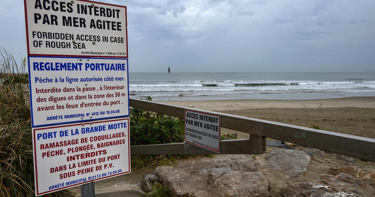
Up to 25 provinces of 12 communities are on alert this Thursday for the storm, with Asturias, Cantabria, Galicia, La Rioja and the Basque Country under orange warning - the second on a scale of three - for winds of up to 110 kilometers per hour and waves of up to seven and eight meters on the Atlantic and Cantabrian coast.
Andalusia, Aragon, Castilla y León, Castilla-La Mancha, Catalonia, Navarra and the Valencian Community have yellow warning, the first level of the Meteoalerta system.
At the moment, the maximum wind gust so far this day has remained at 110 kilometers per hour in Estaca de Bares (A Coruña), compared to the 147 that were measured on Wednesday in Valdezcaray (La Rioja) because of de
Gaetan
, which also left rains of more than 60 liters per square meter in 24 hours in Cádiz and in western Galicia.
But the highlight of the day is the notable rise in minimum temperatures and the end of the thermal inversion.
Hardly any frosts have been recorded, except at high altitudes, with -4.4º in Port Ainé (Lleida) and points in the eastern interior of Catalonia, compared to the -25.4º reached last week during the coldest day of the wave of cold.
“We are immersed in an Atlantic storm in which, at least until Tuesday, the passage of several storms with their fronts, associated with an intense jet stream, which circulates at high levels of the atmosphere at latitudes close to our.
These storms move from west to east, deepening on their way ”, explains the spokesperson of the Aemet, Rubén del Campo.
In this train of storms, now it is the turn of
Hortense
, who is moving quickly and that midnight from Thursday to Friday will be very close to Galicia.
“It is a small storm and not particularly deep, but it will pass very close to the Peninsula and there will be a significant pressure difference between its core and the high pressures that dominate North Africa and the extreme south of the peninsula, for which will be able to produce strong winds.
The wind will be the most significant phenomenon, although it will also leave rain ”, Del Campo advances.
This
afternoon-night
, the wind that already blows with intensity in Galicia and in the surroundings of the Cantabrian Mountains will increase its strength with the arrival of
Hortense
.
In those areas, gusts of 90 to 100 kilometers per hour are expected.
Starting at noon, it will also increase in intensity in the Iberian System and in other areas of the eastern half of the peninsula, with gusts of 70 to 80. The passage of a front will lead to rains in the western half and the central peninsular area, as well as the environment of the Aragonese Pyrenees.
They will be especially abundant in Galicia and the north of Cáceres.
Temperatures will rise due to winds from the south and southwest and may exceed 20 degrees in the Mediterranean area.
On
Friday,
the wind will be a very adverse factor in almost the entire Peninsula and the Balearic Islands and only the southwest of the peninsula and areas of the interior of the Cantabrian will be spared.
There are notices in 16 communities and in Melilla, which are orange level ―which implies that doing outdoor activities represents a significant risk― in Galicia, points of the Cantabrian Mountains, the central area such as Madrid and the eastern third of the peninsula, where gusts of 90 to 110 kilometers per hour will blow.
"A lot of caution, because they can cause, among other effects, the fall of large tree branches," Del Campo warns.
The strong winds will be accompanied by a strong maritime storm in Galicia and the Cantabrian communities, with waves of up to seven and six meters.
In the Mediterranean they will be three to four meters.
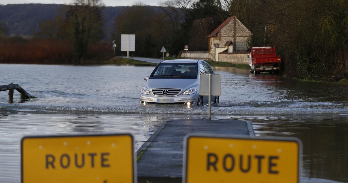
In addition, it will rain in a large part of the Peninsula, except in the Valencian Community, Murcia and eastern Andalusia.
Some drops could also fall in the Balearic Islands.
The rains will be strong, persistent and accompanied by a storm in Galicia, and they can also be intense in the Cantabrian and mountainous areas of the interior of the peninsula.
Temperatures will drop as the wind moves from the southwest to the west.
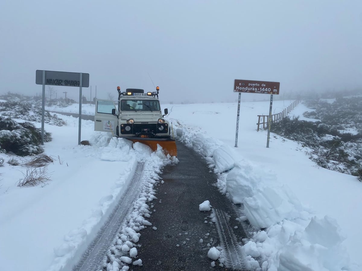
There will be frosts in mountain areas and the snow level will be at 1,000 meters at the end of the day in the center and the northern half of the peninsula.
However, temperatures will rise somewhat more in areas of the southeast of the peninsula, because the west winds arrive overheated, with which the thermometers could reach 22 / 24º.
Hortense will
leave Spain on Saturday, the day when another storm will arrive, which will also produce intense winds and rain, except in the Mediterranean area and stronger in Galicia, the Cantabrian area and surroundings of the Aragonese Pyrenees and the Central System.
At the moment, it has no name but, if it deepens, it would be
Ignacio
.

/cloudfront-eu-central-1.images.arcpublishing.com/prisa/FNKLLK5XKNWEKUJYBF4ZFC5S6U.jpg)