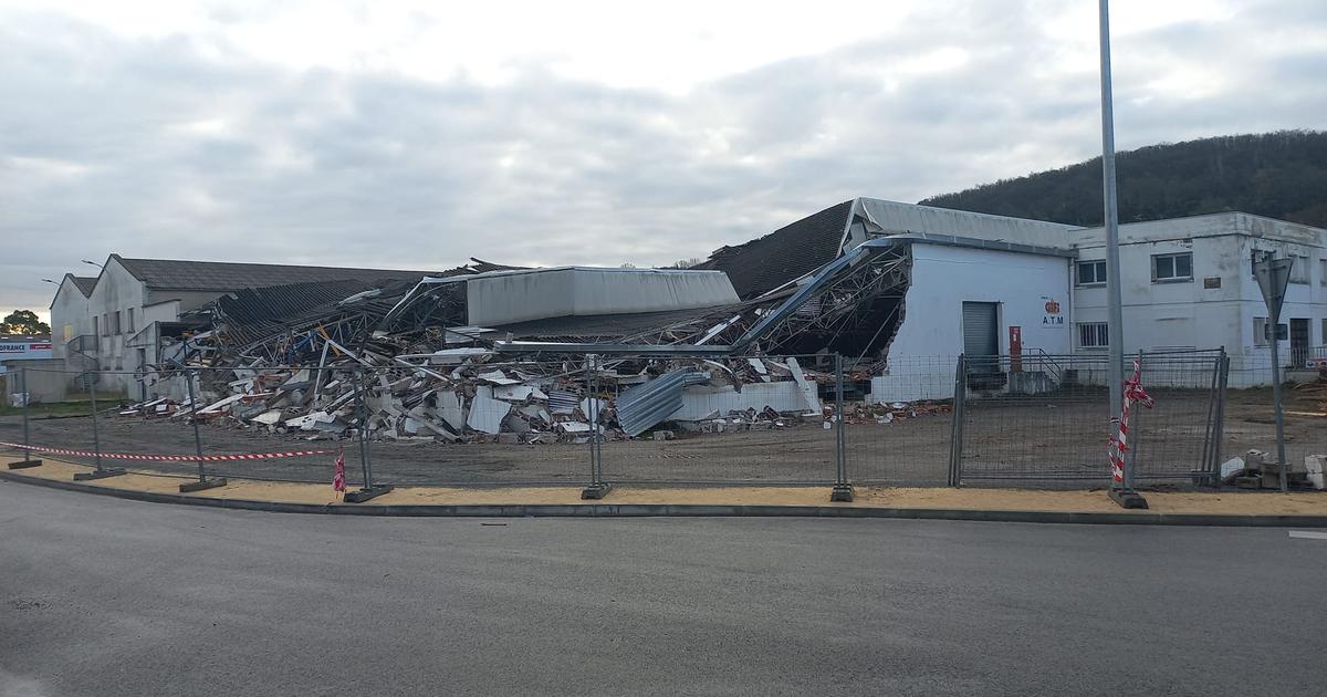
This is how a tornado left Birmingham, Alabama (January 2021) 1:07
(CNN) -
A massive outbreak of cold air, fueled by the La Niña phenomenon, over the central United States in early February set hundreds of records for cold temperatures, putting the electrical grid in Texas to the test and leaving millions without electricity.
Sounds familiar?
It was the year 2011, when a moderate La Niña weather pattern and an active jet stream generated a scenario that is almost identical to what we have experienced so far in 2021.
The weather events that followed the extreme cold snap of 2011 now have forecasters concerned that the United States could have above-normal tornado activity this spring.
The last few months have shown signs of a La Niña phenomenon stronger than that of the winter of 2010-2011.
So the question is whether this spring continues to mirror that year, which ended up being the costliest tornado-recorded year on record and the deadliest in nearly 100 years.
advertising
"The severe weather season is really a collection of several short weather events, and anticipating individual events in long wait times is often tricky," Sam Lillo, an atmospheric researcher at the University of Colorado Boulder, told CNN.
"What we can say instead is whether the probability of ingredients coming together for these events is higher or lower than normal: this year, it is higher than normal."
US faces storms and tornadoes amid COVID-19 battle
Deadliest tornado season in modern history by La Niña
The remarkable tornado season of 2011 was the deadliest in modern times, with more than 550 deaths, second only to the 794 total tornado deaths of 1925.
Almost all of the tornado deaths in 2011 occurred during the extremely active months of April and May.
In April alone there were 875 confirmed tornadoes, more than any month on record.
The April 27 super blast recorded 226 tornadoes, the most tornadoes ever observed in a single day, including destructive tornadoes in Birmingham and Tuscaloosa, Alabama.
Volunteers search destroyed homes on April 30, 2011, in Tuscaloosa, Alabama.
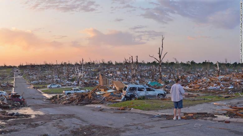
A few weeks later, Joplin, Missouri, was hit by a large-scale EF5 tornado that killed more than 160 people.
It was the deadliest tornado in more than 60 years, as well as the costliest tornado on record, with nearly $ 3 billion in direct damage.
"Looking back at 2011, it was a sheer magnitude of the number of events, the fact that so many hit populated areas, and of course the incredibly high cost in terms of deaths, injuries, and dollar damages," said Bill Bunting, chief of forecasting operations for the National Weather Service's Storm Prediction Center (SPC).
While localized and small-scale weather features played a role in these two tragic days, it is worth looking at the general large-scale weather patterns that fueled the historic 2011 tornado season to determine the risk of similar days this year.
“Every year has some potential (for tornado outbreaks);
it's just a matter of trying to accurately predict, as far in advance as possible, where that area is likely to be and then making sure people are prepared and have a plan, "said Bunting.
A person inspects the damage the day after a tornado struck Joplin, Missouri, killing dozens on May 23, 2011.
Active tornado forecast for this spring by La Niña
To paint a picture of what the weather will look like in the coming weeks and months, forecasters look to the La Niña phenomenon and other global weather and weather patterns, such as the Arctic Oscillation (which is different from the polar vortex), to work out the called sub-seasonal forecasts.
Lillo runs one of these models that "targets slow, predictable parts of the atmosphere" to create forecasts several weeks in advance.
Forecast models like this are important for things like seasonal temperature forecasts, which are used in energy trading markets, and hurricane season forecasts published each year by the National Oceanic and Atmospheric Administration (NOAA).
Lillo's model recently predicted, a month in advance, the polar vortex that gripped the central United States in February.
Now, the focus shifts to what these long-term patterns could reveal as we move into the severe spring storm season.
"In general, the forecasts show peaks with higher than normal temperatures in the south, cooler in the north, and that temperature gradient improves the jet stream in the central United States," Lillo said.
(The jet stream is the main storm path in the northern mid-latitudes and splits cooler air to the north and warmer air to the south.)
During La Niña, the strongest temperature differences tend to develop between hot, humid air in the southern United States and cooler, drier air toward the north.
This establishes a faster jet stream than can severe weather conditions.
"The faster jet stream has all the potential for stronger storm systems and severe weather conditions," Lillo said.
In March, the southern United States is historically the area where severe storms, including tornadoes, are most likely.
Then, as the Northern Hemisphere begins to warm up, the tornado's target will shift from the west to the central United States and eventually north to the Northern Plains when summer rolls around.
"The jet stream pattern is not unfavorable for severe weather, as we are approaching March a little later and certainly beyond," Bunting said.
"If that pattern holds, the very strong wind fields along the gulf coast near the warm, humid air suggest that the gulf coast in the short term may be an area to watch closely."
Before and after images highlighting the severity of the destruction left by tornadoes in Nashville
How La Niña is related to tornadoes
Similar to this year, a moderate La Niña phenomenon was the main feature in 2011. La Niña, and its counterpart, El Niño, may play an important role in the patterns of jet stream position, temperature and precipitation. in United States
El Niño or La Niña conditions in the winter months can be used to help identify the frequency of tornadoes during the peak of the severe storm season in the spring, recent studies have found.
"The hot, humid airflow from the Gulf of Mexico increases in strength during the springs after La Niña, which produces the fuel needed to form storms," said Jason Furtado, assistant professor of meteorology at the University of Oklahoma.
"Stronger flow increases low-level wind shear which also favors tornadoes and hailstorms," Furtado added.
Recent months have featured the strongest La Niña since 2011, and this pattern is expected to continue to impact the weather for months to come, through the heart of the severe weather season, according to the NOAA Center for Weather Prediction. .
Plan where to protect yourself from the possible ravages of La Niña
While severe storms occur year-round in the United States, the peak time for severe storms is during the meteorological spring, which includes March, April, and May.
So far this year, there have only been 27 reports of tornadoes, which is well below normal.
Over the past 15 years, the United States has averaged about 130 tornado reports during the first days of March.
But it's not just tornado reports that are down.
Hail and damaging wind reports are also below average year-to-date.
"There have been many seasons that started out quiet and then did the opposite," Bunting said.
2011 also started below average for tornado and hail reports for much of March, according to data compiled by the SPC, before rapidly accelerating through the rest of the spring.
The next forecast depends on where the jet stream will end in the next few weeks.
Now is the time to review your severe weather plans.
Know where to find your local daily forecast.
Have multiple ways to receive severe storm and tornado alerts and warnings - via wireless emergency alerts, NOAA weather radio, local news stations, and more.
And have a fixed place to shelter at home, work, or school if a tornado strikes.
Bunting advised: "This is the time of year when we have to start thinking a little more about the potential for severe storms and develop that pre-event planning."
La Niña phenomenon