
Sixteen departments were placed in orange vigilance "storms" from this Sunday at 12 noon and until Tuesday 12 noon, in New Aquitaine, Occitanie and Auvergne-Rhones-Alpes, because of "a vast low pressure system that form on the near Atlantic, ”announced La Chaîne Météo * in its latest bulletin.
Météo France indicates, on the other hand, twelve departments on orange alert.
Read also: Weather this Saturday: clear improvement and sharp rise in temperatures
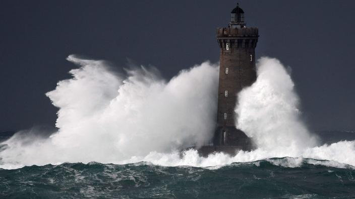
This low pressure system collides with an anticyclone positioned over central Europe. In its very slow progression over France, this low pressure system and the associated disturbance cause a lasting episode of bad weather, from Sunday to Tuesday. Violent winds, with almost stormy gusts in the mountains, thunderstorms sometimes accompanied by hailstorms as well as heavy and lasting rains are likely to cause damage to crops, flooding of rivers flowing down from the mountains and flooding in the plains .
The western regions are first affected on Sunday and the following night by strong winds and sometimes violent thunderstorms.
Then Monday and Tuesday, it is the turn of the east and the south of the country to suffer these bad weather, which is why this special press release was extended this Sunday morning to the south-east of the territory.
Eight other departments have also been placed on orange precipitation alert by La Chaîne Météo.
To read also: By the way, what is a Cévennes episode?
This Sunday afternoon,
the wind will continue to strengthen, blowing like a storm over the Pyrenees, up to 140 km / h and 120 km / h on the summits and plateaus of Auvergne, 80 to 100 km / h in the plains and the valleys. And,
this Sunday evening,
with the arrival of the cold front by the Atlantic, a thunderstorm line will form from Aquitaine to Hauts-de-France, passing through Normandy, the Paris basin and the Center-Val de Loire. These thunderstorms will occasionally be strong, accompanied by hail and powerful gusts of wind. The wind will continue to blow violently from the Massif Central to the Lyon region in the Saône valley to the Langres plateau.
During the night from Sunday to Monday,
the disturbance will extend from the Ardennes and Hauts-de-France to the Pyrenees to Occitanie and the Cévennes where rain and storm activity is very important. The wind will continue to blow very strongly from the south of the Massif Central to the Saône valley and will intensify sharply from the west of Provence to the Prealps, with gusts of over 130 km / h over the Chartreuse and the Belledonne mountains.
On Monday morning
, the rain-storm disturbance will continue over the regions extending from the Cévennes to the Rhône valley, progressing from the Paca region in the Alps to Bourgogne-Franche-Comté in the Grand-Est region where a lasting episode of heavy rains will begin. .
In the afternoon,
if the wind calms down everywhere, thunderstorm rains, continuous, and of moderate to strong intensity will continue to the east of the Rhône to the Cévennes, with a risk of hailstorms in Provence Côte d'Azur.
In the evening
and at
night from Monday to Tuesday
, the situation will continue to worsen with the rise of powerful thunderstorms in the Mediterranean which will persist for several hours from Languedoc to Provence Alpes Côte d'Azur, risking aggravating the phenomena of runoff and flooding.
Tuesday,
the day will remain heavily rainy and stormy from Franche-Comté in the Alps to Provence Côte d'Azur while the Cévennes will see an improvement.
It is only in the evening that conditions will improve everywhere, with the evacuation of this rainstorm disturbance towards central Europe.
* The Weather Channel is owned by the Figaro group.