
Bad weather in Texas puts millions of people on alert 0:42
(CNN) -
Millions of people across southeast Texas will remain on flash flood alert through Thursday due to torrential rains that hit the region, causing power outages.
There are also reports of localized damage.
Tornado watches for the areas around Houston and College Station were lifted early Wednesday, but rain is expected to continue to fall through Friday, before the storm system reaches the Gulf of Mexico.
Texas coastal areas should expect rain through Monday.
At one point in the early hours of Wednesday, more than 100,000 customers were without power in Texas, according to the PowerOutage website.
That number was ultimately reduced to around 65,000 customers.
Between Tuesday night and Wednesday, between 3 and 5 inches of rain had fallen.
Life-threatening flash floods were occurring or were expected to start in streams and creeks, urban areas, roads, streets, and underpasses.
Baseball-sized hail, floods and storms threaten Texas
In Fulshear, about a dozen trees had fallen, blocking roads, the city said in a post on social media.
Officials urged people to stay away from downed power lines and report them.
advertising
In the coastal city of Port Lavaca, the Fire Department urged residents to stay home and off the roads until the storm passed after receiving multiple reports of stranded motorists.
Fatal Damages in Louisiana
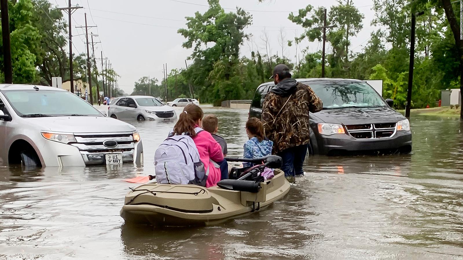
Parents use a boat to pick up their children from school after torrential rains in Lake Charles, Louisiana.
Meanwhile, in Louisiana, authorities were investigating five weather-related deaths.
Three of those deaths were people in submerged vehicles in various parts of the state.
The other two deaths were people on oxygen when the power went out, according to Shane Evans, chief of investigations for the East Baton Rouge Coroner's Office.
"If their machines had been working, I have no doubt that they would be alive today," Evans said.
Louisiana State Police said an accident Monday night in the West Baton Rouge district left one person dead, another missing and others slightly injured.
The vehicle went off the road and into a canal where it sank, the State Police said in a press release.
In neighboring Arkansas, the National Weather Service issued flash flood warnings for early Wednesday.
The Arkansas Division of Emergency Management tweeted that 15 people were rescued after at least four houses and eight cars were affected by flooding in Saline County.
"Please be careful, avoid flooded areas 'turn around so you don't sink,'" the tweet read.
Your city got hotter.
NOAA announced the new climatological normals and these are the changes
Extreme rains closely related to the climate crisis
Extreme rainfall and increasing rainfall rates are closely linked to warming temperatures and the climate crisis.
"The frequency and intensity of heavy rainfall events in the United States have increased […] and are expected to continue to increase over the next century," according to the 2018 US National Climate Assessment.
This is leading to more type 1 extreme rainfall events in 5 years, 1 in 10 years, 1 in 100 years, leading to catastrophic flash floods.
These trends are consistent, according to scientists, with what is expected in a warming world, as warmer temperatures cause more evaporation, leading to higher levels of water vapor in the atmosphere, which in turn it can lead to more frequent and intense rains.
Louisiana has experienced extreme weather-driven rains before with disastrous consequences, such as in 2016 when scientists studied deadly flash floods and found that they had been made at least 40% more likely and 12% to 35% more intense due to the Emissions of greenhouse gases.
CNN's Jamiel Lynch, Jason Hanna and Amanda Jackson contributed to this report.
FloodsRain