the weather
Written by: Deng Yinglin
2021-06-11 16:15
Last update date: 2021-06-11 17:00
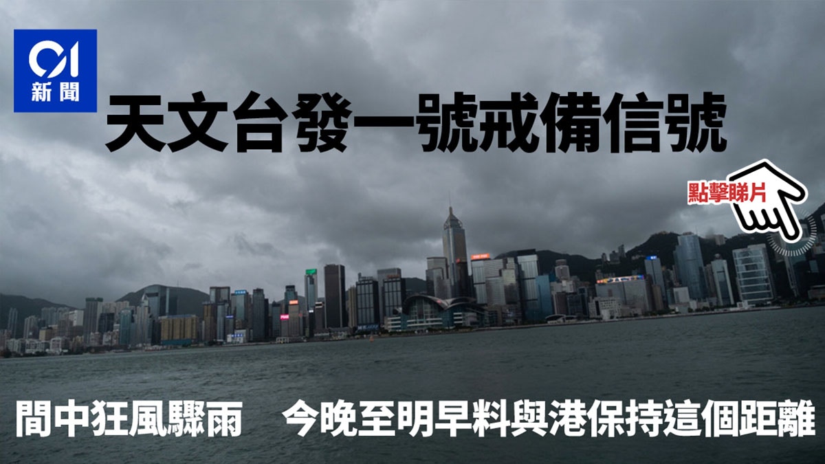
The low pressure area in the middle of the South China Sea intensified into a tropical depression this afternoon. The Hong Kong Observatory issued the alert signal No. 1 at 4:15 pm, the first of this year. It is expected that the system will contact Hong Kong from tonight to tomorrow morning (June 11-12). Keep a distance of about 500 kilometers or more. The wind will be strong in Japan tonight, with occasional squally showers and swells on the sea.
The Macau Observatory said at 4 pm that it is forecast to issue typhoon signal No. 1 and blue storm surge warning at 4:30 pm.
The observatory indicated that the area of low pressure intensified into a tropical cyclone and is expected to move towards Hainan Island.
(Picture of the Observatory)
Observatory: The closest to Hong Kong from dusk to night
The Observatory said that the alert signal No. 1 will be maintained tonight.
At 4 pm, the tropical depression concentrated about 500 kilometers south-southwest of Hong Kong, and is expected to move west-northwest at a speed of about 15 kilometers per hour, towards Hainan Island.
The tropical depression will be the closest to Hong Kong in the evening tonight, passing about 500 kilometers southwest of Hong Kong. Strong winds will blow in the offshore waters and highlands of Hong Kong tonight with occasional squally showers and swells on the sea.
According to the current forecast path, the tropical depression will land on Hainan Island tomorrow morning.
▼European Center for Medium-Term Weather Forecast (ECMWF) Forecast Path▼
+3
+3
+3
▼Global Forecast System GFS Forecast Path▼
+3
+3
+3
▼Central waterfront check-in artwork "The Stream Does Not Quit"▼
+10
+10
+10
The Macau Observatory said that the low pressure area in the South China Sea has intensified into a tropical depression. It is currently about 500 kilometers south of Macau. Typhoon signal No. 1 and a blue storm surge warning will be issued at 4:30 pm.
The Observatory said that the low pressure area is intensifying and the tropical cyclone is forming, and it plans to issue the No. 1 typhoon signal
The Observatory predicts that the South China Sea low pressure area will intensify the warning of squally rainstorms on weekends in Macau
Observatory | Showers for several days, strong winds on weekends 6.14 Temperatures up to 30 degrees during the Dragon Boat Festival
The Observatory said that the development of low-pressure areas moved to Hainan Island in recent weekends. There are significant differences in computer predictions
The Observatory expects low-pressure areas to develop in the central South China Sea over the weekend to welcome unstable weather and thunderstorms during the Dragon Boat Festival
01News
Hong Kong Observatory Weather Forecast Typhoon Weather Instant Tropical Cyclone News My Home 01 Video01 Video OTT
/cloudfront-eu-central-1.images.arcpublishing.com/prisa/3I74UEXLYRBBRPGPSGWNN6WXH4.jpg)