
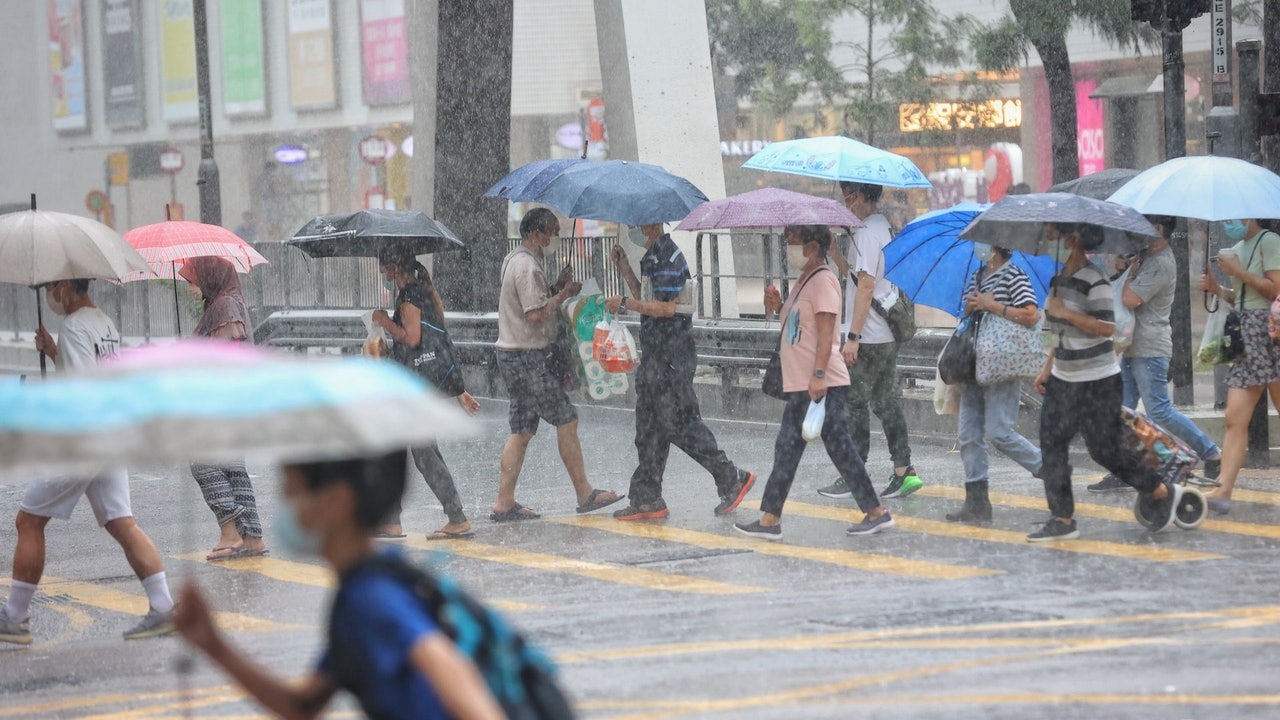
Entering August, Hong Kong once again welcomes a tropical cyclone.
As of 12 noon today (3rd), the alert signal No. 1 is in effect. The Observatory predicts that the tropical depression in the northern part of the South China Sea will be the closest to Hong Kong from tonight to tomorrow morning (4th).
The circulation of this tropical depression is relatively small. Unless it moves closer to Hong Kong or increases significantly, it is expected that Typhoon Signal No. 1 will be maintained during most of the day.
The Macau Meteorological Bureau is also hoisting the No. 1 typhoon signal and stated that the No. 3 typhoon signal will be changed at 1 pm.
The Observatory also pointed out that the outer rainbands associated with the tropical depression will bring showers and squalls to Hong Kong today and in the next few days, and there will also be swells on the sea.
According to the nine-day weather forecast, offshore wind will reach the level of No. 3 typhoon for three consecutive days starting from tomorrow.
The weather in Hong Kong is expected to gradually improve from the beginning to the middle of next week, and the weather will also be very hot from next Wednesday (11th).
▼On July 20, the Observatory once issued the No. 3 strong wind signal and the yellow rainstorm warning signal▼
+9
▼On July 19th, tropical storm Chapaka struck Ha Shek O, there are still citizens swimming ▼
+8
According to the Observatory, the tropical depression located in the northern part of the South China Sea gathers about 130 kilometers south-southwest of Hong Kong, and is expected to move slowly eastward across the coastal waters of Guangdong.
In the past few hours, the tropical depression moved more slowly and increased slightly.
According to the current forecast path, the tropical depression will be the closest to Hong Kong from tonight to tomorrow morning, passing about 100 kilometers south of Hong Kong.
The observatory’s track forecast shows that the tropical depression is expected to intensify into a tropical storm tomorrow.
The Observatory also predicted that the tropical depression will then turn to the northeast, approaching the area from eastern Guangdong to the coast of Fujian, but its path and development are variable.
According to the nine-day weather forecast, a force 6 wind will blow offshore tomorrow (4th), with force 7 at the beginning; and a force 6 wind will occasionally be offshore on Thursday (5th).
According to Beaufort's wind scale, the average wind speed of winds of 6 and 7 ranges from 41 to 62 kilometers per hour, reaching the level of No. 3 typhoon.
Central Meteorological Observatory: It may develop into a typhoon in the next 24 hours
The Macau Meteorological Bureau also hoisted the No. 1 typhoon signal and stated that the No. 3 typhoon signal will be issued in the afternoon depending on the situation, and the chance of issuing the No. 8 typhoon signal is low.
According to the Central Meteorological Observatory of the Mainland, the intensity of the tropical depression is gradually increasing, and it may develop into a typhoon in the next 24 hours, with the strongest reaching tropical storm level or severe tropical storm level.
The tropical depression will pass or land on the coast from eastern Guangdong to southern Fujian on Thursday, and then move into the East China Sea.
With reference to the European Centre for Medium-Term Weather Forecast (ECMWF) forecast, the tropical depression will pass over the sea to the south of Hong Kong tomorrow.
It made landfall in the vicinity of Jieyang City on Thursday, and then moved towards Japan. The lowest pressure at the center of the sea level is 983 hPa, which is a severe tropical storm.
The US Global Forecast System (GFS) is also expected to be the closest to Hong Kong on Wednesday, but it is expected to gradually dissipate after landing in Shanwei City.
▼ECMWF forecast▼
▼GFS forecast▼
In Hong Kong, the Observatory predicts that it will be generally cloudy today, with occasional showers and squally winds, and thunderstorms in some areas; the blowing moderates to fresh east to northeast winds, occasional strong winds offshore, and swells on the sea.
Looking forward to tomorrow and Thursday, the wind will be quite strong, with occasional heavy showers and squally winds; there will be swells on the sea, and there will be occasional showers in the following one or two days.
As the high-altitude anticyclone strengthens, the weather in southern China will gradually improve in the early to mid-term next week.
Leizhou Peninsula low pressure area is expected to "rise". The Observatory will consider hoisting the No. 1 Typhoon Observatory tonight until tomorrow morning. The rain on Ya Island is particularly heavy or there is severe flooding. The thunderstorm will continue until the beginning of the autumn Chapaka typhoon. Liang Rongwu dismantled the "return to the horse wind", the reason for the unsustainable stamina of the Chapaka typhoon | C-shaped turn will weaken the impact of the Observatory's "fireworks" to 34 degrees on Friday
01News


/cloudfront-eu-central-1.images.arcpublishing.com/prisa/LK4BWLOG5F4TALNACDXUI4NVI4.jpg)