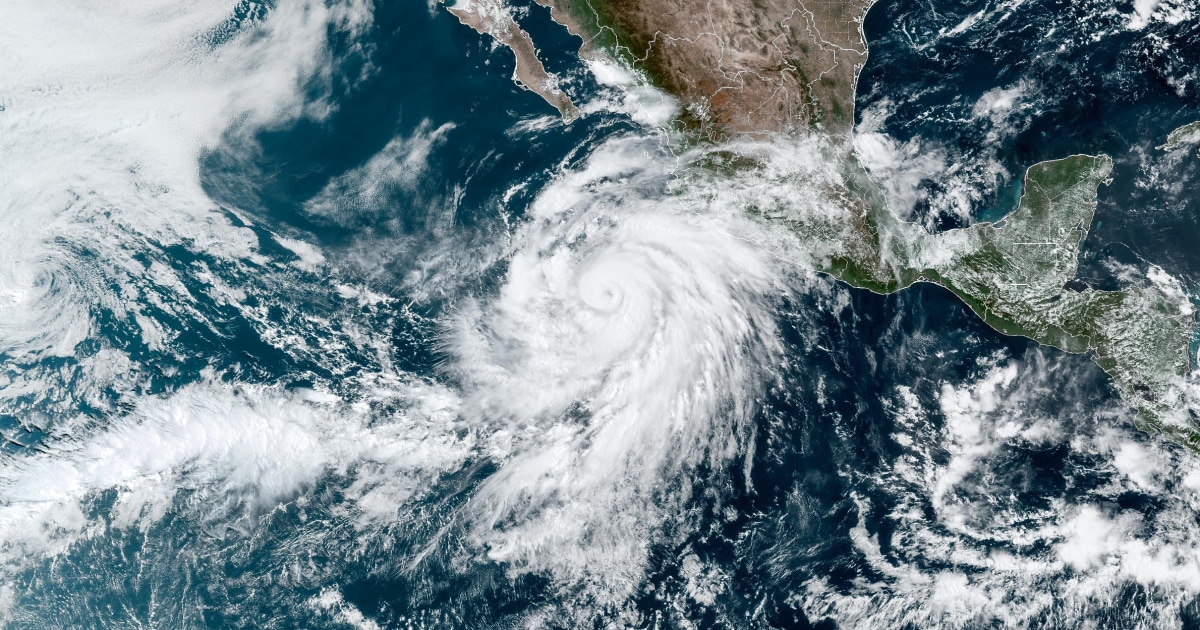
Satellite image of Hurricane Linda off the Mexican coast.
Hurricane Linda has gained strength to become category 4 although it is moving away from the shores of the Mexican Pacific, the National Meteorological Service (SMN) reported this Saturday.
In its most recent report, the agency has detailed that the cyclone, with maximum sustained winds of 215 kilometers per hour, is already located about 850 kilometers south of Cabo San Lázaro, in the State of Baja California Sur.
“We had gusts of winds of 260 kilometers per hour and displacement to the west-northwest at 20 kilometers per hour,” indicated the SMN.
More information
Linda becomes a Category 1 hurricane and will cause heavy rains in western Mexico
Linda had intensified from a tropical storm to a Category 1 hurricane on Thursday and this Friday rose to Category 2 and 3 within hours.
The official forecast foresees that the cyclone will descend again to a category 3 hurricane during the early hours of Sunday, when it will be located more than 890 kilometers from the coast of Baja California Sur.
In its displacement it will continue to lose strength and it is expected that by next Wednesday it will already be a tropical storm.
Despite Hurricane Linda moving away from the Mexican coast, there are still weather threats over the country.
This Saturday, the Meteorological Service has forecast very heavy rains due to a low pressure channel located over the northwest, west and central Mexico that interacts with tropical wave number 20 in the west of the country.
According to estimates, the States most affected by rainfall will be Chiapas, Chihuahua, Colima, Sonora, the State of Mexico, Jalisco and Michoacán.
"The rains could cause landslides, increase in the levels of rivers and streams, and overflows and floods in low-lying areas, so the population of the aforementioned states and maritime navigation are urged to heed the warnings," warned the Mexican authorities .
In the next 3 hours there will be conditions for #Rains from strong to very strong in areas of #Jalisco, #Colima, #Nayarit, # Michoacán, #Guanajuato and #Aguascalientes, as well as strong in places of #Veracruz.
They will be accompanied by # Electric Downloads and possible # Hail ⬇️ pic.twitter.com/QWL19WlJsU
- CONAGUA Climate (@conagua_clima) August 14, 2021
The 2021 rainy and tropical cyclone season in the Pacific officially began on May 15 and is expected to end in November.
At the moment, cyclones Andrés, Blanca, Carlos, Dolores, Enrique, Felicia, Guillermo, Hilda, Ignacio, Jimena, Kevin and Linda have formed in the Pacific.
Dolores made landfall on June 19 and had a special impact on the states of Colima and Michoacán, leaving three dead due to electrical storms.
The National Water Commission (Conagua), on which the SMN depends, predicted last May the formation of between 14 and 20 named systems in the Pacific Ocean for this season, while for the Atlantic it predicted 15 to 19 meteorological phenomena .
Subscribe here
to the
newsletter
of EL PAÍS México and receive all the informative keys of the current situation of this country

/cloudfront-eu-central-1.images.arcpublishing.com/prisa/OACTL5T33BGFXBR4DT7C52AANE.GIF)


/cloudfront-eu-central-1.images.arcpublishing.com/prisa/QMTJUZ634RCHPHI2Y4A27EYAOQ.jpg)

