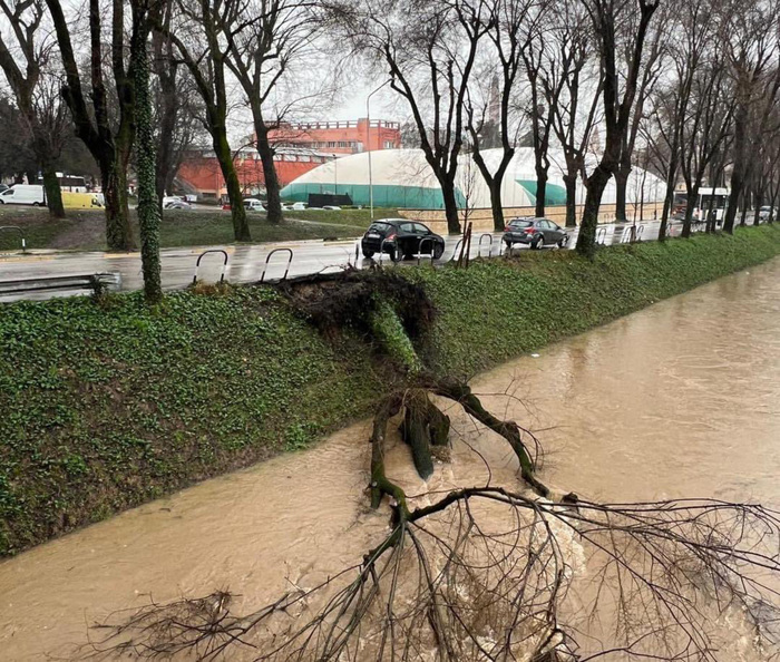
It was not only the flood disasters in July of this year in the west of the republic that led to the fact that floodplains were also identified on the waters in the district. Flood events in recent years have shown that the Inninger Bach, for example, also leads to flooding and that flooding can occur. The newly identified floodplains were only recently officially announced.
Inning
- In 1965 floods in the Inninger Bach resulted in the natural course of the brook being buried along the through-road.
The creek is open in the town only from the pond in the south to Leitenstrasse.
A small section on Mühlstraße is then open again, where a place with benches and plants was only created in 2018 with a pleasant atmosphere.
There are also bridges with an open stream at the town hall and in the Münchner Straße area.
The brook was not finally tamed by the scourge.
The Weilheim water management office, in cooperation with the municipality of Inning and the Starnberg district office, has now identified areas that are still at risk.
This mapping has an impact - on future construction projects and also on storage areas.
Particularly affected are agricultural areas in the south of Innings, but also the sawmill and storage areas there. Flood areas have also been identified in the town hall area and the surrounding buildings, as well as from the Münchner Straße intersection and out towards Ampermoos. In future construction projects, care will be taken to ensure that retention areas are retained or that compensation areas can be created, explains Alexander Wimmer. He is responsible for the environment in the Inninger Building Department and has participated in the mapping.
The official announcement is therefore not set in stone. The result is preliminary, emphasizes Wimmer. He also points out that the provisional securing of these areas is also "dynamic". Because it is planned, but not yet approved by the local council, to intercept the so-called white water from the Kellerberg, for example. This would have an impact on the flood situation and would affect the floodplains. The same applies to renaturation options on the Anger at the northern exit of the village.