news
News in Israel
Events in Israel
Including light rail: Tel Aviv's new public transportation maps
The Tel Aviv Municipality will soon begin deploying 800 new maps that will show the transportation routes in the city on a map of the city in a clear and simple way to get around.
At the same time, work on the red line of the light rail is progressing and infrastructure work is beginning on the following lines.
Tags
The light rail in Gush Dan
Public Transport
Light Rail
Tel Aviv Jaffa
Keenan Cohen
Thursday, 18 November 2021, 13:30 Updated: 13:47
Share on Facebook
Share on WhatsApp
Share on general
Share on general
Share on Twitter
Share on Email
0 comments
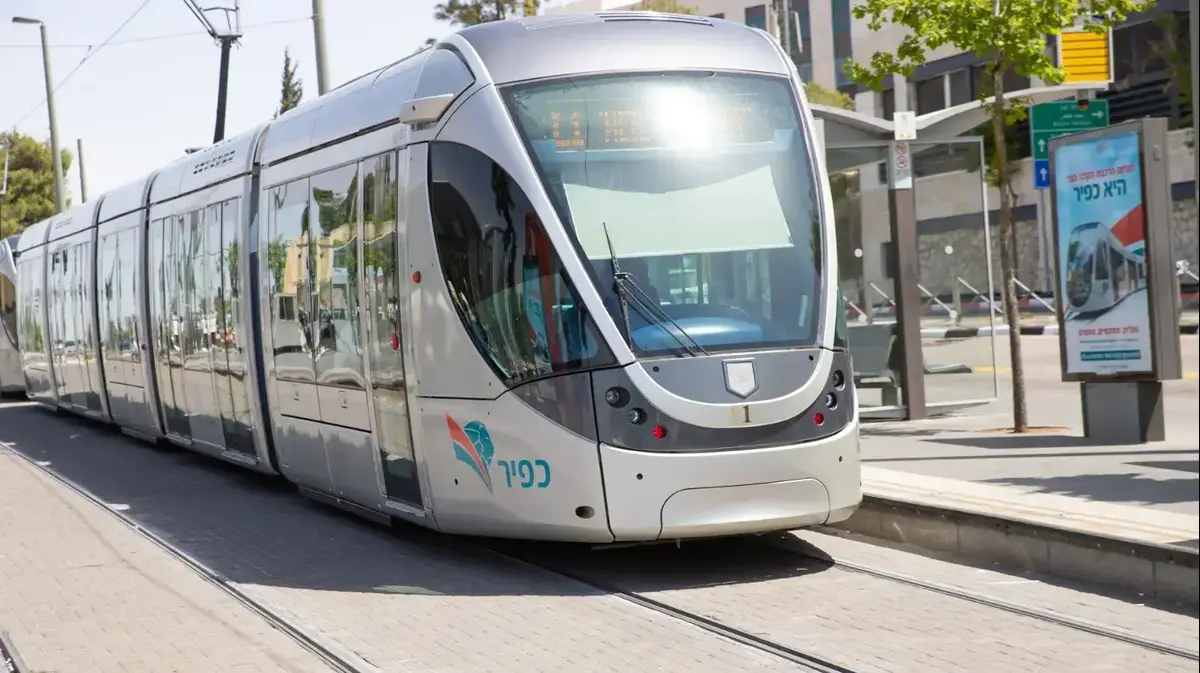
A test ride of the light rail in Jaffa. October 21, 2021 (NATA)
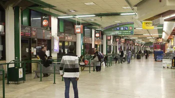
Completion of the light rail works may be postponed again and again, but the city's commuters will soon be able to take comfort in new and improved maps of public transport routes. The Tel Aviv Municipality will soon begin deploying 800 new maps, which will show the route routes across a map of the city in a clear and simple way to get around.
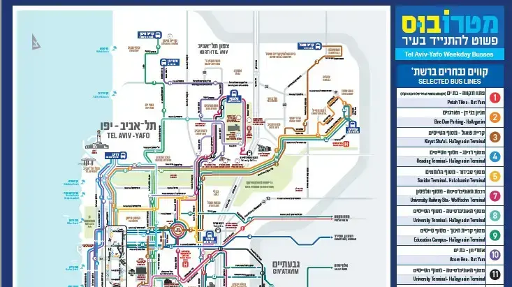
The metro bus lines will appear on the map, which together with the three future light rail lines will form the backbone of transportation in Gush Dan. "As in advanced cities around the world, the Ministry of Transportation and the Tel Aviv-Yafo Municipality are promoting a hierarchical system of public transportation service," Walla! Ofir Cohen, director of the municipality's transportation, traffic and parking authority, said. "Most of the lines already operate at a high frequency of 10-4 minutes during peak hours, and enjoy preference for exclusive lanes (Natzim). The metro bus network is complemented by dozens of other urban lines, and of course a wide network of suburban and intercity lines.".
More on Walla!
Petah Tikva to Bat Yam: The light rail completed a first test ride
To the full article
More on Walla!
After years of waiting: The light rail set out for its first test ride in Petah Tikva
Minister of Finance: NIS 110 billion will be invested in infrastructure
Doctors recommend: six minutes, twice a day and no pain
As in advanced cities in the world.
Map of the metro bus (Photo: PR)
The new maps will come into use as the work progresses on the red line of the light rail, which held its first full test ride three weeks ago.
In addition, infrastructure work is now beginning on the following lines, which are being carried out, among others, on Ibn Gvirol and Ben Yehuda streets.
"We believe that precisely while working on the three light rail lines at the same time, there is a need to upgrade the level of service in public transport," says Cohen, "both by significantly increasing the frequency of travel and by giving preference to the various streets."
Share on Facebook
Share on WhatsApp
Share on general
Share on general
Share on Twitter
Share on Email
0 comments