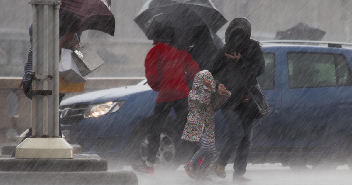
As expected, the snow made its arrival in the plains this weekend.
All the mountain ranges of the country are affected by the chain of winter disturbances.
But for the first time in the cold season, snowflakes reach the plains and can temporarily stick to the ground.
Météo France also places a very large part of the territory in yellow vigilance (level 2 out of 4) for snow and ice.
Only the west and the edges of the Mediterranean are spared.
But in Brittany and along the Channel coasts, winter conditions result in a strong wind, depriving several thousand homes of electricity, as reported by France Bleu.
/Meteo France
For Sunday, Météo France estimates that it will be the New Aquitaine, Occitanie and Auvergne-Rhône-Alpes regions that will be the most exposed to snow and ice.
In Nouvelle-Aquitaine and Occitanie, these are the mountainous regions that will be affected.
/Meteo France
As for the accumulations of snow caused by the succession of disturbances this Saturday and Sunday, here are the forecasts of the meteorological organization.
/Meteo France
This Saturday morning, snow showers covered part of the ground in the Grand Est region.
Watch out for #snowfall in the Grand-Est this morning, at very low altitude.
https://t.co/cnd7saDJVq
- The Weather Channel (@lachainemeteo) November 27, 2021
The flakes also reached the departments of Orne, in the West, and Somme, in the North.
Same landscape when you wake up in Forceville in the Somme. # Snow
📽 Thank you for the video @ LaMeteo2laSomme pic.twitter.com/rvUeM4waw0
- Météo-France (@meteofrance) November 27, 2021
The Oise and, further north, the Lille region were also concerned.
❄️8h25: showers of #snow are frequent in the west of the # oise and the soils are well bleached as here in Sainte Geneviève with a barely positive temperature.
Be careful in these areas. # Meteo #nordparisien #weekend pic.twitter.com/kRWJNotpta
- Météo Nord Parisien 🌪⚡️🌈☀️ (@MeteoNordParis) November 27, 2021
❄️ #snow makes its appearance in the plains, with a light dusting in the agglomeration of #Lille.
📸Villeneuve d'Acsq via our forecaster Alexandre Slowik.
pic.twitter.com/KCB6SNoF57
- Guillaume Séchet (@Meteovilles) November 27, 2021
From 6 a.m., the soils also started to whiten in some parts of Ile-de-France as shown in this radar animation provided by The Weather Channel and where the snow appears in pink.
The radar animation of the precipitation highlights the #neige (pink color) which mixes with the rain north of #Paris, without sticking to the ground due to weakly positive temperatures.
Only the highest plateaus can temporarily whitewash.
pic.twitter.com/bNDwme3g2i
- The Weather Channel (@lachainemeteo) November 27, 2021
When arriving in Seine-et-Marne, the snowfall became more massive throughout the department.
❄️ #snow is also present in #IledeFrance.
Sometimes strong intensities this morning around #Melun.
📽️Webcam APPR via @Viewsurf - A5 / A105 junction pic.twitter.com/Yf6wjfV7im
- Guillaume Séchet (@Meteovilles) November 27, 2021
10:15 am: ❄️🟡 #snow follow-up
The pluvio-snow front evacuates towards the East and the South of the #seineetmarne and the soils whiten like here in Rebais (77) under the strongest intensities thanks to cold temperatures of 0 / +1 degree.
Be careful! #Meteo #nordparisien pic.twitter.com/5lTF2zmQRZ
- Météo Nord Parisien 🌪⚡️🌈☀️ (@MeteoNordParis) November 27, 2021
At Disneyland Paris Park located in the north of Seine-et-Marne, snowflakes greeted the visitors of the day.
✨ It's snowing on NEVERLAND!
Yo Ho!
🏴☠️❄️✨ # disneyparks #DisneylandParis #neige pic.twitter.com/LOoaOMTDM6
- 🧞♂️ Disney Cave 0f Wonders 💫🏰 (@ Cave0fWonders) November 27, 2021
As the day progresses, with warmer temperatures, snow showers must turn to rain.