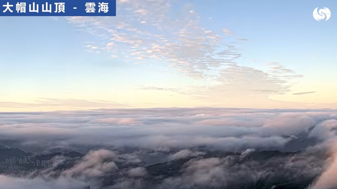
The December typhoon Rey was dissipating. The weather in Hong Kong stabilized today (22nd). The camera set up on the top of Tai Mo Shan at the Observatory also captured a large view of the sea of clouds this morning.
In addition to "selling photos" on Facebook, the Observatory also took the opportunity to explain that the formation of clouds is related to the "inversion layer" phenomenon, that is, when the altitude increases, the temperature does not fall but rises, hindering the development of clouds to high altitude, and eventually forming a sea of clouds.
According to the analysis conducted by the Observatory earlier, many conditions must be met in order to see the sea of clouds. When the ocean air current affects Hong Kong and other coastal areas in South China in spring, the relevant conditions are very common, but the phenomenon of "inversion layer" occasionally occurs in other areas. Seasons appear, so there is a sea of clouds in winter today, which is worth seeing more.
According to the Observatory, it can be seen from the high-altitude weather observation chart at 8 o'clock this morning that the temperature between more than 600 meters and more than 700 meters above the ground is close to the same as the dew point temperature. "This suppresses the upward development of the clouds, so you can see the sea of clouds from the peaks of Tai Mo Shan.
The spring ocean air current affects the common favorable “inversion layer” conditions along the South China coast
The Observatory explained earlier that the appearance of the sea of clouds is often related to the "inversion layer". The "inversion layer" is warm at the top and cool at the bottom, which is not good for the rise of water vapor in the air. In addition, the airflow is very humid, which is beneficial to the formation of stratiform clouds. In spring, the ocean currents affect the coast of South China. These conditions are very common, while "inversion layers" and shallow stratospheres occasionally appear in other seasons.
It rains on Christmas Eve and the temperature drops sharply by 10 degrees overnight. The observatory expects a minimum of 11 degrees and a strong winter monsoon. Christmas will reach the observatory. Surrounding the mountains and the sea of clouds and watching the weather and traffic ︱ Rey continues to weaken today, cool and rainy, the highest temperature is 19 degrees Rey’s Typhoon Signal |