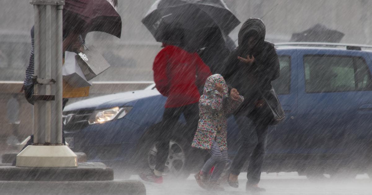
An air mass conflict crosses France between cold air coming down from Northern Europe and very soft air.
Long-lasting and sustained rains will occur in the North-East with the equivalent of 15-20 days of rain from the Ardennes to Lorraine, warns La Chaîne Météo * which places 12 departments with a high risk of precipitation in the North-East.
The departments concerned are: Aisne, Ardennes, Marne, Haute-Marne, Meurthe-et-Moselle, Meuse, Moselle, Nord, Oise, Pas-de-Calais, Haute- Saône, Seine-Maritime, Somme and Vosges.
Eight others present a significant risk of flooding.
Snow will fall in the evening from 1000 meters on the Vosges, 1200 meters on the Jura and the Massif-Central.
In the North-East, 8 departments present a significant risk of flooding and 12, of precipitation.
The Weather Channel
Read alsoWhy do we fall ill more often when it's cold?
The weather in your area
From Brittany to Normandy to Hauts-de-France
, a relative calm is expected in the morning with a cloudy sky leaving some clearings through.
The weather becomes more unstable in the afternoon with a few showers forecast.
The Weather Channel warns of the risk of overflows due to high tidal coefficients (coefficient 99) that can slow down river flow into the sea for coastal areas (Boulonnais, Calaisis).
A drop in temperatures is expected in the afternoon, between 7 to 9 ° C.
From Pays de la Loire and Center-Val de Loire to Ile-de-France and Picardy
, the weather is rainy in the morning but a temporary lull will occur at midday before the return of more unstable weather in the afternoon. Temperatures will vary between 7 and 10 ° C in the morning and between 8 and 12 ° C in the afternoon.
From the Grand Est and Burgundy-Franche-Comté
, the weather is rainy most of the day. The cumulative rainfall could approach records in 24 hours in the regions of the North-East where a risk of flooding, usual for this time of the year, is to be feared in these sectors because of the already high level of water prices. 'water, explains La Chaîne Météo *. Considering the already high level of the rivers, a risk of flooding, usual for this time of the year, is to be feared in these sectors. The southwest wind blows quite strong with gusts of 60-70 km / h, up to 90 km / h in the Vosges. Temperatures will vary between 4 and 8 ° C in the morning and between 10 and 14 ° C in the afternoon.
From Nouvelle-Aquitaine to Auvergne
, the weather gradually deteriorates until midday and the arrival of some light to moderate rains.
Temperatures are between 5 and 10 ° C in the morning and between 12 and 16 ° C in the afternoon.
From Occitania and the Alps to the Mediterranean regions
, the weather remains dry with clouds and clearings.
Temperatures will be mild in the afternoon with 13 to 17 ° C.
* The Weather Channel belongs to the Figaro group.