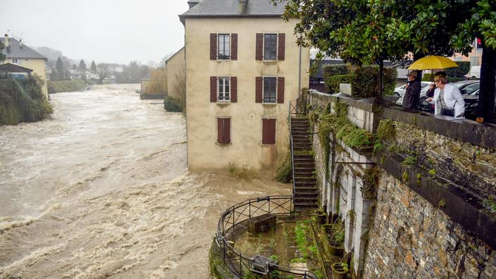
Five departments in the South-West, hit by very heavy rainfall, were placed on red alert by La Chaîne Météo * this Monday, January 10: Ariège, Haute-Garonne, Pyrénées-Atlantiques, Landes and Hautes- Pyrenees.
Read alsoThe economy of Western Canada paralyzed by the floods
This episode of very heavy rains leading to dangerous flooding is the second in less than a month in the South-West.
It is due to an "atmospheric river", a meteorological phenomenon long known to scientists.
"
It is a colorful and recent word which designates
air masses loaded with humidity which move while undulating, like the meanders of a river
", explains Régis Crépet, meteorologist for La Chaîne Météo *.
These air masses draw their moisture from the oceans and evolve over the continents with the help of high altitude winds.
A satellite image of Sunday January 9 where we can perfectly see the atmospheric ravière in the cloud band which goes up from Florida towards France.
NASA
"
Today, the technologies on board satellites make it possible to capture water vapor in the atmosphere and to see perfectly these rivers of humidity which circulate all around the globe, like sea currents in the oceans
", reports Régis. Crepet.
In the departments affected by the flood alert in France, an atmospheric river directed masses of soft and humid air against the mountain barrier of the Pyrenees.
"
These air masses saturated with humidity come directly from the West Indian arc
".
Going up towards Western Europe, the river bypassed the high pressure off France to go up to Ireland and then down again to the south-west of France.
Generalized floods
These moisture plumes can extend over several thousand kilometers but remain very narrow (a few hundred kilometers).
They mainly carry phenomenal amounts of water in the atmosphere.
"
The mountains block the descent of this humid air and cause precipitation
", explains the meteorologist.
At the same time, the mild humidity, coming from the Caribbean, raises the rain / snow limit at high altitude, above 2300 meters, which causes significant snowmelt.
A combination of circumstances which led to the swelling of all the rivers, which flow more easily into the sea, causing widespread flooding.
Read alsoNatural disasters: "We are already facing the consequences of climate change"
“
From this Tuesday, the air will be drier and colder,
” warns Régis Crépet. "
The atmospheric river will end but villages will remain under water all week long, while all the accumulated water goes downstream
". On the Pyrenean foothills of Ariège, monthly rain records were broken with in particular 52 mm in 24 hours in Saint-Girons, beating the record of January 1970 when it fell 47 mm. In December, the floods had caused no casualties but extensive material damage. The state of natural disaster had been declared.
* The Weather Channel belongs to the Figaro group.

