
Winter storm paralyzes northeastern US 0:44
(CNN) -
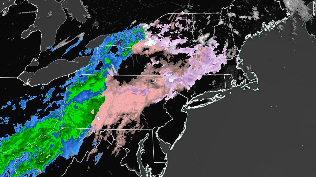
The dangerous conditions generated by the ice begin to cover much of the northeastern United States, while millions of people along the Gulf Coast are under the threat of strong storms since this Sunday.
In the Northeast, freezing rain and sleet covered parts of Pennsylvania and New York.
Other areas of the region are being hit by snow.
More than 30 million people across the region are under winter weather advisories this Sunday.
"Major icing" is expected in parts of central Pennsylvania, where there was an ice storm warning until 2 pm this Sunday, the National Weather Service (NWS) office said in State. College, Pennsylvania.
He indicated that a quarter to a half inch of ice is expected to accumulate this Sunday.
"Extremely dangerous travel conditions. Untreated surfaces will be very slippery. Isolated power outages are possible," the NWS office said.
advertising
More than 45 million people under winter weather warnings in the Midwest and Northeast of the United States.
Residents are urged to avoid driving unless absolutely necessary.
"If you have to travel, have an extra flashlight, food and water in your vehicle in case of an emergency," said the NWS office at State College.
By this Sunday afternoon, the chilly mix of winter rainfall in the Northeast will transition to freezing rain for most and snow for some of the higher elevations before ending tonight.
Wide swaths of New England are expected to receive between an ice sheet and a quarter inch of ice this Sunday.
However, most of the ice accumulations are expected to remain west of major metropolitan areas.
Possible severe storms and tornadoes in the south
More than 10 million people from East Texas to Northwest Florida could face strong to severe storms today.
"Damaging gusts, a pair of tornadoes and isolated large hail will be possible today across parts of Louisiana, Mississippi and Alabama," the NWS Storm Prediction Center said Sunday.
There is now a level 2 out of 5 risk for severe storms across Louisiana, Mississippi and Alabama.
Cities under this threat include Jackson and Hattiesburg in Mississippi.
Flooding could also be a problem for some parts of the Gulf Coast, with some areas expected to receive 2 to 3 inches of rain this Sunday.
Icy, arctic air envelops the upper Midwest
Cold subzero wind is expected to engulf much of the upper Midwest this Sunday.
Temperatures will have a hard time getting above zero degrees in some areas of northern North Dakota and Michigan.
Another winter storm is approaching the US See here a breakdown of its impact in four regions
This intense cold will spread to the Great Lakes this Sunday and to the northeast on Monday and Tuesday.
By Tuesday morning, the inland areas of the Northeast and New England could face freezing temperatures.
The brutally cold air and intense winds will cause heavy lake-effect snowfalls in favor of Lake Superior and Lake Ontario.
And by Tuesday morning, parts of Michigan's Upper Peninsula and New York's Tug Hill Plateau could have more than a foot of snow on the ground, the NWS Weather Prediction Center said.