A severe winter storm affects several US states. 2:11
(CNN) --
A storm is strengthening in the western United States and will bring ice, snow and the threat of tornadoes as it crosses the country through the end of the week.
"Snow is expected in the front range of the Rocky Mountains and critical fire threats are expected in the southern High Plains. In the afternoon/evening, a powerful storm will begin to impact the Plains and Mississippi Valley with severe thunderstorms and wintry weather." tweeted the National Weather Service (NWS).
How the climate crisis is affecting tornadoes in the United States
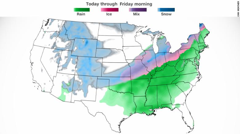
The potential for heavy snow began Wednesday in the northern Rockies, where more than 6 inches of snow could fall near Denver.
However, heavier snowfall is likely to the east.
This system is expected to drop snow from the central Plains region to southern Michigan on Thursday, with possible totals in some areas of nearly a foot.
"It looks like right now the heaviest snow will stretch from north-central Oklahoma to Detroit with a thin band of ice just south of that line. Another area of concern will be areas changing from rain and freezing rain to pellets." of sleet and finally a layer of snow on top," said CNN meteorologist Chad Myers.
advertising
Cities at risk from snow and ice include Kansas City, Chicago, and Lansing, Michigan.
In addition to snow in excess of 2 inches per hour at times, regions in the storm's path will be subject to high winds, creating even greater danger.
"The combination of heavy snow and strong gusts of wind may lead to greatly reduced visibility and hazardous travel conditions on Thursday and Thursday night," the Weather Prediction Center (WPC) tweeted.
Freezing rain is expected from central Missouri to northern Ohio, which could make travel difficult.
The Southwest may escape the worst of the storm;
however, it will experience its own weather hazards on Wednesday.
Extreme wind gusts of up to 120 kilometers per hour could be recorded in the area.
A combination of low relative humidity and gusty winds could create the optimal environment for fire hazards, leaving more than six million people under red flag warnings.
Severe storm threat emerging as system moves east
"As the advancing cold front collides with the warm, moist air mass Wednesday night, a line of thunderstorms may develop across northern Texas and Oklahoma," the WPC noted.
"There is a potential for the storms to produce damaging wind gusts, hail and isolated tornadoes in this region."
The Storm Prediction Center (SPC) posted a slight risk warning for severe thunderstorms, Level 2 of 5, for northern Texas and Oklahoma from Wednesday afternoon through early Thursday.
Severe thunderstorms pose a threat of damaging winds, large hail, and possible tornadoes.
"We constantly talk about the 'ingredients' needed for a thunderstorm to produce a tornado. There are likely to be some tornadoes with the strongest storms, but this, at least at this point, doesn't look like a massive tornado outbreak," Myers said. .
However, nighttime tornadoes present a greater danger to the public, primarily because people are asleep and may not hear severe weather warnings or are inside vulnerable structures.
Four safety tips that could save your life in a tornado
"You should always have a way to be warned, especially at night," Myers stressed.
As a cold front moves east Thursday, so does the threat of severe weather and heavy rain.
The SPC projects a region of increased risk across much of the South Central and Southeast on Thursday, a level higher than Wednesday's slight risk, putting cities like Memphis, Nashville and Murfreesboro in Tennessee and Tuscaloosa in Alabama particularly vulnerable to the threat of damaging winds and tornadoes.
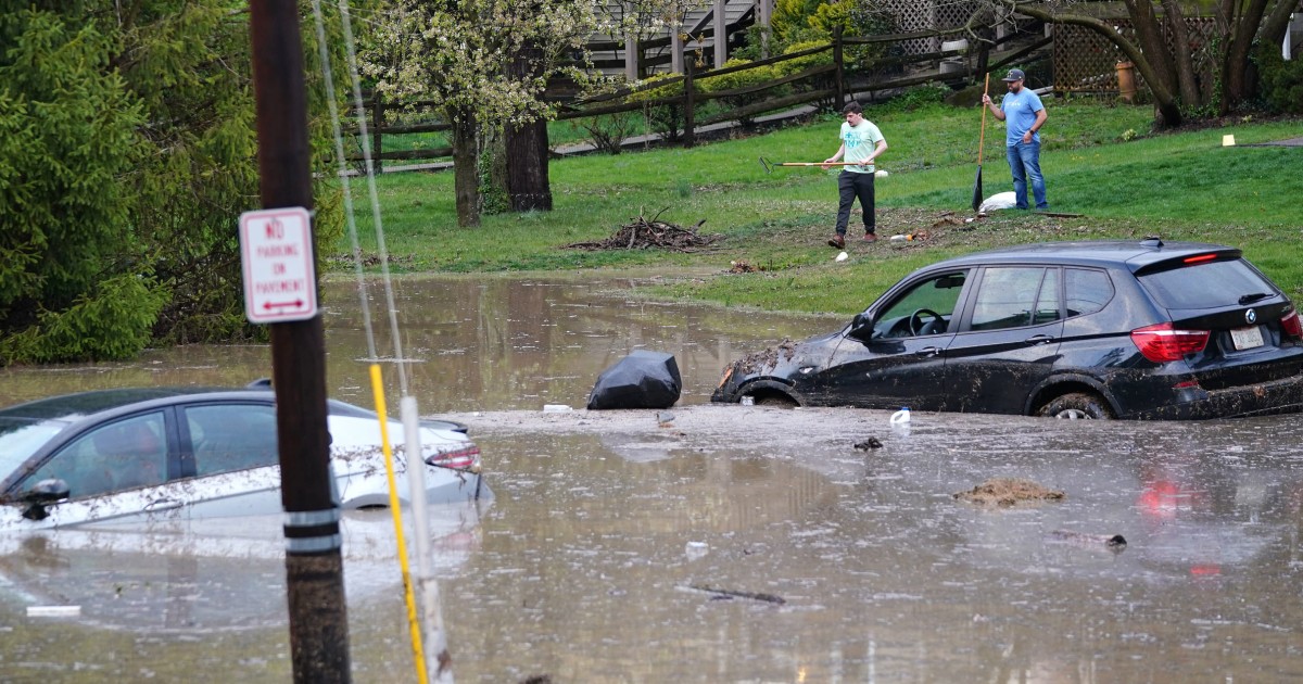
A combination of heavy rain along the cold front and heavy rainfall associated with thunderstorms will produce a risk of flash flooding in the southern US.
The south is not the only region at risk of flooding.
"There is a slight risk (Level 2 of 4) of excessive rainfall from southern Illinois to western New York, as well as portions of the southern Appalachians on Thursday. These areas are expected to have the highest chance of scattered instances." of flash flooding," reported the WPC.
The northernmost regions have the potential for flash flooding as a result of melting snow, in addition to the heavy rains the storm will bring.
Basically, this storm has it all, and there are likely to be more storms like it.
"As we get closer to spring, the combination of severe weather on the south side of a storm and snow on the north side becomes more common," Myers added.
Whether it's your raincoat or your snow boots, make sure you're prepared and informed for the next 48 hours.
StormTornadoes