Tropical Storm Siamba is gradually approaching. The Observatory issued the first typhoon signal No. 1 this year last night (29th). It is expected that Siamba will generally move towards the western coast of Guangdong in the next one or two days and gradually intensify. The northern South China Sea and the southern China coast will blow Strong winds and their associated outer rainbands will also bring squally showers and thunderstorms to the region, and severe weather will continue this long weekend.
The Observatory said that in the past few hours, Siamba continued to move in a northerly direction, and the associated outer rainbands were affecting Hong Kong.
According to the current forecast path, as Siamba gradually approaches the western coast of Guangdong and strengthens slightly, the local wind will gradually strengthen tonight, and the Observatory will change the strong wind signal No. 3 before midnight.
[18:55] Zhang Bing, senior scientific director of the Observatory, said that the weather on July 1st will further deteriorate, with strong winds, stronger winds in the highlands, and squally showers.
He also said that there is not enough data to analyze whether the No. 8 gale or storm signal will be forwarded. It is believed that "Siamba" will be closest to Hong Kong from tomorrow night to the day after tomorrow, when the intensity and actual path will become clearer.
[18:50] Alert Signal No. 1 is now in effect.
The Observatory predicts that at 7 p.m., Tropical Storm Siamba will be concentrated about 630 kilometers south of Hong Kong, and is expected to move north-northwestward at a speed of about 15 kilometers per hour, generally moving towards the western coast of Guangdong.
Over the past few hours, Siamba has continued to move northerly and its associated outer rainbands are affecting Hong Kong.
According to the current forecast path, as Siamba gradually approaches the western coast of Guangdong and strengthens slightly, the local wind will gradually strengthen tonight, and there will be swells on the sea surface. The Observatory will change the strong wind signal No. 3 before midnight.
[16:55] The Observatory stated that Tropical Storm Siamba is expected to gather about 650 kilometers south of Hong Kong at 5 pm, and will move north-northwestward at a speed of about 15 kilometers per hour, generally moving towards the western coast of Guangdong.
The Observatory predicts that Siamba will generally move to the western coast of Guangdong in the next one or two days, and gradually strengthen. It is expected that there will be squally showers and thunderstorms tomorrow during the July 1st holiday. wave.
According to the current forecast path, the maximum sustained wind speed near the center of Siamba will reach 75 kilometers per hour tomorrow, and it will intensify to 85 kilometers per hour the next day. It will make landfall in Zhanjiang City on the same day.
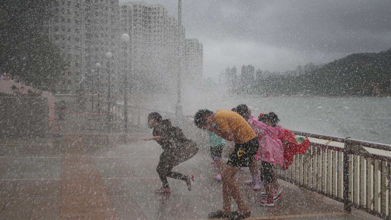
▼October 13, 2021 Typhoon Compass hit Hong Kong with wind and rain, and some citizens went out to watch the waves▼
+1
▼On June 27, the hot weather warning came into effect, and the temperature in some New Territories reached 34 degrees▼
+3
Siamba typhoon | Observatory expects tropical storm 7.1 to break into Hong Kong for a 400-kilometer long weekend to face squally thunderstorms Siamba typhoon | Siamba typhoon moves closer and intensifies as a tropical storm Observatory plans to change to No. 3 typhoon to hit the wind?
|Hong Kong’s first typhoon signal No. 1 takes effect this year, Macau is forecast to dance with a double spin or change its path to hit the wind|The Observatory says the weather will gradually turn bad on 7.1 and the wind will increase