
Severe tropical storm "Siamba" was gradually approaching on July 1, the return day. As of 12:00 noon today (1st), the No. 3 strong wind signal was in force.
The Observatory predicts that Siamba will generally move towards the western coast of Guangdong on today and tomorrow (2nd), and gradually intensify, and its associated outer rainbands will also bring squally showers and thunderstorms.
The Observatory expects that winds of magnitude 8 will be reached between the offshore and highland areas of Hong Kong, that is, the winds of Typhoon No. 8 have been reached.
In addition, another tropical cyclone is also formed in the northwestern Pacific Ocean. The Observatory expects Tropical Storm Airy to move northerly in the next one or two days, but it is forecast to move away from Hong Kong and generally move towards the Ryukyu Islands.
Affected by the active southerly airstream, the coastal weather in Hong Kong is expected to remain unstable next week, with cloudy and rainy weather continuing until next Saturday (9th).
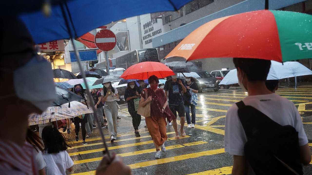
▼On June 30, the tropical cyclone Siamba was approaching on the eve of the July 1st return▼
The Observatory said that at 12 noon, Severe Tropical Storm Siamba gathered about 410 kilometers south of Hong Kong and was expected to move northwestward at a speed of about 18 kilometers per hour, generally moving towards the western coast of Guangdong.
In the past few hours, Siamba continued to move northwestward, and its associated rainbands occasionally brought heavy showers and violent gusts to the coast of Guangdong. Strong winds were generally blowing in Hong Kong, with stronger winds in the south.
The Observatory also expects that according to the current forecast path, Siamba will maintain a distance of more than 300 kilometers from Hong Kong most of the time today, and the No. 3 strong wind signal is expected to be maintained before 5 pm.
Whether the No. 8 Gale or Storm Signal will be issued later will depend on the development of Siamba and changes in local winds.
In 2001 and 2013, July 1st typhoon signal No. 3 was hoisted
According to the tropical cyclone track information from the Observatory, it is expected that Siamba will soon enter the range of 400 kilometers in Hong Kong, and has maintained a distance of nearly 400 kilometers since then.
The Observatory also predicts that Siamba will intensify into a typhoon at 8:00 a.m. tomorrow and make landfall in the area of Zhanjiang City. It will weaken into a severe tropical storm on Sunday (3rd).
As for Avery, it is expected to intensify into a severe tropical storm on Sunday and move towards the Okinawa area.
It is worth mentioning that Siam Ba is the third tropical cyclone since the 25th anniversary of the return of the motherland to the Hong Kong Observatory to issue a tropical cyclone warning on July 1.
For the last two tropical cyclones, Typhoon "Durian" in 2001 and Severe Tropical Storm "Umbia" in 2013, the two highest tropical cyclone warnings were both typhoon No. 3.
▼European Centre for Medium-Range Weather Forecasts ECMWF forecast▼
▼US Global Forecast System GFS forecast▼
The Mainland Central Meteorological Observatory predicts that Siamba will move to the northwest at a speed of 15 to 20 kilometers per hour, and the intensity will gradually increase. The strongest will reach the level of a severe tropical storm to a typhoon. Landing on the coast in the west.
As for Avery, it is expected to move to the west-north at a speed of 15 to 20 kilometers per hour, and the intensity will gradually increase. It will move into the East China Sea on Sunday, and then turn to the north.
The Observatory expects some heavy rain today
In terms of weather in Hong Kong, the Observatory pointed to strong easterly winds today, occasional gale force winds off the coast and highlands, and mostly cloudy with squally showers and thunderstorms, with heavy rain at times.
The outlook is mostly cloudy tomorrow with squally showers and thunderstorms, and the rain will be heavy at times later.
In terms of wind, the east wind is expected to be 6 to 7, with 8 between offshore and highland.
The Observatory also predicts that the next nine days will also be cloudy and rainy. Citizens should remember to bring umbrellas when going out.
The Observatory expects the next nine days to be cloudy and rainy as well.
(Screenshot of the Observatory's website)
▼On June 30, when Tropical Cyclone Siamba hit Hong Kong, some citizens still went to Shek O for surfing▼
+7
Siam Ball.
Latest | Typhoon Signal No. 3 maintains squally showers in the afternoon, or typhoon signal No. 8 Siamba will be hoisted in Macau at night.
Multiple pictures|Double rainbows suddenly appear in various districts under the wind The cause of the dismantling of the observatory in Siamba|The name of the Siamba typhoon was provided by Thailand, a common plant in Hong Kong that hit Korea in 2016. The Observatory plans to issue the No. 3 typhoon signal at Siamba at night | The Observatory issues the No. 3 typhoon signal for kindergartens and some special schools to suspend classes for the typhoon |